The Bob Webber Trail at Tiadaghton State Forest near Cammal, Pennsylvania is a strenuous 3.6-mile out-and-back trail that features a beautiful vista point at the end of the trail, Wolf Run Bald Vista.
This trail lies within the Wolf Run Wild Area within the Tiadaghton State Forest and follows yellow blazes throughout the entirety of the hike. It's advised to bring trekking poles on this hike due to the steep elevation grade in many sections of the trail.
The trail begins first by heading gradually uphill along a small conifer forest, with the trail substrate being mostly pine needles over dirt, which can be slippery. Not long after the conifer forest is a small field opening with a view of the mountains closest to the parking lot.
Continuing along further, the trail will level out for a very short while before it begins the initial climb. This first climb does not last much longer than 0.2-miles before the trail heads back downhill slightly and then levels out.
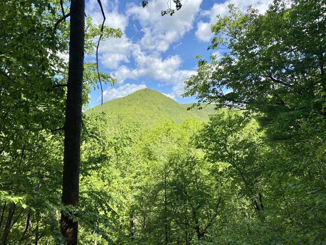
Once the trail levels out, it will turn to the right - heading northeast. Along this section of the trail is a small vista of the mountain ridge and peak that the Golden Eagle Trail runs along. Here, the trail surface is mostly loose flat rocks, so watch your step.
Not long after the loose flat-rock section of the trail, the Bob Webber Trail starts up a steep uphill climb and thus begins the final ascent up to the top of the mountain along switchbacks.
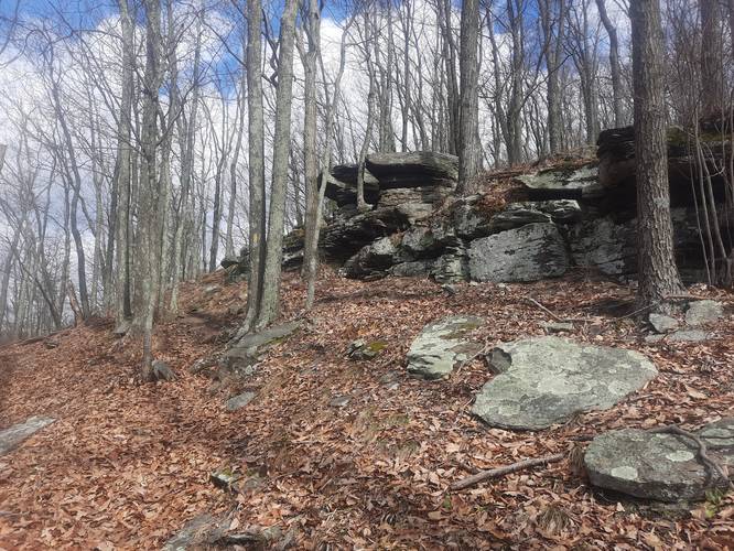
Here, the trail will start to follow switchbacks, about 7 in total, before reaching a much more level terrain along the mountain ridge. Hiking up these switchbacks can be slow and the trail is fairly narrow; however, the hillside is not steep enough to warrant any kind of warning.
Once you battle the switchbacks, hikers will reach the mountain ridge, with roughly one more small hill to climb before the trail meanders out to the Wolf Run Bald Vista, at the end of the Bob Webber Trail. Along this mountain ridge, hikers will find an abundance of blueberry bushes and other scrub-land brush that likes to live at these elevations.
Finally, you'll reach the vista with the registration box and carved bench. Soak up the views and enjoy your rest before hiking back downhill.
The hike back downhill is just as difficult as the hike up to the vista since you end up working very different muscles along these steep elevation-grade switchbacks and downhill descents. Again, trekking poles help tremendously on this trail.
Wolf Run Bald Vista
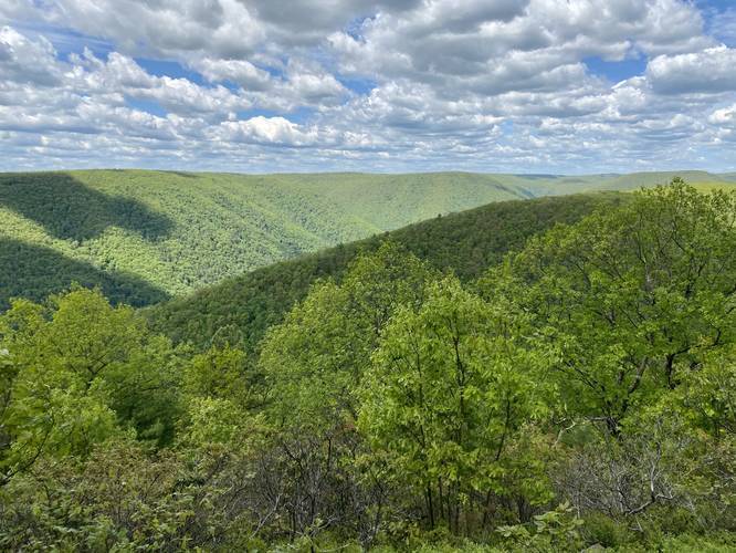
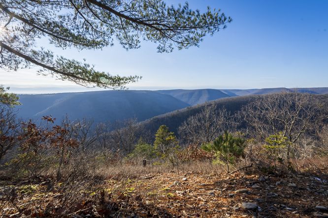
The destination for this hike, and where the trail terminates, is at the Wolf Run Bald Vista. As f June 2020, hikers will find a beautiful tree-carved bench and a trail registration box by the vista. The views include Raven's Horn Vista across the valley, which lies along the Golden Eagle Trail.
Parking
Hikers will find parking at the coordinates provided at the Ross Run Access Area along the Pine Creek Trail.
Pets
Dogs are allowed if leashed.
Difficulty
This trail is rated as 'Strenuous' because of the difficult elevation grade; however, some very experienced hikers may find this hike to be on the 'Difficult' (slightly less challenging) side. Regardless, the elevation gain in this hike is over 1,300-feet so do not take this trail lightly.
Pine Creek Pinnacles (PCP20)
This hike is part of the Pine Creek Pinnacles hiking challenge. For more information, details, and FAQs, please visit our Pine Creek Pinnacles (PCP20) page.
This trail lies within the Wolf Run Wild Area within the Tiadaghton State Forest and follows yellow blazes throughout the entirety of the hike. It's advised to bring trekking poles on this hike due to the steep elevation grade in many sections of the trail.
The trail begins first by heading gradually uphill along a small conifer forest, with the trail substrate being mostly pine needles over dirt, which can be slippery. Not long after the conifer forest is a small field opening with a view of the mountains closest to the parking lot.
Continuing along further, the trail will level out for a very short while before it begins the initial climb. This first climb does not last much longer than 0.2-miles before the trail heads back downhill slightly and then levels out.
Once the trail levels out, it will turn to the right - heading northeast. Along this section of the trail is a small vista of the mountain ridge and peak that the Golden Eagle Trail runs along. Here, the trail surface is mostly loose flat rocks, so watch your step.
Not long after the loose flat-rock section of the trail, the Bob Webber Trail starts up a steep uphill climb and thus begins the final ascent up to the top of the mountain along switchbacks.
Here, the trail will start to follow switchbacks, about 7 in total, before reaching a much more level terrain along the mountain ridge. Hiking up these switchbacks can be slow and the trail is fairly narrow; however, the hillside is not steep enough to warrant any kind of warning.
Once you battle the switchbacks, hikers will reach the mountain ridge, with roughly one more small hill to climb before the trail meanders out to the Wolf Run Bald Vista, at the end of the Bob Webber Trail. Along this mountain ridge, hikers will find an abundance of blueberry bushes and other scrub-land brush that likes to live at these elevations.
Finally, you'll reach the vista with the registration box and carved bench. Soak up the views and enjoy your rest before hiking back downhill.
The hike back downhill is just as difficult as the hike up to the vista since you end up working very different muscles along these steep elevation-grade switchbacks and downhill descents. Again, trekking poles help tremendously on this trail.
Wolf Run Bald Vista
The destination for this hike, and where the trail terminates, is at the Wolf Run Bald Vista. As f June 2020, hikers will find a beautiful tree-carved bench and a trail registration box by the vista. The views include Raven's Horn Vista across the valley, which lies along the Golden Eagle Trail.
Parking
Hikers will find parking at the coordinates provided at the Ross Run Access Area along the Pine Creek Trail.
Pets
Dogs are allowed if leashed.
Difficulty
This trail is rated as 'Strenuous' because of the difficult elevation grade; however, some very experienced hikers may find this hike to be on the 'Difficult' (slightly less challenging) side. Regardless, the elevation gain in this hike is over 1,300-feet so do not take this trail lightly.
Pine Creek Pinnacles (PCP20)
This hike is part of the Pine Creek Pinnacles hiking challenge. For more information, details, and FAQs, please visit our Pine Creek Pinnacles (PCP20) page.