Island Peaks Trail at Black Canyon of the Gunnison National Park
near Crawford, Colorado is an easy 0.3-mile loop hike that features stunning views of the jutting rock ledges and outcroppings that reside within the Black Canyon.
Hike
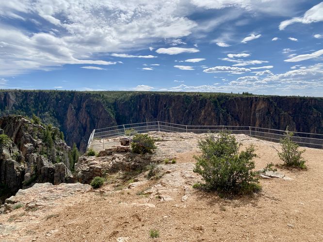
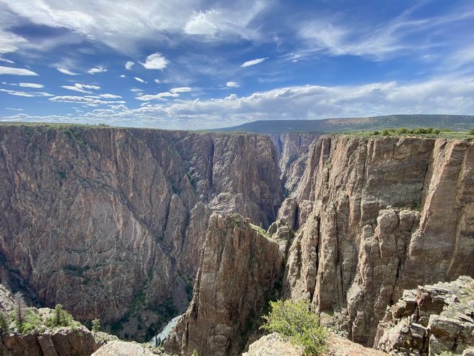
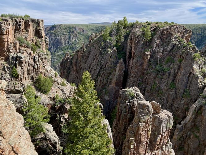
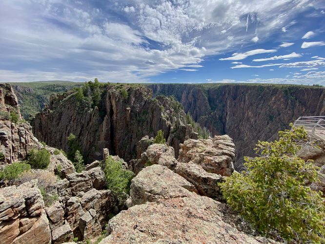
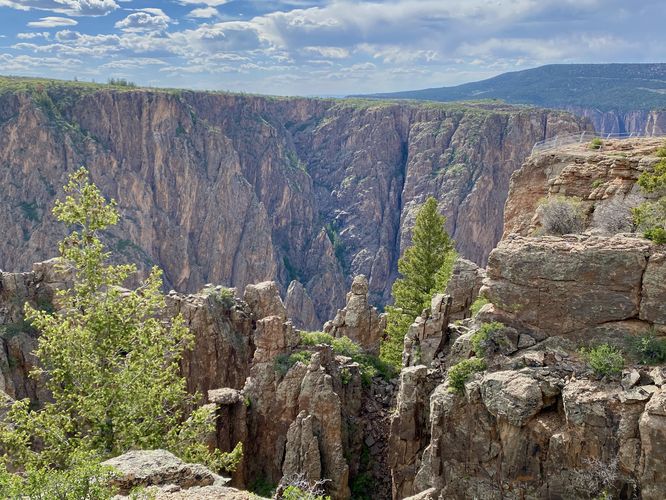
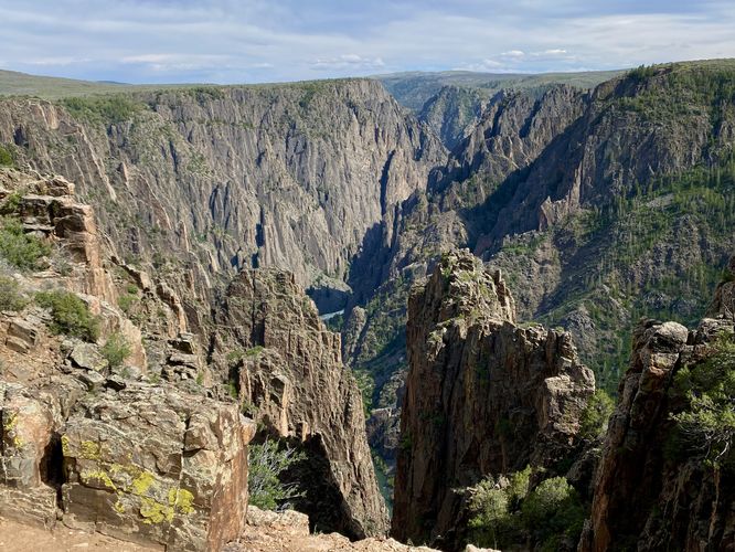
This short hike begins at the main trailhead for Island Peaks View and heads in along the northern side of the loop to start the hike (counter-clockwise loop). The trail runs through the low-growing shrubs along the canyon's north rim to eventually reach an overlook that sits right on the edge of the canyon's 2,000-foot tall cliffs. Here, you'll find stunning views of the Black Canyon and the Gunnison River as it cuts its way through the gorge below. The Peak Islands, referring to the massive jutting rock cliffs and outcroppings that reside within the canyon, can be seen best from this overlook. The views aren't over yet as the trail heads south from the first overlook to reach more views along the loop. Just south of the first overlook is a neat rock outcropping the juts into the canyon with steep cliffs on each side - you can walk this jutting bedrock to see a different view of the canyon. Further down the trail are several more views into the Black Canyon and its massive jutting rock outcroppings with sheer cliffs that extend for 2,000-feet to the Gunnison River below. Eventually the trail leads back to North Rim Drive to complete this short 0.3-mile hike.
Seclusion on the North Rim
Black Canyon Gunnison National Park's north rim is visited by far less people and provides abundant seclusion for those who want to get away from the crowds. For popular day hikes on the north rim, consider checking out the Chasm View Nature Trail in addition to other trails like the North Vista Trail and the Deadhorse Trail. The rest of the quick-hit trails along the north rim are very short walks or short paths that lead to canyon overlooks. Plan your trip to the Black Canyon by checking out our guides to each of the short overlooks along the north rim - starting from west to east: The Narrows View, Balanced Rock View, Big Island View, Island Peaks View, and the Kneeling Camel View.
Pets
Dogs are allowed on this trail only if leashed and must be cleaned up after. Note that dogs are only allowed in parking lots, campgrounds, on paths to overlooks (like this one), the Rim Rock Trail, and the Chasm View Nature Trail. Dogs are not permitted on any other trails in the park. You can read all of the rules and regulations for pets at the park here.
Parking
Hikers will find a parking turnout at the coordinates provided, located along North Rim Drive in the park. The lot is large enough to fit less than a dozen vehicles as of June 2024.
Warnings
Steep cliffs: Despite the abundance of safety precautions (i.e. fencing), this trail leads to cliffs that might drop 2,000-feet or more into the Black Canyon. Be aware of your surroundings.
Sun exposure: This trail has very-little shade and also sits at about 7,700-feet above sea level which increases the UV index. It's smart to wear sunscreen and bring extra sun protection when hiking this trail and other trails at Black Canyon of the Gunnison National Park.
Elevation sickness: This trail brings hikers through an altitude of about 7,700-feet above sea level. Around the 7,000-foot mark above sea level, you may start to experience symptoms of elevation sickness including shortness of breath, headaches, muscle aches, dizziness, rapid heartbeat, fatigue, or vomiting if you are not fully acclimated. If you're experiencing bad altitude sickness symptoms, the smartest move is to get to lower elevation as soon as possible.
Hike
This short hike begins at the main trailhead for Island Peaks View and heads in along the northern side of the loop to start the hike (counter-clockwise loop). The trail runs through the low-growing shrubs along the canyon's north rim to eventually reach an overlook that sits right on the edge of the canyon's 2,000-foot tall cliffs. Here, you'll find stunning views of the Black Canyon and the Gunnison River as it cuts its way through the gorge below. The Peak Islands, referring to the massive jutting rock cliffs and outcroppings that reside within the canyon, can be seen best from this overlook. The views aren't over yet as the trail heads south from the first overlook to reach more views along the loop. Just south of the first overlook is a neat rock outcropping the juts into the canyon with steep cliffs on each side - you can walk this jutting bedrock to see a different view of the canyon. Further down the trail are several more views into the Black Canyon and its massive jutting rock outcroppings with sheer cliffs that extend for 2,000-feet to the Gunnison River below. Eventually the trail leads back to North Rim Drive to complete this short 0.3-mile hike.
Seclusion on the North Rim
Black Canyon Gunnison National Park's north rim is visited by far less people and provides abundant seclusion for those who want to get away from the crowds. For popular day hikes on the north rim, consider checking out the Chasm View Nature Trail in addition to other trails like the North Vista Trail and the Deadhorse Trail. The rest of the quick-hit trails along the north rim are very short walks or short paths that lead to canyon overlooks. Plan your trip to the Black Canyon by checking out our guides to each of the short overlooks along the north rim - starting from west to east: The Narrows View, Balanced Rock View, Big Island View, Island Peaks View, and the Kneeling Camel View.
Pets
Dogs are allowed on this trail only if leashed and must be cleaned up after. Note that dogs are only allowed in parking lots, campgrounds, on paths to overlooks (like this one), the Rim Rock Trail, and the Chasm View Nature Trail. Dogs are not permitted on any other trails in the park. You can read all of the rules and regulations for pets at the park here.
Parking
Hikers will find a parking turnout at the coordinates provided, located along North Rim Drive in the park. The lot is large enough to fit less than a dozen vehicles as of June 2024.
Warnings
Steep cliffs: Despite the abundance of safety precautions (i.e. fencing), this trail leads to cliffs that might drop 2,000-feet or more into the Black Canyon. Be aware of your surroundings.
Sun exposure: This trail has very-little shade and also sits at about 7,700-feet above sea level which increases the UV index. It's smart to wear sunscreen and bring extra sun protection when hiking this trail and other trails at Black Canyon of the Gunnison National Park.
Elevation sickness: This trail brings hikers through an altitude of about 7,700-feet above sea level. Around the 7,000-foot mark above sea level, you may start to experience symptoms of elevation sickness including shortness of breath, headaches, muscle aches, dizziness, rapid heartbeat, fatigue, or vomiting if you are not fully acclimated. If you're experiencing bad altitude sickness symptoms, the smartest move is to get to lower elevation as soon as possible.