The Kneeling Camel Overlook at Black Canyon of the Gunnison National Park
near Crawford, Colorado is a roadside view that features a natural rock formation that resembles a kneeling camel within the Black Canyon and provides visitors with expansive views of the canyon.
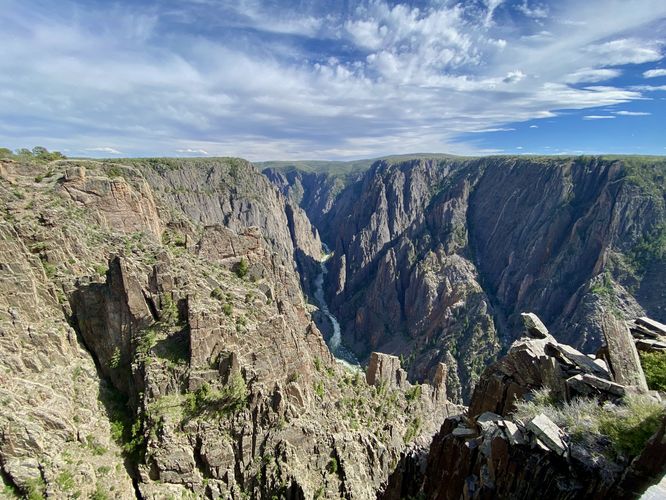
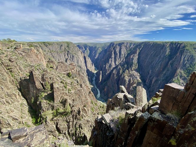
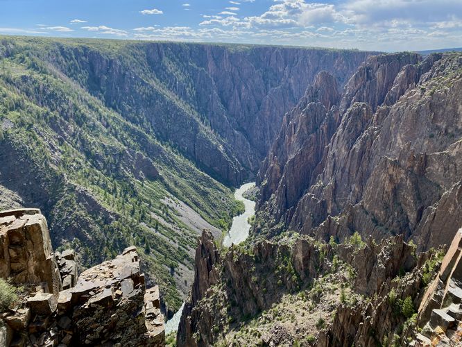
This is not a hike but rather a very short roadside walk that provides visitors with views down each side of the Black Canyon. If you look closely enough while facing the southeast, you can find a natural rock formation that looks like a camel kneeling -- with its back hump raised and connected by a flat back to a shorter head that sits a bit lower than the hump. The views from this overlook are the last of the easterly views of the canyon without hiking the longer Deadhorse Trail, located at the far east end of North Rim Drive. Before leaving you can explore the western side of the overlook which provides visitors with a slightly different view of the canyon than you've previously seen -- this view includes sloped canyon walls with trees that adorn its slopes. The canyon wall as seen here appears to be covered in skree -- a terrain full of very fine loose rocks.
Seclusion on the North Rim
Black Canyon Gunnison National Park's north rim is visited by far less people and provides abundant seclusion for those who want to get away from the crowds. For popular day hikes on the north rim, consider checking out the Chasm View Nature Trail in addition to other trails like the North Vista Trail and the Deadhorse Trail. The rest of the quick-hit trails along the north rim are very short walks or short paths that lead to canyon overlooks. Plan your trip to the Black Canyon by checking out our guides to each of the short overlooks along the north rim - starting from west to east: The Narrows View, Balanced Rock View, Big Island View, Island Peaks View, and the Kneeling Camel View.
Pets
Dogs are allowed on this trail only if leashed and must be cleaned up after. Note that dogs are only allowed in parking lots, campgrounds, on paths to overlooks (like this one), the Rim Rock Trail, and the Chasm View Nature Trail. Dogs are not permitted on any other trails in the park. You can read all of the rules and regulations for pets at the park here.
Parking
Hikers will find a parking turnout at the coordinates provided, located along North Rim Drive in the park. The lot is large enough to fit less than a dozen vehicles as of June 2024.
Warnings
Steep cliffs: Despite the abundance of safety precautions (i.e. fencing), this trail leads to cliffs that might drop 2,000-feet or more into the Black Canyon. Be aware of your surroundings.
Sun exposure: This trail has very-little shade and also sits at about 7,700-feet above sea level which increases the UV index. It's smart to wear sunscreen and bring extra sun protection when hiking this trail and other trails at Black Canyon of the Gunnison National Park.
Elevation sickness: This trail brings hikers through an altitude of about 7,700-feet above sea level. Around the 7,000-foot mark above sea level, you may start to experience symptoms of elevation sickness including shortness of breath, headaches, muscle aches, dizziness, rapid heartbeat, fatigue, or vomiting if you are not fully acclimated. If you're experiencing bad altitude sickness symptoms, the smartest move is to get to lower elevation as soon as possible.