One of the most picturesque and quaint villages in all of the Swiss
Alps, Grindelwald, has something for everyone. Whether you're looking to
enjoy spa days, hikes, or shopping, the town provides something for
everyone with breathtaking Alps that surround the town. One of the best
ways to explore Grindelwald is by foot, but if you stay close to the
town's main street and shopping district along Dorfstrasse, you'll miss
the ultra-scenic, quiet parts of town.
This trail guide, while not technically a hike, leads visitors through the heart of Grindelwald where you'll find stunning views of the Alps, glaciers, rivers, historic buildings, shops and restaurants, and more along a 4.7km (2.9 mile) walk.
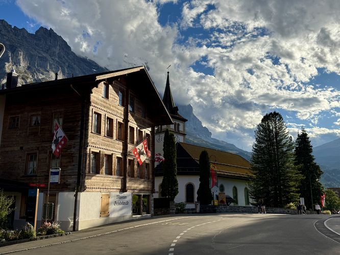
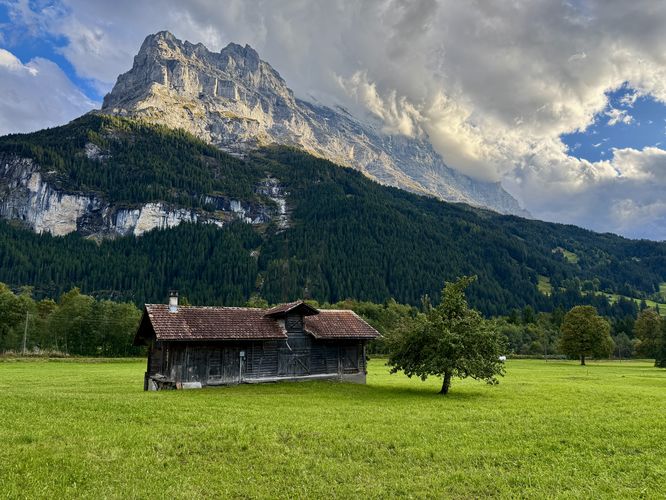
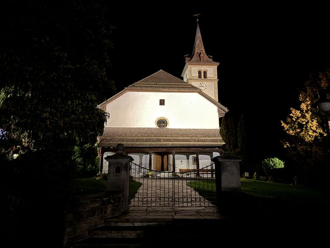
The walk leads down the road where you'll find nice views of the nearby Swiss Chalet-styled houses and towering alpine peaks. As you reach the intersection of Dorfstrasse, you'll find the Grindelwald Museum and a scenic church. The quaint chalet-styled buildings at the intersection simply add to the scenery.
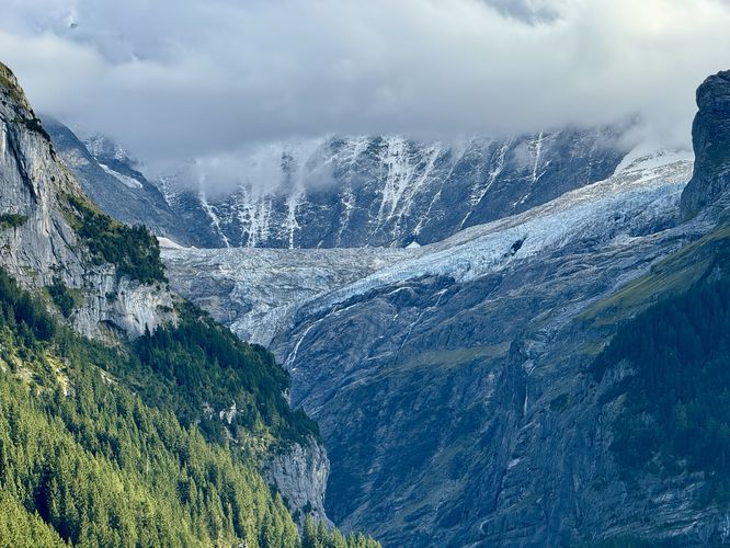
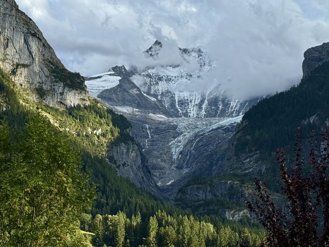
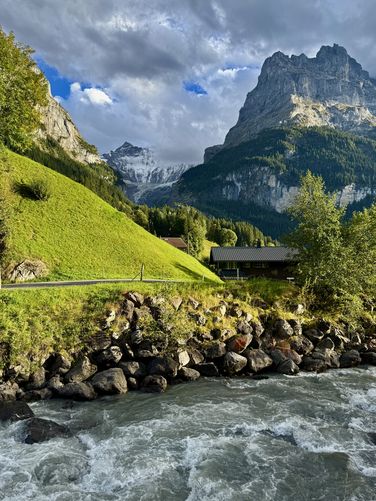
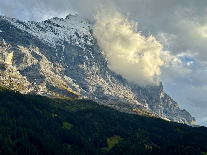
The route then leads down Ribygässli to reach Schwarze Lütschine. Along the way are amazing views of the Eiger and Lower Grindelwald Glacier that sits above Glacier Canyon. At Schwarze Lütschine, the route follows a skinny road, Locherbodenstrasse, as it heads westward through a campground. Along Locherbodenstrasse are more breathtaking views of the Eiger, Lower Grindelwald Glacier, and the alpine meadows within Grindelwald Valley. Remember to stay on-trail at all times and respect the local's privacy as you'll be walking right by scenic, quiet homes.
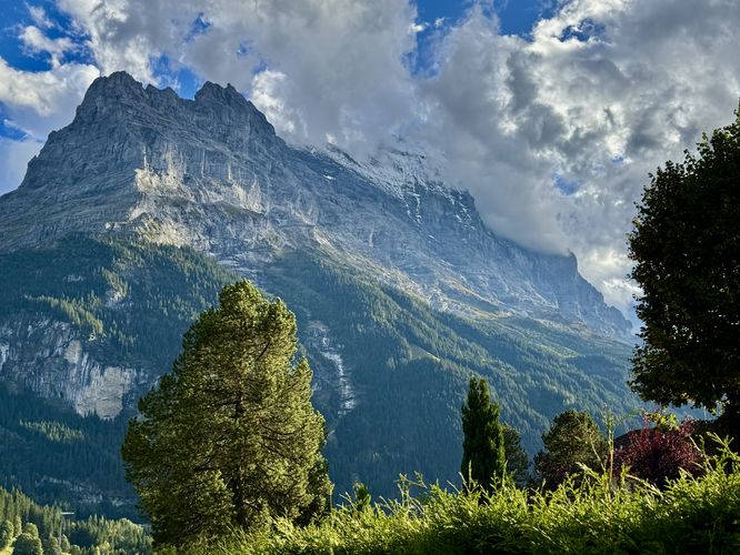
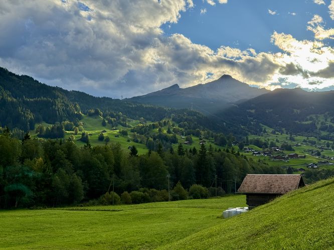
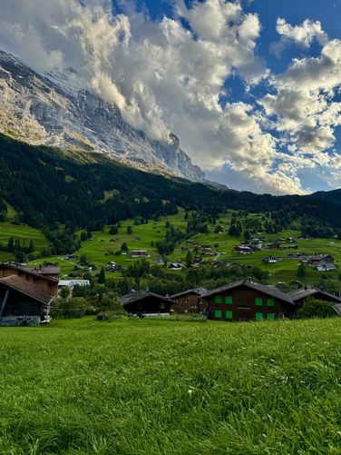
As you pass the open meadows along Locherbodenstrasse, the walk eventually reaches a right-hand turn along Endweg where you'll start walking back uphill toward the center of town. Along the way are more scenic views of the Grindelwald Valley and the Eiger. One noteworthy stop along the route is near 2.6km at a public bench along the road. Following Endweg uphill, the route leads to a small trail that shortcuts back to Dorfstrasse in the center of town.
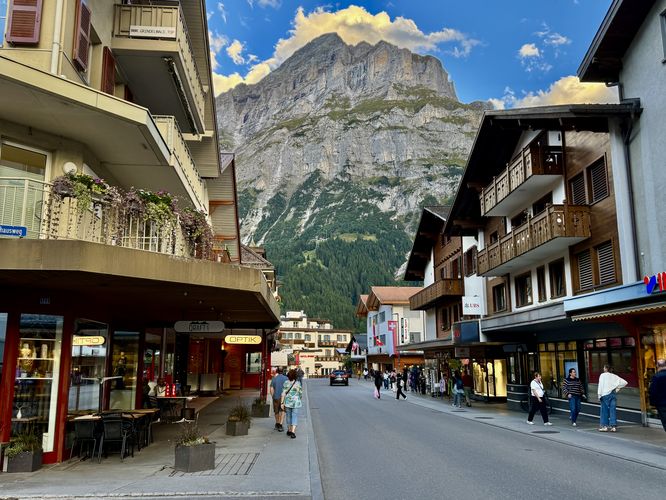
Once you reach Dorfstrasse, the walk leads through the busiest part of Grindelwald - the tourist shopping center that lines the road. Passing shops and tourists alike, Dorfstrasse has a bit of something for everyone from more scenic views of the Eiger and surrounding alpine peaks, to shops and restaurants. On our walk, we took a long break and had ate dinner before wrapping up the walk.
Finally, the route leads directly back uphill along Obere Gletscherstrasse to reach the Grindellodge.
This trail guide, while not technically a hike, leads visitors through the heart of Grindelwald where you'll find stunning views of the Alps, glaciers, rivers, historic buildings, shops and restaurants, and more along a 4.7km (2.9 mile) walk.
Explore Grindelwald by Foot
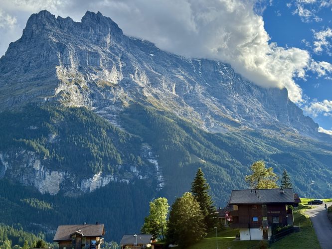
During our visit, we stayed at a really nice hotel, the Grindellodge, which is where this route begins along Obere Gletscherstrasse. If you're staying elsewhere in town, I highly encourage a walk up toward the Grindellodge as the views of town and the towering Eiger are unmatched.The walk leads down the road where you'll find nice views of the nearby Swiss Chalet-styled houses and towering alpine peaks. As you reach the intersection of Dorfstrasse, you'll find the Grindelwald Museum and a scenic church. The quaint chalet-styled buildings at the intersection simply add to the scenery.
The route then leads down Ribygässli to reach Schwarze Lütschine. Along the way are amazing views of the Eiger and Lower Grindelwald Glacier that sits above Glacier Canyon. At Schwarze Lütschine, the route follows a skinny road, Locherbodenstrasse, as it heads westward through a campground. Along Locherbodenstrasse are more breathtaking views of the Eiger, Lower Grindelwald Glacier, and the alpine meadows within Grindelwald Valley. Remember to stay on-trail at all times and respect the local's privacy as you'll be walking right by scenic, quiet homes.
As you pass the open meadows along Locherbodenstrasse, the walk eventually reaches a right-hand turn along Endweg where you'll start walking back uphill toward the center of town. Along the way are more scenic views of the Grindelwald Valley and the Eiger. One noteworthy stop along the route is near 2.6km at a public bench along the road. Following Endweg uphill, the route leads to a small trail that shortcuts back to Dorfstrasse in the center of town.
Once you reach Dorfstrasse, the walk leads through the busiest part of Grindelwald - the tourist shopping center that lines the road. Passing shops and tourists alike, Dorfstrasse has a bit of something for everyone from more scenic views of the Eiger and surrounding alpine peaks, to shops and restaurants. On our walk, we took a long break and had ate dinner before wrapping up the walk.
Finally, the route leads directly back uphill along Obere Gletscherstrasse to reach the Grindellodge.