Nestled in the heart of Grindelwald, Switzerland right below glacier-capped slopes of the Eiger sits Glacier Canyon and the scenic Glacier Canyon Trail. Visitors will find waterfalls, canyon swing jumpers, tunnels, and stunning canyon walls that were once carved out by ancient, receding glaciers.
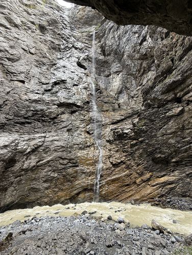
Today, the steep and deep walls of Glacier Canyon stand as a testament to the eons-long work of the Lower Grindelwald Glacier, with its melting waters still rushing through the gorge. As you make your way up the canyon, you'll be suspended approximately 8m above the stream, so consider using a tether for your phone just in case.
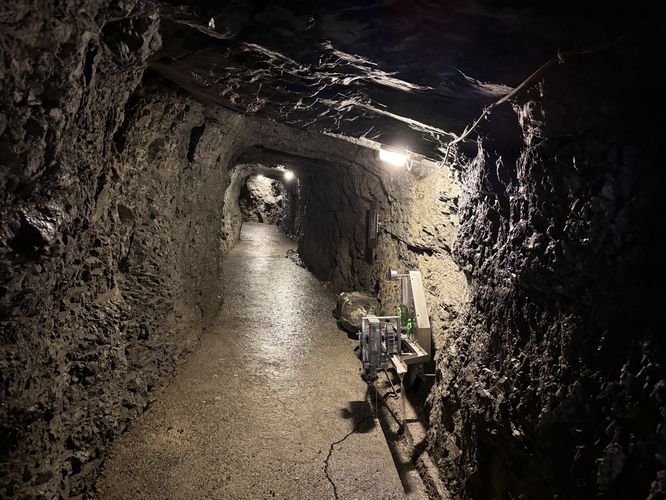
Just 100 meters into the trail, you'll pass through a tunnel. After rounding the bend, the gorge opens up to reveal the Lütschine Stream, a scenic stone bridge crossing it, and a backdrop of quaint Swiss hillsides dotted with homes. As you come around the canyon's bend, you may find adrenaline-seekers swinging into the canyon from high above. As they fly by, these canyon jumpers can gain speeds of about 140km/hour.
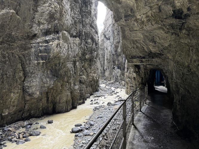
The Glacier Canyon Trail continues to dip in and out of tunnels, interchanging short, dimly-lit tunnels for more exposed suspended metal bridge paths. Watch your head on some of the tunnels.
Exploring Grindelwald's Glacier Canyon
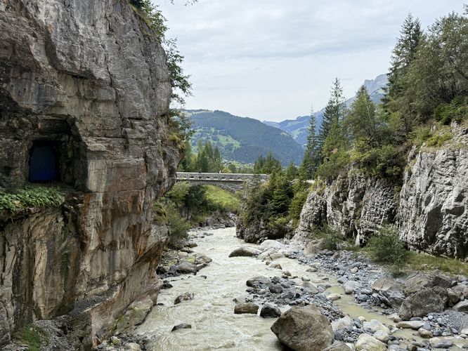
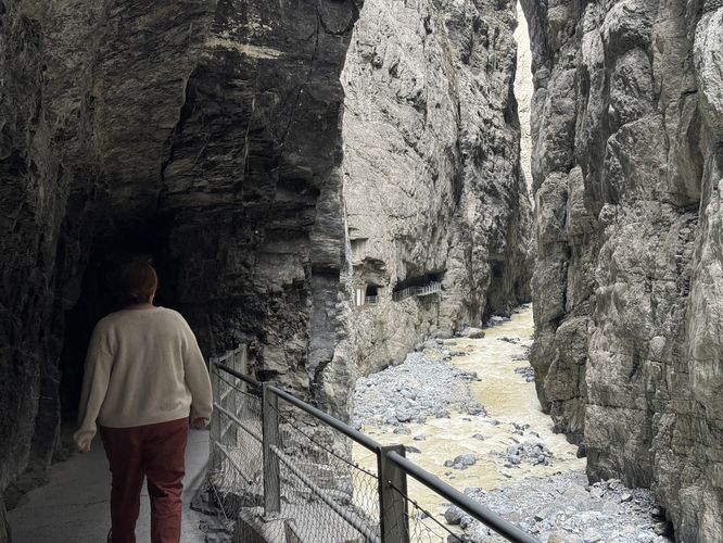
Located on the southeast side of Grindelwald sits Glacier Canyon (Gletscherschlucht Grindelwald) where visitors will find a pay-to-enter gorge with a suspended metal path that passes through tunnels, as it makes its way up the gorge's valley.Today, the steep and deep walls of Glacier Canyon stand as a testament to the eons-long work of the Lower Grindelwald Glacier, with its melting waters still rushing through the gorge. As you make your way up the canyon, you'll be suspended approximately 8m above the stream, so consider using a tether for your phone just in case.
Just 100 meters into the trail, you'll pass through a tunnel. After rounding the bend, the gorge opens up to reveal the Lütschine Stream, a scenic stone bridge crossing it, and a backdrop of quaint Swiss hillsides dotted with homes. As you come around the canyon's bend, you may find adrenaline-seekers swinging into the canyon from high above. As they fly by, these canyon jumpers can gain speeds of about 140km/hour.
The Glacier Canyon Trail continues to dip in and out of tunnels, interchanging short, dimly-lit tunnels for more exposed suspended metal bridge paths. Watch your head on some of the tunnels.