The Far View Sites Loop at Mesa Verde National Park, Colorado is an easy 1.1-mile loop hike that leads to several ancient Puebloan buildings and complexes including the Pipe Shrine House, Coyote Village, Far View Reservoir, Megalithic House, and the Far View Tower.
Hike
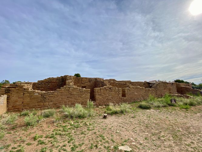
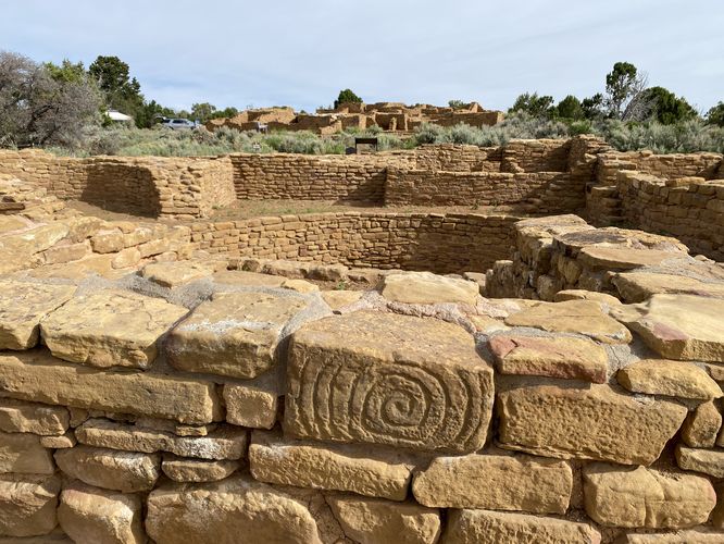
This easy hike begins at the main parking turnout, located along the edge of the road at the end of the Far View Sites road in the park. Visitors will be met with three choices of how to hike the loop, but this route brings you to the Far View House and Pipe Shrine first before heading south toward the Coyote Village. To start out, the trail leads to the massive complex known as the Far View House -- here, you'll find the stone structure with dozens of rooms that once housed a large community. To the south sits another stone structure, known as the Pipe Shrine House. The Pipe Shrine House features a neat spiral stone located on its south side -- so if you walk around the structure, you'll find that along with a view looking back at both buildings.
Coyote Village - Mile 0.3
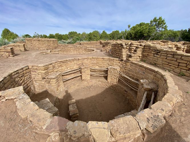
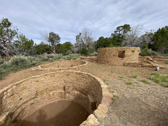
The route then takes you back to parking and south to follow a trail that leads to the Coyote Village complex. Here, you can actually walk around the inside of the complex, but please be respectful of the "keep out" signs in certain rooms -- the park does not want anyone damaging the stone walls that separate these ancient rooms and kivas. The complex has 5 different kivas and one tower along with several other smaller rooms.
Far View Reservoir - Mile 0.65
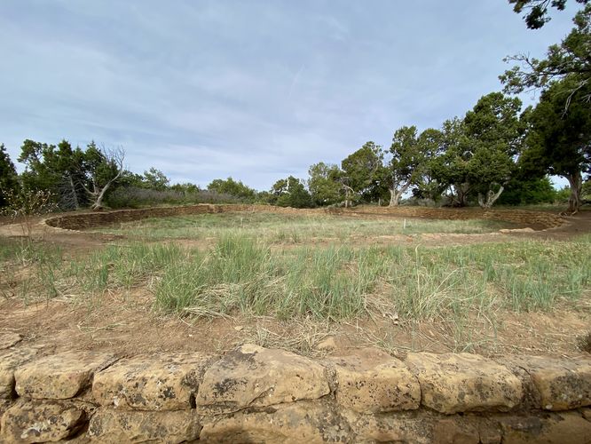
After exploring the Coyote Village complex, hikers will want to head north to reach the Far View Reservoir, located around mile 0.65. This ancient reservoir was built to store fresh water for the community for drinking and farming alike.
Megalithic House - Mile 0.75
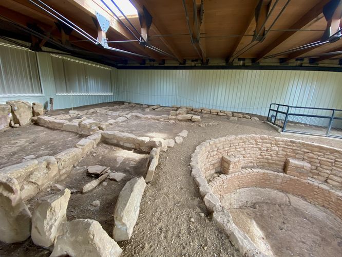
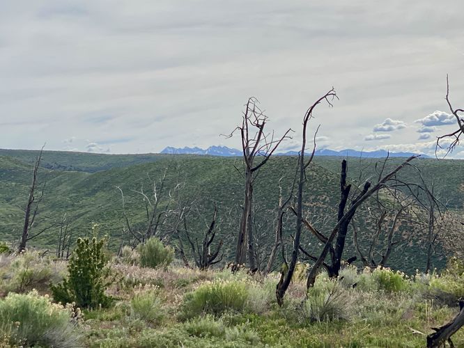
The trail runs northward from the Far View Reservoir to reach the Megalithic House site. Here, you'll find a large stone stucture, with a kiva, that was just one small part of a larger housing complex. On the far side of the Megalithic House, inside the shelter, is a view of the mountains that sit above the nearby canyon.
Far View Tower Site - Mile 1
The hike then leads south to head back to parking, but you'll first pass the Far View Reservoir on your way out and then you'll find the Far View Tower Site located just down the trail at mile 1. Here, you'll find a couple more kivas, rooms, and a tower that sat between it all. This is the last of the ancient Puebloan architecture along the Far View Sites Loop.
The trail then ends at the parking lot for a 1.1-mile loop hike.
Parking
Visitors will find a parking turnout at the coordinates provided, located at the end of the Far View Sites dead end road. As of June 2024, the turnout is large enough to fit about a dozen vehicles.
Pets
Dogs are not allowed on this trail. Dogs are allowed on paved trails including the Park Point Trail and the Mesa Top Loop Sites including: The Navajo Canyon Overlook, Square Tower House Overlook Trail, Pithouses & Pueblos Loop, Mesa Top Sites Trail, Sun Point Pueblo, Sun Point View, Oak Tree House View, Fire Temple & New Fire House View, and the Sun Temple & Cliff Palace View.
Warning
Rattlesnakes: Mesa Verde is home to rattlesnakes that might be out basking in the sun during warm months. While encounters are rare, give any rattlers you find plenty of space.
Sun exposure: Due to the lack of trees and shade, this trail has a high exposure to the sun and weather. Plan to bring sunscreen to protect yourself against high UVs.
Hike
This easy hike begins at the main parking turnout, located along the edge of the road at the end of the Far View Sites road in the park. Visitors will be met with three choices of how to hike the loop, but this route brings you to the Far View House and Pipe Shrine first before heading south toward the Coyote Village. To start out, the trail leads to the massive complex known as the Far View House -- here, you'll find the stone structure with dozens of rooms that once housed a large community. To the south sits another stone structure, known as the Pipe Shrine House. The Pipe Shrine House features a neat spiral stone located on its south side -- so if you walk around the structure, you'll find that along with a view looking back at both buildings.
Coyote Village - Mile 0.3
The route then takes you back to parking and south to follow a trail that leads to the Coyote Village complex. Here, you can actually walk around the inside of the complex, but please be respectful of the "keep out" signs in certain rooms -- the park does not want anyone damaging the stone walls that separate these ancient rooms and kivas. The complex has 5 different kivas and one tower along with several other smaller rooms.
Far View Reservoir - Mile 0.65
After exploring the Coyote Village complex, hikers will want to head north to reach the Far View Reservoir, located around mile 0.65. This ancient reservoir was built to store fresh water for the community for drinking and farming alike.
Megalithic House - Mile 0.75
The trail runs northward from the Far View Reservoir to reach the Megalithic House site. Here, you'll find a large stone stucture, with a kiva, that was just one small part of a larger housing complex. On the far side of the Megalithic House, inside the shelter, is a view of the mountains that sit above the nearby canyon.
Far View Tower Site - Mile 1
The hike then leads south to head back to parking, but you'll first pass the Far View Reservoir on your way out and then you'll find the Far View Tower Site located just down the trail at mile 1. Here, you'll find a couple more kivas, rooms, and a tower that sat between it all. This is the last of the ancient Puebloan architecture along the Far View Sites Loop.
The trail then ends at the parking lot for a 1.1-mile loop hike.
Parking
Visitors will find a parking turnout at the coordinates provided, located at the end of the Far View Sites dead end road. As of June 2024, the turnout is large enough to fit about a dozen vehicles.
Pets
Dogs are not allowed on this trail. Dogs are allowed on paved trails including the Park Point Trail and the Mesa Top Loop Sites including: The Navajo Canyon Overlook, Square Tower House Overlook Trail, Pithouses & Pueblos Loop, Mesa Top Sites Trail, Sun Point Pueblo, Sun Point View, Oak Tree House View, Fire Temple & New Fire House View, and the Sun Temple & Cliff Palace View.
Warning
Rattlesnakes: Mesa Verde is home to rattlesnakes that might be out basking in the sun during warm months. While encounters are rare, give any rattlers you find plenty of space.
Sun exposure: Due to the lack of trees and shade, this trail has a high exposure to the sun and weather. Plan to bring sunscreen to protect yourself against high UVs.