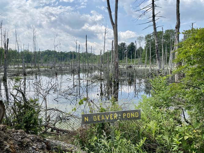
The Yellow Trail at Lindsay-Parsons Biodiversity Preserve in West Danby, New York is an easy 0.9-mile one-way trail that features views of North Beaver Pond and connects to other trails at the park.
Hike Description
Hikers will find this trail's trailhead locations along the Red Trail. This track begins along the eastern-most trailhead and follows this path heading west to connect back to the Red Trail. Along the way, hikers will get vies of the North Beaver Pond from several different locations.
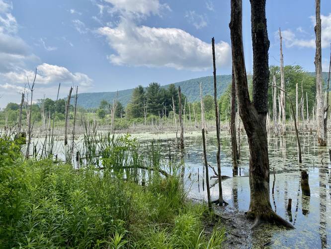
North Beaver Pond View - Mile 0.03
Right after hopping on the this trail, hikers will find a view of the North Beaver Pond located just a stone's throw from the trailhead.
After passing the first view of the pond, hikers will keep left at all trail junctions along the way which connect to the Orange Trail and eventually the White Trail. Along the way, this trail undulates and gain elevation throughout, making for good exercise, but hikers should consider the elevation grade as "easy".
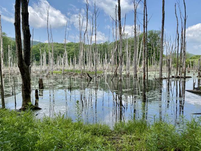
North Beaver Pond View - Mile 0.55
Around mile 0.55, hikers will reach the shores of the North Beaver Pond once more. Here, you get views of the dead-standing trees and surrounding mountains that tower over the shallow pond's water. You might spot some Northern Water Snakes, bullfrogs, heron, or other wildlife at the pond.
After leaving this pond view, the trail will make an abrupt sharp turn after crossing a wooden footbridge that spans a connecting tributary between two ponds.
Private Property - Mile 0.6 to 0.7
Note that as of June 2023 (and earlier) flooding in the pond has caused the trail to reroute onto private property and back to the preserve land from miles 0.6 to 0.7 - please stay on-trail here.
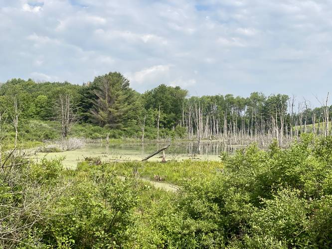
North Beaver Pond View - Mile 0.66
At mile 0.66, hikers get one last view of the North Beaver Pond, which as of June 2023 sits on private property.
White Trail Junction - Mile 0.8
Around mile 0.8, hikers will reach a junction with the White Trail.
Finally, the Yellow Trail ends at the western trailhead along the Red Trail where hikers will start to get meadow and mountain views once more.
Parking
Visitors will find a parking lot at the coordinates provided. It's large enough to fit a half-dozen vehicles or slightly more.
Pets
Dogs are allowed only if leashed and must be cleaned up after.
Warnings
Buggy: This trail can be very buggy during warmer months. The kettle holes, ponds, and stagnant bodies of water help mosquitos, horseflies, and even ticks thrive here.
Poison ivy: This trail tends to have a lot of poison ivy located just off-trail. The path is skinny as well, which makes it easy to accidentally step on the poison ivy as well.
Hike Description
Hikers will find this trail's trailhead locations along the Red Trail. This track begins along the eastern-most trailhead and follows this path heading west to connect back to the Red Trail. Along the way, hikers will get vies of the North Beaver Pond from several different locations.
North Beaver Pond View - Mile 0.03
Right after hopping on the this trail, hikers will find a view of the North Beaver Pond located just a stone's throw from the trailhead.
After passing the first view of the pond, hikers will keep left at all trail junctions along the way which connect to the Orange Trail and eventually the White Trail. Along the way, this trail undulates and gain elevation throughout, making for good exercise, but hikers should consider the elevation grade as "easy".
North Beaver Pond View - Mile 0.55
Around mile 0.55, hikers will reach the shores of the North Beaver Pond once more. Here, you get views of the dead-standing trees and surrounding mountains that tower over the shallow pond's water. You might spot some Northern Water Snakes, bullfrogs, heron, or other wildlife at the pond.
After leaving this pond view, the trail will make an abrupt sharp turn after crossing a wooden footbridge that spans a connecting tributary between two ponds.
Private Property - Mile 0.6 to 0.7
Note that as of June 2023 (and earlier) flooding in the pond has caused the trail to reroute onto private property and back to the preserve land from miles 0.6 to 0.7 - please stay on-trail here.
North Beaver Pond View - Mile 0.66
At mile 0.66, hikers get one last view of the North Beaver Pond, which as of June 2023 sits on private property.
White Trail Junction - Mile 0.8
Around mile 0.8, hikers will reach a junction with the White Trail.
Finally, the Yellow Trail ends at the western trailhead along the Red Trail where hikers will start to get meadow and mountain views once more.
Parking
Visitors will find a parking lot at the coordinates provided. It's large enough to fit a half-dozen vehicles or slightly more.
Pets
Dogs are allowed only if leashed and must be cleaned up after.
Warnings
Buggy: This trail can be very buggy during warmer months. The kettle holes, ponds, and stagnant bodies of water help mosquitos, horseflies, and even ticks thrive here.
Poison ivy: This trail tends to have a lot of poison ivy located just off-trail. The path is skinny as well, which makes it easy to accidentally step on the poison ivy as well.