The Orange Trail at Lindsay-Parsons Biodiversity Preserve in West Danby, New York is a moderate 1.2-mile one-way trail that features kettle hole views, a glacial deposit, and a peaceful forest setting.
Hike Description
This trail has two trailhead located along the Yellow Trail at the park. This track begins at the southern-most trailhead and heads east, following orange blazes. Note that this trail gains a fair amount of elevation in a short period of time, hence the moderate difficulty.
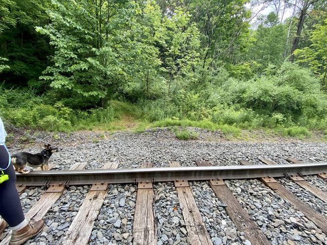
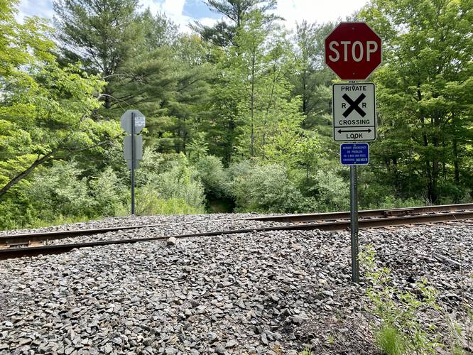
Railroad Crossing - Mile 0.1
Around mile 0.1, hikers will reach a railroad crossing. The trail continues directly across from the tracks.
Purple Trail Junction - Mile 0.11
Just after the railroad crossing, hikers will head up a steep hill to reach the trailhead for the Purple Trail. Stay left here to continue along the Orange Trail.
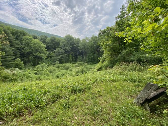
Kettle Hole View - Mile 0.2
At mile 0.2, hikers will reach a cutout in the forest where they'll find a large deep depression in the forest floor, a hidden kettle hole. There's a bench here where you can sit to enjoy the view or listen to the birds. The kettle hole itself is filled mostly with grasses and thus any pond or water that's filled in isn't visible during warm months with tall grasses. Additionally, there's a small view of the surrounding mountains, but this trail and viewing area can be buggy.
Purple Trail Junction - Mile 0.35
Around mile 0.35, hikers will pass the other Purple Trail trailhead junction.
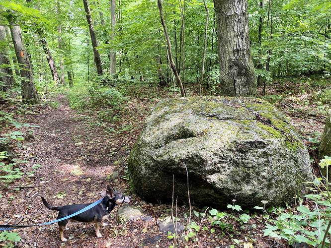
Glacial Deposit - Mile 0.4
Around mile 0.4 is a large rock located on the side of the trail. This out-of-place rock is a remnant from the glacier that once passed through there. The glacier ended up dropping this large rock (also known as a glacial erratic or glacial deposit) long ago.
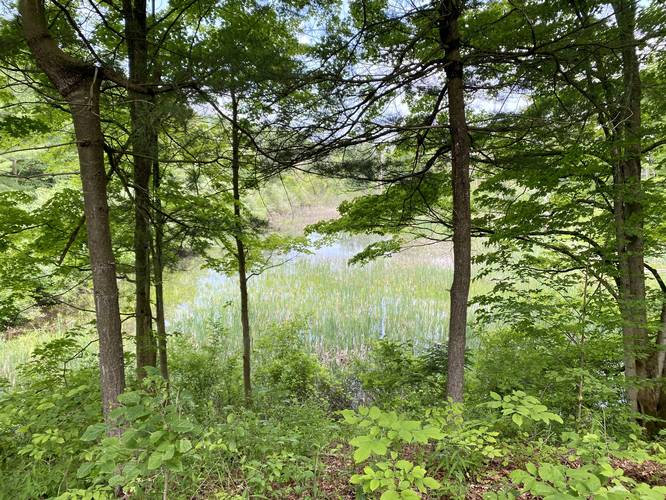
Obstructed Kettle Holes - Mile 0.85
Around mile 0.85, hikers will reach another bench "view", albeit obstructed, of another kettle hole. On the opposite side is another hidden kettle hole that's just barely visible.
Railroad Crossing - Mile 0.9
At mile 0.9, the trail crosses the railroad tracks once more and can be picked up across the tracks.
Turn - Mile 0.95
At mile 0.95, hikers should stay left (hiking south to north) to stay on preserve land and off of private property.
Yellow Trail Junction - Mile 1.2
Finally, after ascending another hill and hiking through the forest for another 0.25 miles, hikers will reach the end of the Orange Trail at the Yellow Trail.
Parking
Visitors will find a parking lot at the coordinates provided. It's large enough to fit a half-dozen vehicles or slightly more.
Pets
Dogs are allowed only if leashed and must be cleaned up after.
Hike Description
This trail has two trailhead located along the Yellow Trail at the park. This track begins at the southern-most trailhead and heads east, following orange blazes. Note that this trail gains a fair amount of elevation in a short period of time, hence the moderate difficulty.
Railroad Crossing - Mile 0.1
Around mile 0.1, hikers will reach a railroad crossing. The trail continues directly across from the tracks.
Purple Trail Junction - Mile 0.11
Just after the railroad crossing, hikers will head up a steep hill to reach the trailhead for the Purple Trail. Stay left here to continue along the Orange Trail.
Kettle Hole View - Mile 0.2
At mile 0.2, hikers will reach a cutout in the forest where they'll find a large deep depression in the forest floor, a hidden kettle hole. There's a bench here where you can sit to enjoy the view or listen to the birds. The kettle hole itself is filled mostly with grasses and thus any pond or water that's filled in isn't visible during warm months with tall grasses. Additionally, there's a small view of the surrounding mountains, but this trail and viewing area can be buggy.
Purple Trail Junction - Mile 0.35
Around mile 0.35, hikers will pass the other Purple Trail trailhead junction.
Glacial Deposit - Mile 0.4
Around mile 0.4 is a large rock located on the side of the trail. This out-of-place rock is a remnant from the glacier that once passed through there. The glacier ended up dropping this large rock (also known as a glacial erratic or glacial deposit) long ago.
Obstructed Kettle Holes - Mile 0.85
Around mile 0.85, hikers will reach another bench "view", albeit obstructed, of another kettle hole. On the opposite side is another hidden kettle hole that's just barely visible.
Railroad Crossing - Mile 0.9
At mile 0.9, the trail crosses the railroad tracks once more and can be picked up across the tracks.
Turn - Mile 0.95
At mile 0.95, hikers should stay left (hiking south to north) to stay on preserve land and off of private property.
Yellow Trail Junction - Mile 1.2
Finally, after ascending another hill and hiking through the forest for another 0.25 miles, hikers will reach the end of the Orange Trail at the Yellow Trail.
Parking
Visitors will find a parking lot at the coordinates provided. It's large enough to fit a half-dozen vehicles or slightly more.
Pets
Dogs are allowed only if leashed and must be cleaned up after.