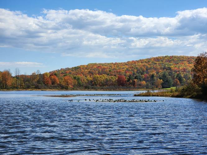
The Tauschers Loop Trail at Hills Creek State Park near Wellsboro, Pennsylvania is an easy 1.4-mile loop that features views of Hills Creek Lake.
This trail can be picked up from various places, but the easiest lot to park in is on Kelly's Swamp Road, just west of Spillway Road.
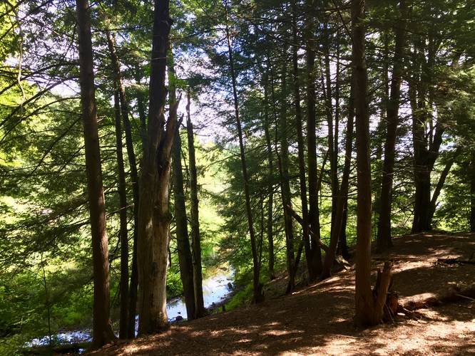
Starting the Tauschers Loop clockwise, hikers will first enter a forest mixed with deciduous and coniferous trees before hiking through a scenic pine grove. Shortly after hiking through the pine grove, the trail will spit hikers out onto Kelly's Swamp Road as it follows the road for about a quarter-mile before heading back into the woods. While hiking along the road, hikers get views of Hills Creek Lake. Additionally, there's a house, located on private property, in the woods off of the trail - be sure to not enter any trails that lead to this house since it's private land.
Just before the trail heads back into the woods, off of Kelly's Swamp Road, hikers will pass a maple syrup stand, which is often operational in the Autumn. After heading back into the woods, the trail will cross a road shortly after before continuing north and passing several cabins.
Not long after hiking past the cabins, the trail will hit an intersection where the loop continues to the right-hand side. Hikers can, however, head downhill and out to the street - hike up the street 100-feet to the Yellow Birch Trail (0.6-mile loop). Just beyond the intersection where the loop continues is a bench for hikers to sit and relax. At the bench, there's a large downhill slope of a hill that leads to a creek below.
The trail, from here on out, does not have much to see, but runs through beautiful forests. Eventually, the trail will follow the road where the rental cabins are - just follow the road south until you find the yellow blazes again. Continue hiking until you reach the parking lot to complete the loop.
Note: This trail technically follows a section of the Lakeside Trail, from the parking lot, until you reach the northwestern corner of this loop.
Pets: Dogs are allowed if leashed and their waste must be carried out by the hiker.
Biking: Biking is not allowed on this trail.
This trail can be picked up from various places, but the easiest lot to park in is on Kelly's Swamp Road, just west of Spillway Road.
Starting the Tauschers Loop clockwise, hikers will first enter a forest mixed with deciduous and coniferous trees before hiking through a scenic pine grove. Shortly after hiking through the pine grove, the trail will spit hikers out onto Kelly's Swamp Road as it follows the road for about a quarter-mile before heading back into the woods. While hiking along the road, hikers get views of Hills Creek Lake. Additionally, there's a house, located on private property, in the woods off of the trail - be sure to not enter any trails that lead to this house since it's private land.
Just before the trail heads back into the woods, off of Kelly's Swamp Road, hikers will pass a maple syrup stand, which is often operational in the Autumn. After heading back into the woods, the trail will cross a road shortly after before continuing north and passing several cabins.
Not long after hiking past the cabins, the trail will hit an intersection where the loop continues to the right-hand side. Hikers can, however, head downhill and out to the street - hike up the street 100-feet to the Yellow Birch Trail (0.6-mile loop). Just beyond the intersection where the loop continues is a bench for hikers to sit and relax. At the bench, there's a large downhill slope of a hill that leads to a creek below.
The trail, from here on out, does not have much to see, but runs through beautiful forests. Eventually, the trail will follow the road where the rental cabins are - just follow the road south until you find the yellow blazes again. Continue hiking until you reach the parking lot to complete the loop.
Note: This trail technically follows a section of the Lakeside Trail, from the parking lot, until you reach the northwestern corner of this loop.
Pets: Dogs are allowed if leashed and their waste must be carried out by the hiker.
Biking: Biking is not allowed on this trail.