Loading...

WINTER SALE! 50% OFF Supporter Accounts — now through January 31st. Learn More.

South Taconic Trail - Mt Alander to Bash Bish Falls

This 2.9 mile one-way section of the South Taconic Trail at the Mt Washington State Forest in Massachusetts runs from the summit of Mount Alander and runs to the west parking lot for the Bash Bish Falls Trail. Along the way, the trail also passes the summit of Bash Bish Mountain before the descent to Bash Bish Brook.

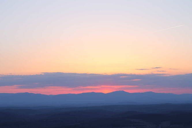
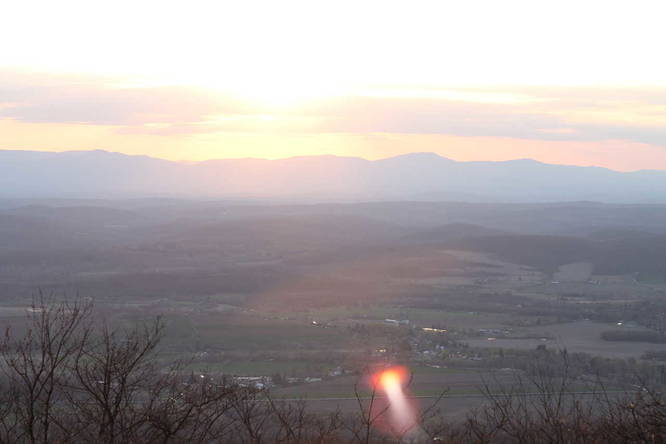
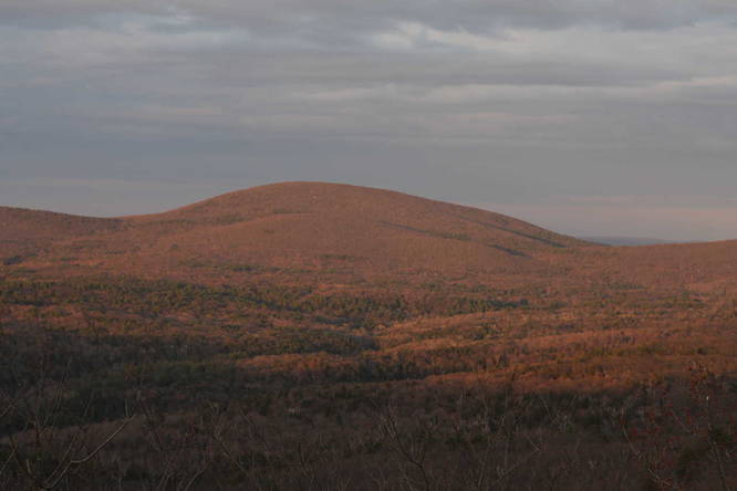
The hike is moderate as you'll have various mountain ridge ascents and descents, but the mountain ridge gives amazing views of the Berkshire mountains and New York state.

The last descent from Bash Bish Mountain is more strenuous on the knees as well. If you plan to hike this out-and-back, plan to bring plenty of water or bring a water filter system to use at Bash Bish Brook.

There's an additional trail, not marked here in the GPS map, that leads east to the Bash Bish Falls eastern parking lot.

Camping/Backpacking: This trail can be used for backpacking, but considering the ridge, it's not as easy. Hammock camping may be easier along this trail. You can use the Mt Alander trail for more camping options.
Explore 16 trails near Copake, MA

Know Before You Go

  • The 2.9-mile one-way South Taconic Trail section offers moderate hiking with scenic views from mountain ridges between Mt. Alander and Bash Bish Falls, including the summit of Bash Bish Mountain.
  • The trail involves ascents and descents, with a particularly strenuous descent from Bash Bish Mountain, requiring adequate water or a water filter for longer hikes.
  • While suitable for backpacking, the ridgeline terrain may present challenges, potentially favoring hammock camping, and alternative camping options are available via the Mt. Alander trail.
Interactive topographic map for South Taconic Trail - Mt Alander to Bash Bish Falls located in Copake, MA. Click the "View Map" button to load GPS coordinates and trail markers.
Get directions
Distance
2.9 mi
Difficulty
Moderate
Type
One-Way
Est. Time
1.5 hrs
Elev. Gain
111'
Rating
0.0
Added
March 11, 2018
Updated
July 17, 2019

Weather Forecast

Loading...
Total Change
1,515'
Ascent
111'
Descent
1,699'
Loading...

Download the GPX Data for Offline Use

Supporters get exclusive access to download trail routes to the MyHikes app for offline use. Stay prepared on your adventure, even without an internet connection! Become a Supporter today to unlock this feature and hike with confidence.

Download South Taconic Trail - Mt Alander to Bash Bish Falls GPX Data to the MyHikes Mobile App

Features

Vista / Lookout Point
Dogs
Mountain Summit
Camping

Points of interest

  1. Parking

    42.088215, -73.504005
  2. Main Trailhead

    42.088215, -73.504005
  3. View into New York state

    42.08962, -73.50373
    View into New York state
  4. View into New York state

    42.08967, -73.50373
    View into New York state

Safety information

For your own safety: plan ahead, let someone know where you'll be, and hike at your own risk.

Markers

Blaze Color

White

Availability

All seasons

Surface type

Dirt

Trip Reports (Reviews)

Your opinion matters! Be the first to rate this trail.

Ready to help fellow hikers? Add a trip report to share your experience and provide valuable insights for other hikers!

No community routes found. To add your own hike as a Community Route for this Trail guide, leave a Trip Report with an attached GPX file.

Popular categories

Scenic mountain view representing vista trails
Vista trails
Scenic gorge of cascades representing waterfall trails
Waterfall hikes
Rugged mountain terrain representing summit trails
Summit trails
Scenic mountain view representing dog-friendly trails
Dog-friendly
Scenic campsite with a view representing camping trails
Camping trails
Appalachian Trail logo representing A.T. hikes
A.T. hikes

You May Also Like

Colorado's Million Dollar Highway - Plan a day's drive adventure along the iconic Million Dollar Highway in Colorado. Explore the best short trails, roadside stops, waterfalls, vistas, ghost towns, and hot springs within a ~6 hour road trip.
Explore

Colorado's Million Dollar Highway

Plan a day's drive adventure along the iconic Million Dollar Highway in Colorado. Explore the best short trails, roadside stops, waterfalls, vistas, ghost towns, and hot springs within a ~6 hour road trip.

Read
Glacier's Going-to-the-Sun Road - Discover the breathtaking beauty of Glacier National Park along the iconic Going-to-the-Sun Road. From stunning roadside stops to picturesque waterfalls and vistas, this engineering marvel offers endless opportunities for exploration.
Explore

Glacier's Going-to-the-Sun Road

Discover the breathtaking beauty of Glacier National Park along the iconic Going-to-the-Sun Road. From stunning roadside stops to picturesque waterfalls and vistas, this engineering marvel offers endless opportunities for exploration.

Read
🍪 We use cookies to learn about site usage and to serve map tiles. You may block cookies manually in the browser. By continuing you agree. Learn more