The Right Steele Run Road Trail at Tioga State Forest in Shippen Township, Pennsylvania is an easy 1.7-mile out-and-back trail that runs atop a mountain ridge along Deadman Hollow Road and features seasonal views of Mt. Tom in the distance.
This drive-able road is also considered a hiking trail, which is often used during autumn and winter for hunting. The trail also links up to the Bee Tree Ski Trail at the junction located at the large clear-cut area along the trail; however, this section of the trail is not currently included on the map.
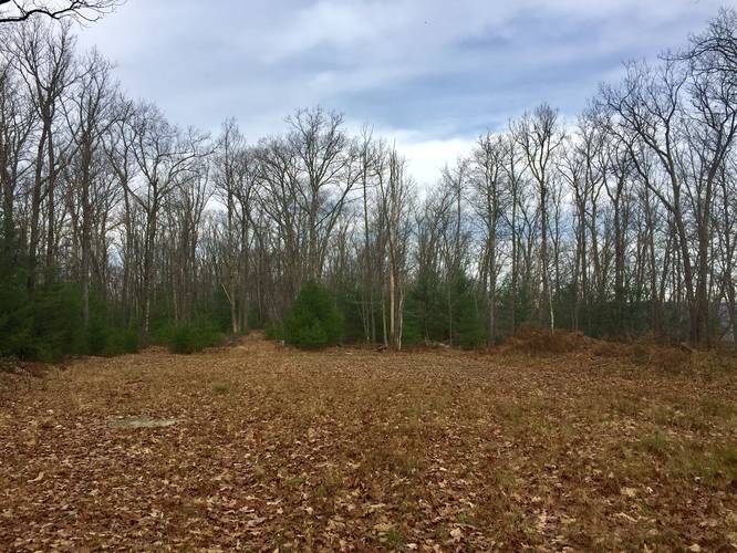
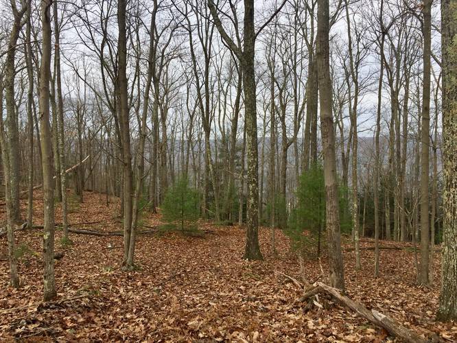
Hikers will find the trail is wide and relatively smooth throughout most of the trek. First, the trail begins in a small coniferous forest before it leads into a forest mixed with plenty of birch and deciduous trees. The trail leads uphill at a gradual slope before reaching a large clearing where hikers can take a right-hand turn to connect down to the Bee Tree Ski Trail or continue straight and follow the skinnier trail that lies dead ahead. This track follows the skinnier trail located directly across from where the trail enters the clearing and follows the trail until it starts to head downhill.
Hikers can choose to continue hiking downhill, which should connect to the Bee Tree Ski Trail, but I did not track the entire trail down to find out.
Seasonal View
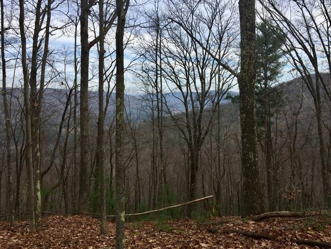
Hikers can find a seasonal obstructed view of Mt. Tom, which lies at the start of the PA Grand Canyon and where Pine Creek and Marsh Creek converge. This view is located off of the trail, so some bushwhacking is required to reach it and is only worth trying to find if the leaves are all off of the trees. The lookout point is located on the map provided.
Parking
There's a small turnout just before the yellow gate that leads into the trail. Vehicles can park here, but should not block the gate.
Warning
Hunting is permitted during certain times of the year. Wearing blaze orange is recommended.
Pets
Dogs are allowed if leashed.
Biking
Mountain biking is permitted along this trail.
Winter Road Conditions
Tioga State Forest does not maintain this road during the winter. Do not attempt driving on this road without proper equipment including snow tires and/or chains unless the road is clear. High wind storms may also cause trees to fall across the road, making the road impassible. If you plan to visit during the winter, plan accordingly.
This drive-able road is also considered a hiking trail, which is often used during autumn and winter for hunting. The trail also links up to the Bee Tree Ski Trail at the junction located at the large clear-cut area along the trail; however, this section of the trail is not currently included on the map.
Hikers will find the trail is wide and relatively smooth throughout most of the trek. First, the trail begins in a small coniferous forest before it leads into a forest mixed with plenty of birch and deciduous trees. The trail leads uphill at a gradual slope before reaching a large clearing where hikers can take a right-hand turn to connect down to the Bee Tree Ski Trail or continue straight and follow the skinnier trail that lies dead ahead. This track follows the skinnier trail located directly across from where the trail enters the clearing and follows the trail until it starts to head downhill.
Hikers can choose to continue hiking downhill, which should connect to the Bee Tree Ski Trail, but I did not track the entire trail down to find out.
Seasonal View
Hikers can find a seasonal obstructed view of Mt. Tom, which lies at the start of the PA Grand Canyon and where Pine Creek and Marsh Creek converge. This view is located off of the trail, so some bushwhacking is required to reach it and is only worth trying to find if the leaves are all off of the trees. The lookout point is located on the map provided.
Parking
There's a small turnout just before the yellow gate that leads into the trail. Vehicles can park here, but should not block the gate.
Warning
Hunting is permitted during certain times of the year. Wearing blaze orange is recommended.
Pets
Dogs are allowed if leashed.
Biking
Mountain biking is permitted along this trail.
Winter Road Conditions
Tioga State Forest does not maintain this road during the winter. Do not attempt driving on this road without proper equipment including snow tires and/or chains unless the road is clear. High wind storms may also cause trees to fall across the road, making the road impassible. If you plan to visit during the winter, plan accordingly.