The Flat Oak Loop Trail at Black Canyon of the Gunnison National Park
near Montrose, Colorado is a moderate 1.3-mile loop hike leads hikers down into the gorge and features breathtaking views of the 2,000-foot deep Black Canyon.
Hike
This hike begins at the eastern most trailhead, located near the start to the Gunnison Point Trail at the visitors center. The trail leads into the main loop after following a short spur as it passes through low-growing shrubs. At mile 0.15, hikers will reach a "Loop" sign where this route heads down into the canyon, taking a right-hand turn.
Eastern Switchbacks - Mile 0.15 to 0.45
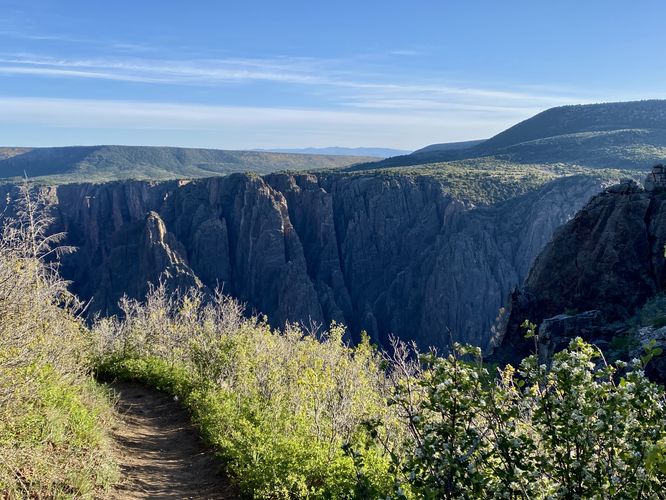
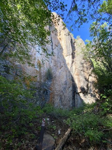
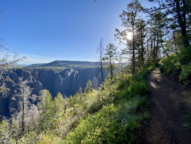
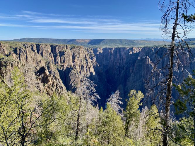
Once on the official loop, the trail becomes more interesting. Hikers will find a view not far after hopping onto the loop, located around mile 0.16. This on-trail view allows you to peer into the Black Canyon from the trail, but the best views are coming up. The trail then leads back into the shaded forest to follow several switchbacks as it descends into the Black Canyon.
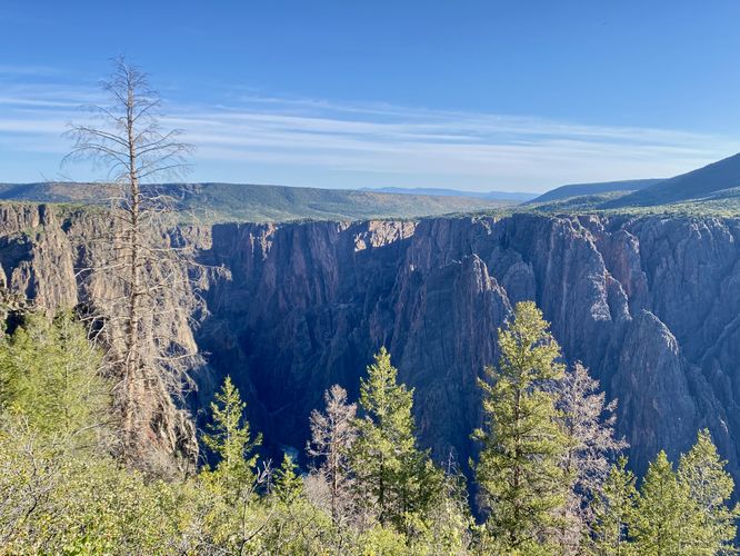
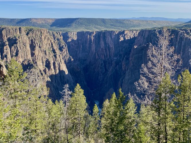
Rock Outcropping View - Mile 0.45
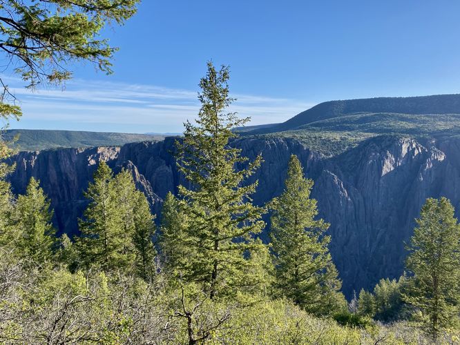
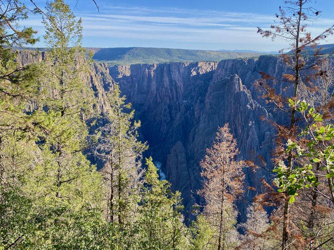
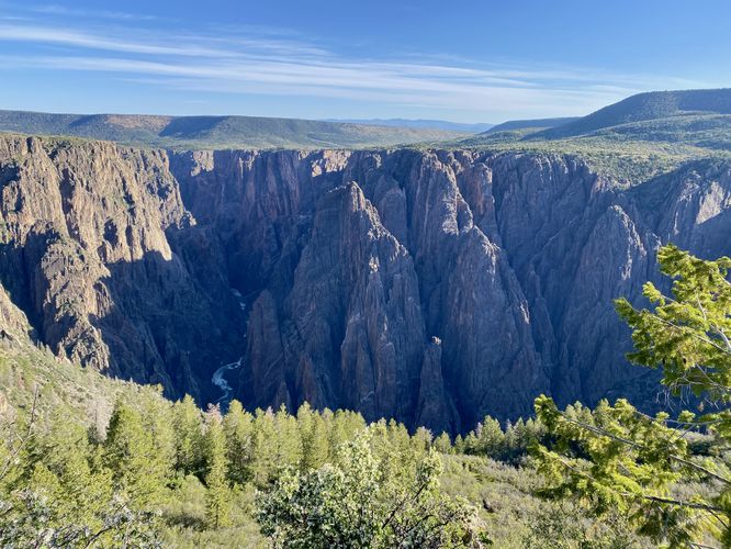
At mile 0.45, the trail reaches its lowest point -- to the right-hand side you'll find a nice rocky outcropping with a view into the canyon. Below is the Gunnison River as it roars through the canyon with its white water rapids visible from 2,000-feet above. Watch your step as you scramble around the rocks for a better view -- there are cliffs nearby!
Hiking Out of the Black Canyon - Mile 0.45 to 1
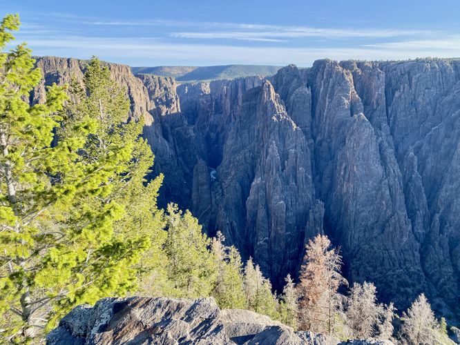
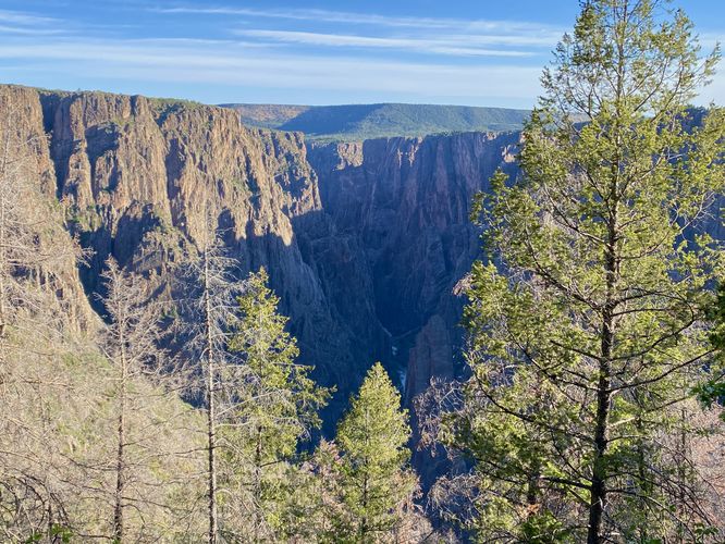
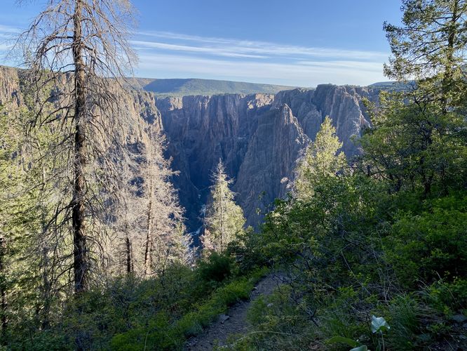
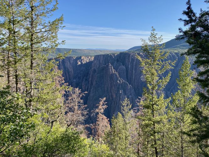
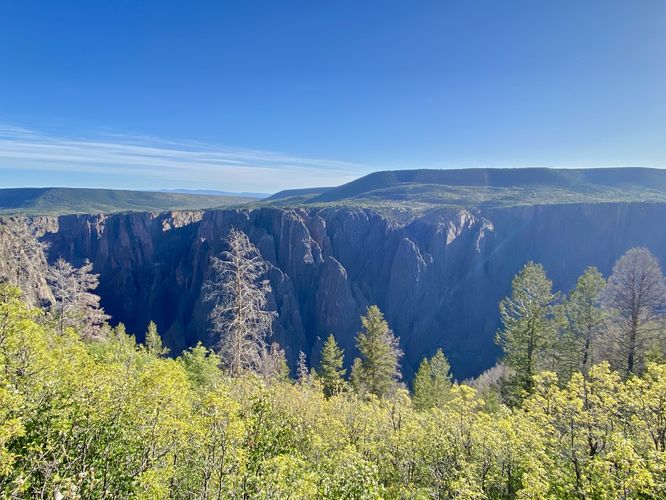
After exploring the rock outcropping view, the trail then leads back up and out of the canyon. It doesn't take very long to hike to the lowest point, but hiking back up is certainly more work. The hike out of the canyon isn't all that difficult, hence the "moderate" difficulty for the average hiker, but it does include more views of the canyon. Hiking the loop counter-clockwise provides you with nice views to take breaks at on your ascent out of the canyon and this part of the trail delivers. Hikers will find more than a handful of northwest-facing views of the Black Canyon and Gunnison River as you make your way along the trail. You'll hike switchbacks a few times, while passing some super-steep canyon rock walls on your way up. Stay on-trail at all times for safety as some of the terrain of the canyon is still extremely steep off-trail here.
Flat Rim Hiking - Mile 1 to 1.3
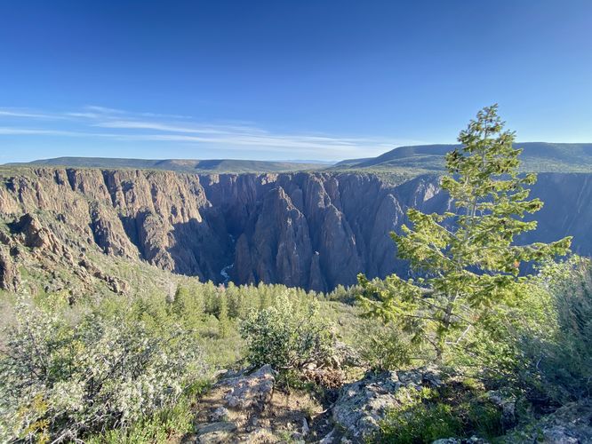
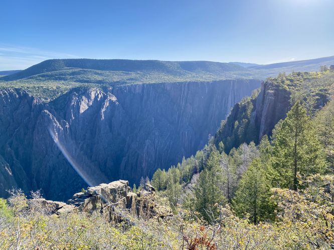
Around mile 1, hikers will be up and out of the canyon and back on the top of the southern rim. The trail follows a mostly-flat grade as it makes its way back toward the loop / trailhead. Along the way are even more views of the Black Canyon, located around mile 1.15 and 1.2. At mile 1.2, the view here finally gives one last chance to see into the eastern section of Black Canyon from this lookout, as most of the previous views were northwest-facing.
Uplands Trail - Mile 1.3
At mile 1.3, hikers will reach the junction with the Uplands Trail. Here, we decided to end our hike along the Oak Flat Loop Trail and we hopped on the Uplands Trail. Note that this trail continues for another ~0.18-miles. The park signage says the loop is 2-miles long, but in reality the Oak Flat Loop Trail is closed to 1.5-miles in total length. We skipped the connecting section to explore different parts of the park; however, the missing section of trail runs through scrubland to reach the trailhead by the visitors center.
Other Hikes
While checking out this hike, you might want to consider hiking other trails nearby like the Gunnison Point Trail, Uplands Trail, or the Rim Rock Trail -- all of which connect close to this trail or are accessible from the same parking lot.
Pets
Dogs are not allowed on this trail. Note that dogs are only allowed in parking lots, campgrounds, on paths to overlook, the Rim Rock Trail, and the Chasm View Nature Trail. Dogs are not permitted on any other trails in the park. You can read all of the rules and regulations for pets at the park here.
Parking
Hikers will find a large parking lot at the visitors center. The lot is large enough to fit a few dozen vehicles as of June 2024.
Warnings
Steep cliffs: Despite the abundance of safety precautions (i.e. fencing), this trail leads to cliffs that might drop 2,000-feet or more into the Black Canyon. Be aware of your surroundings.
Elevation sickness: This trail brings hikers through an altitude of about 8,000-feet above sea level. Around the 7,000-foot mark above sea level, you may start to experience symptoms of elevation sickness including shortness of breath, headaches, muscle aches, dizziness, rapid heartbeat, fatigue, or vomiting if you are not fully acclimated. If you're experiencing bad altitude sickness symptoms, the smartest move is to get to lower elevation as soon as possible.
Hike
This hike begins at the eastern most trailhead, located near the start to the Gunnison Point Trail at the visitors center. The trail leads into the main loop after following a short spur as it passes through low-growing shrubs. At mile 0.15, hikers will reach a "Loop" sign where this route heads down into the canyon, taking a right-hand turn.
Eastern Switchbacks - Mile 0.15 to 0.45
Once on the official loop, the trail becomes more interesting. Hikers will find a view not far after hopping onto the loop, located around mile 0.16. This on-trail view allows you to peer into the Black Canyon from the trail, but the best views are coming up. The trail then leads back into the shaded forest to follow several switchbacks as it descends into the Black Canyon.
Rock Outcropping View - Mile 0.45
At mile 0.45, the trail reaches its lowest point -- to the right-hand side you'll find a nice rocky outcropping with a view into the canyon. Below is the Gunnison River as it roars through the canyon with its white water rapids visible from 2,000-feet above. Watch your step as you scramble around the rocks for a better view -- there are cliffs nearby!
Hiking Out of the Black Canyon - Mile 0.45 to 1
After exploring the rock outcropping view, the trail then leads back up and out of the canyon. It doesn't take very long to hike to the lowest point, but hiking back up is certainly more work. The hike out of the canyon isn't all that difficult, hence the "moderate" difficulty for the average hiker, but it does include more views of the canyon. Hiking the loop counter-clockwise provides you with nice views to take breaks at on your ascent out of the canyon and this part of the trail delivers. Hikers will find more than a handful of northwest-facing views of the Black Canyon and Gunnison River as you make your way along the trail. You'll hike switchbacks a few times, while passing some super-steep canyon rock walls on your way up. Stay on-trail at all times for safety as some of the terrain of the canyon is still extremely steep off-trail here.
Flat Rim Hiking - Mile 1 to 1.3
Around mile 1, hikers will be up and out of the canyon and back on the top of the southern rim. The trail follows a mostly-flat grade as it makes its way back toward the loop / trailhead. Along the way are even more views of the Black Canyon, located around mile 1.15 and 1.2. At mile 1.2, the view here finally gives one last chance to see into the eastern section of Black Canyon from this lookout, as most of the previous views were northwest-facing.
Uplands Trail - Mile 1.3
At mile 1.3, hikers will reach the junction with the Uplands Trail. Here, we decided to end our hike along the Oak Flat Loop Trail and we hopped on the Uplands Trail. Note that this trail continues for another ~0.18-miles. The park signage says the loop is 2-miles long, but in reality the Oak Flat Loop Trail is closed to 1.5-miles in total length. We skipped the connecting section to explore different parts of the park; however, the missing section of trail runs through scrubland to reach the trailhead by the visitors center.
Other Hikes
While checking out this hike, you might want to consider hiking other trails nearby like the Gunnison Point Trail, Uplands Trail, or the Rim Rock Trail -- all of which connect close to this trail or are accessible from the same parking lot.
Pets
Dogs are not allowed on this trail. Note that dogs are only allowed in parking lots, campgrounds, on paths to overlook, the Rim Rock Trail, and the Chasm View Nature Trail. Dogs are not permitted on any other trails in the park. You can read all of the rules and regulations for pets at the park here.
Parking
Hikers will find a large parking lot at the visitors center. The lot is large enough to fit a few dozen vehicles as of June 2024.
Warnings
Steep cliffs: Despite the abundance of safety precautions (i.e. fencing), this trail leads to cliffs that might drop 2,000-feet or more into the Black Canyon. Be aware of your surroundings.
Elevation sickness: This trail brings hikers through an altitude of about 8,000-feet above sea level. Around the 7,000-foot mark above sea level, you may start to experience symptoms of elevation sickness including shortness of breath, headaches, muscle aches, dizziness, rapid heartbeat, fatigue, or vomiting if you are not fully acclimated. If you're experiencing bad altitude sickness symptoms, the smartest move is to get to lower elevation as soon as possible.