The Lake Josephine Loop at Glacier National Park near Babb, Montana is an easy 4.9-mile loop hike that features breathtaking views of Mount Gould, Josephine Lake, Salamander Glacier, and the 960-foot tall Grinnell Falls.
Muddy: Please note that the South Shore Josephine Lake Trail can be very muddy especially in the northern sections. This is a popular horseback riding trail and thus the terrain gets ripped up a lot more than than North Shore Josephine Lake Trail by comparison. The trail also appears to collect more rainwater as it washes down from Allen Mountain which adds to the spongy / muddy/ wet trail conditions.
Trails
This hike follows several named trails in order: Swiftcurrent Lake Loop Trail, North Shore Josephine Lake Trail, Josephine Walk (boardwalk), South Shore Josephine Lake Trail, Piegan Pass Trail.Hiking Josephine Lake
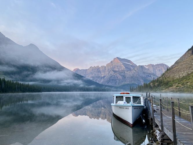
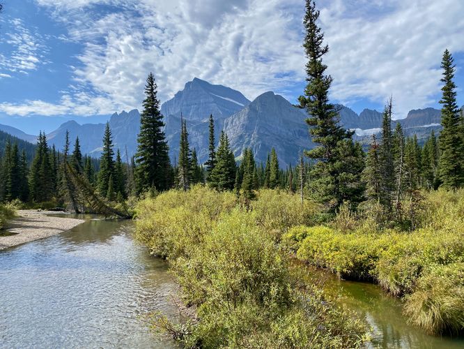
This hike begins at the southern trailhead along the Swiftcurrent Lake Loop Trail, located just south of the Many Glacier Hotel. Hikers can choose to follow several different routes in to reach Lake Josephine, but this route follows the most scenic trails to reach the lake, by following the Swiftcurrent Lake Loop Trail first as it provides views along Swiftcurrent Lake as it meanders toward Lake Josephine. Around mile 0.95, hikers will reach a junction with the North Shore Lake Josephine Trail where you'll want to keep-left at the junction to follow this trail.Lake Josephine Boat Dock View - Mile 1.15
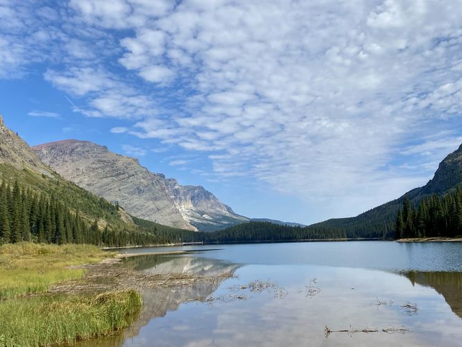
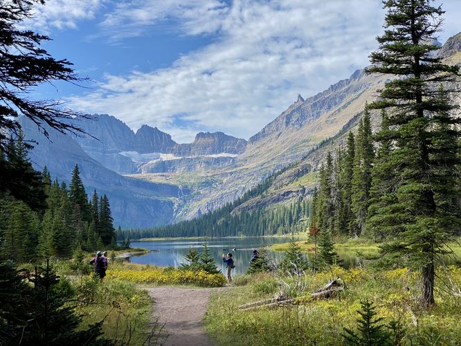
After heading south along the North Shore Josephine Lake Trail, hikers will reach their first view of Lake Josephine around mile 1.15 located at a scenic boat dock. This view of Lake Josephine, in my opinion, is arguably the best view of the lake. You'll find the towering ramparts of Mount Gould on the opposite side of the lake with its reflection in the water. If you show up at a time of calm water (no wind) you'll find Mount Gould perfectly reflected in the lake, which makes for a breathtaking view. Oh and Lake Josephine's water is clear enough to view the colorful rocks that sit at the bottom of the lake which only adds to this stunning vista.Hiking N Shore Josephine Lake Trail to Josephine Walk - Mile 0.95 to 2.3
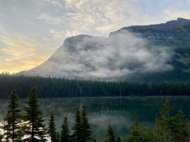
Aside from the boat dock, the North Shore Josephine Lake Trail has plenty of views for hikers to take-in as they make their way south toward the Josephine Walk (boardwalk). Hikers will find Allen Mountain located southeast from the trail with its red-colored bedrock that sits high above Lake Josephine. As you make your way south along the trail, you'll find more views of Mount Gould and Lake Josephine directly from the trail. At mile 2, hikers will find a split in the trail -- here, keep left to stay on the N Shore Josephine Lake Trail as the right-hand turn leads to Grinnell Glacier. Around mile 2.3, hikers will reach a junction with the Grinnell Glacier Trail and the Josephine Walk (boardwalk) -- at this junction, do not hike uphill but rather follow south to reach the boardwalk.Josephine Walk (Boardwalk) - Mile 2.3 to 2.6
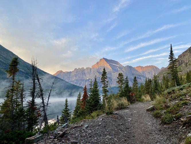
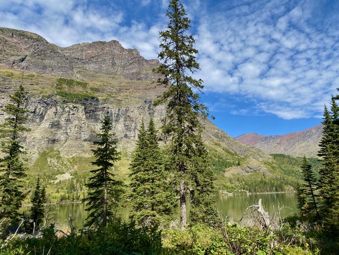
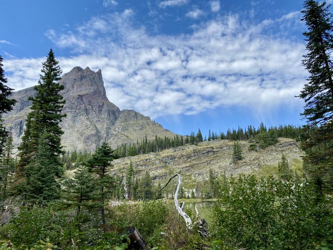
The Josephine Walk section of this hike begins just beyond the southern terminus for the Grinnell Glacier Trail and leads hikers past an annoying section of tree roots to reach a raised boardwalk that spans wetlands near Grinnell Creek. The trail leads to a footbridge that spans Grinnell Creek and provides views of Mount Gould, Angel Wing (peak), Salamander and Gem Glaciers, Grinnell Creek, Grinnell Mountain, Lake Josephine, and Allen Mountain. The footbridge is by-far one of the most scenic stops along this hike, so be sure to take-in the views as you pass. After the footbridge, the trail follows a dirt path before quickly returning to a skinny raised boardwalk. The boardwalk lasts until mile 2.6 where it reaches the junction with the South Shore Josephine Lake Trail.Hiking the South Shore Josephine Lake Trail - Mile 2.6 to 4.55
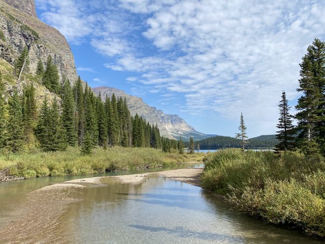
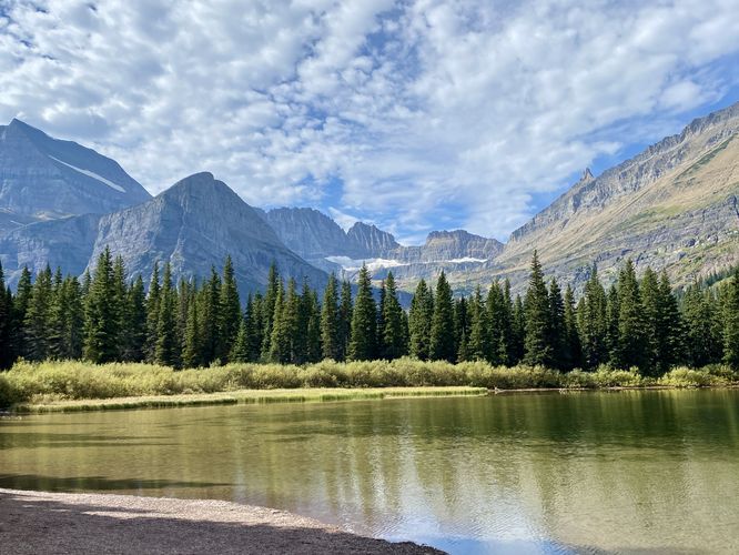
The South Shore Josephine Lake Trail begins around mile 2.6, just after the Josephine Walk (boardwalk). This trail is generally much more secluded than the North Shore Josephine Lake Trail and for good reason -- it's a longer hike to reach Grinnell Glacier or Grinnell Lake and is often a lot more muddy. Despite the mud, the seclusion on this trail is a nice change of pace from the throngs of hikers hiking on the opposite side of the lake. The first stop along this route (hiking north) is the southern boat dock located around mile 2.65 -- located just off-trail, you'll have to spot a view of Lake Josephine and the boat dock shelter from the trail to hike over. The view from the southern boat dock is another beautiful view of the lake, Mount Gould, Angel Wing, and Salamander Glacier. After visiting the boat dock you can choose to take a small break in the shelter to eat a snack or relax a bit. The trail continues onward from the boat dock as it heads north through the open but shaded forest. Hikers will find views along the way, mostly of Grinnell Mountain. The best view is located around mile 3.7 where you'll find a view of Lake Josephine, Grinnell Falls (960-feet tall), Mount Gould, Angel Wing, and the Salamander Glacier. This is the last of the good view you'll find along the loop. The trail then reaches a junction around mile 4 -- the trail technically keeps-right to head toward the Piegan Pass Trail (park service road). By keeping-right at mile 4, you'll follow an even-muddier trail that's primarily used by horseback riders. The trail finally spits hikers out along the park's service road which is also a section of the Piegan Pass Trail located around mile 4.55Piegan Pass (Service Road) Trail to Trailhead - Mile 4.55 to 4.9
The last section of this hike leads you north along the dirt road of the Piegan Pass Trail which is primarily used by park workers to reach private residences but also leads back directly to the trailhead. Follow this section of trail from mile 4.55 to 4.9 to complete this easy but ultra-scenic hike around Lake Josephine.Vehicle Reservations
Depending on what time of year you visit, you may need to reserve a vehicle entrance pass to get into the park, in addition to a park entry fee (or annual National Parks pass). Before planning this hike, ensure you've checked the NPS website for when and where Glacier NP vehicle reservations are required.Parking at Many Glacier Hotel
This trail guide leads hikers to the parking lot at Many Glacier Hotel to start their hike, which is located at the coordinates provided. The parking lot is large enough to fit many dozens of vehicles as of September 2024. Note that if you plan to park here when the hotel is open for the season, the parking lot may be mostly-full from the visitors who are staying at the hotel.Parking Construction (Sept 2024 - May 2026)
Additional parking note: The park began construction west of the Many Glacier Hotel access road on September 16, 2024. This closed down the road and the western parking lot for the Swiftcurrent Lake Loop Trail / Grinnell Glacier Trail trailheads, forcing hikers to use the Many Glacier Hotel parking lot until the road reopens in May 2026. For the time being, this parking lot and trailhead will be the main access to Grinnell Glacier until construction is completed. Due to this, parking is even-more limited for this hike. If you show-up before the Many Glacier Hotel closes for the season, you'll have to battle for parking spaces or show-up super early in the morning to claim a spot. We woke up at 4AM to do the 2.5-hour drive from West Glacier to snag a spot around 6:30AM to start our hike -- at the time, the hotel was closing the same day so hotel guests had filled 90% of the parking lot, leaving very-little room for day hikers traveling from other places. For more details, please see the official page for the Swiftcurrent area construction.Pets
Dogs are not allowed on any trails at Glacier National Park.Wildlife
This trail is great for possible wildlife viewing opportunities including mountain goats and longhorn sheep high in the cliffs or near trail grazing, moose, elk, deer, and even grizzly bears on occasion.Warning
Grizzly bears: This trail is frequented often by grizzly bears, especially in late Summer and early Fall as they scrounge for 20 hours/day bulking for the winter. Always give wild animals plenty of space, including several hundred feet for grizzlies. It's best to bring bear spray on this hike as a last defense just in case a grizzly were to charge at you. Always make plenty of noise while hiking to alert animals to your presence long before you see them. It's also smart to hike with another person.Muddy: Please note that the South Shore Josephine Lake Trail can be very muddy especially in the northern sections. This is a popular horseback riding trail and thus the terrain gets ripped up a lot more than than North Shore Josephine Lake Trail by comparison. The trail also appears to collect more rainwater as it washes down from Allen Mountain which adds to the spongy / muddy/ wet trail conditions.