Loading...

๐ŸŽ‰ Enjoy a Free 7-Day Supporter Trial and Unlock Exclusive Perks โ€” No Credit Card Required. Learn more.

Swiftcurrent Lake Loop Trail

Directions
Map
Pictures
Send to App
Distance:
2.6 Miles / 4.2 km
Type:
Loop
Difficulty:
Easy
Time to Hike:
1 hour, ~18 minutes
Features:
Surface Type:
Universal Access
Park:
Glacier National Park
Town:
Babb, Montana
Directions:
48.795631, -113.656042
Added:
September 19, 2024
Updated:
October 15, 2024
Copy Trail Link Hiking this trail? Send a friend or family member a link to this trail guide for your own safety. Hike at your own risk (disclaimer)
Loading...
Loading...
55'

Total Change
87'

Ascent
87'

Descent

Download the Trail Route for Offline Use

Supporters get exclusive access to download trail routes to the MyHikes app for offline use. Stay prepared on your adventure, even without an internet connection! Become a Supporter today to unlock this feature and hike with confidence.

Send to App

Swiftcurrent Lake Loop Trail

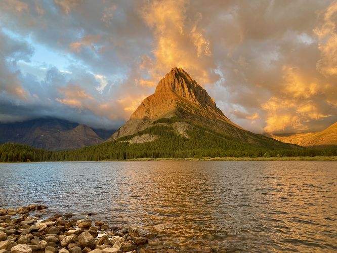
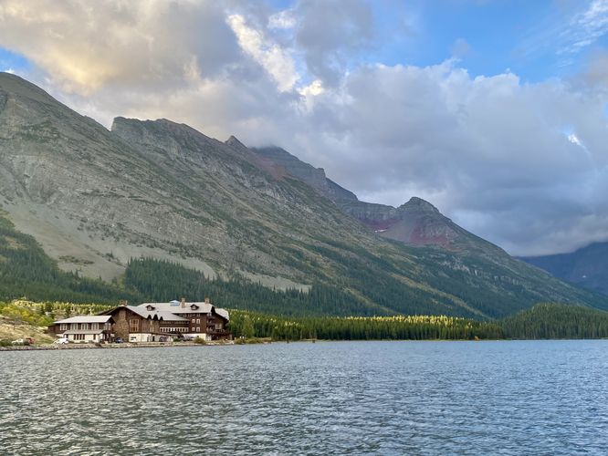
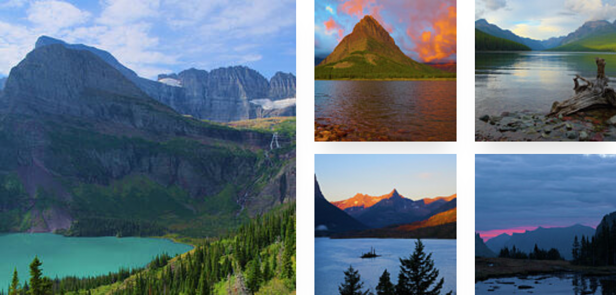
The Swiftcurrent Lake Loop Trail at Glacier National Park near Babb, Montana is an easy 2.6-mile loop hike that encompasses Swiftcurrent Lake and features stunning views of the neighboring alpine mountains that tower high above the water.

Partial Trail Closure

Please note that part of the north and the entire western side of this loop is closed as of September 2024 and will be closed for repairs until sometime in 2025.

Hiking around Swiftcurrent Lake

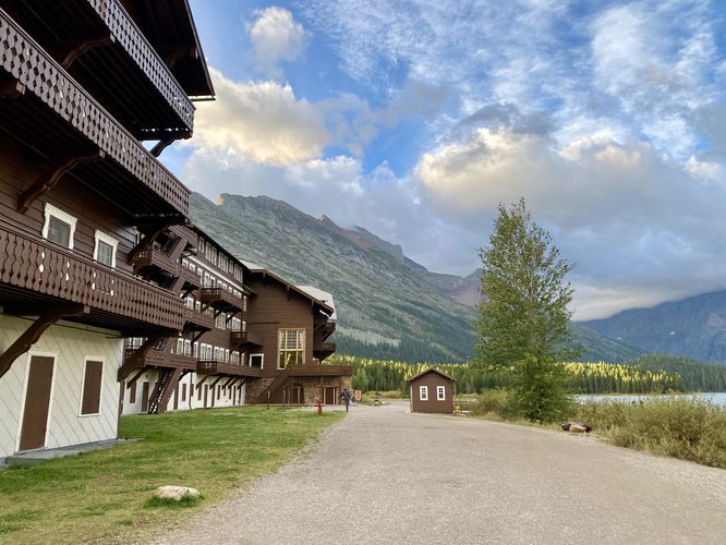
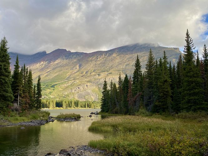
This hike begins at the southern trailhead, located just south of the Many Glacier Hotel, and follows the trail clockwise around Swiftcurrent Lake. Hikers will find a paved and universally-accessible path which follows along the water's edge, passing through the forest, as it makes its way around the lake. Throughout the trail are various viewpoints that can be enjoyed by simply hopping off-trail to take-in views of Grinnell Mountain, the hotel, Altyn Peak, and other mountains in the distance. The trail will pass a private residence (for park staff) before crossing a footbridge that spans a connecting creek between Stump and Swiftcurrent Lakes where you'll find more scenic views of the surrounding landscape including views of Allen Mountain to the south.

The trail reaches a junction with the North Shore Lake Josephine Trail where the Swiftcurrent Lake Loop Trail turns right to head north, located near mile 0.9. This is also where the paved and universally-accessible portion of the trail ends. The trail then leads north along the shoreline, passing through another section of shaded forest before it leads hikers alongside the parking lot. Once at the northern parking lot, the trail then connects back to the Many Glacier Hotel by heading east and following the northern shore of Swiftcurrent Lake. Hikers will finally hike across the bridge and back to the Many Glacier Hotel, passing arguably some of the best views on the trail, before ending the hike back at the trailhead.  

Universal Access

This trail is paved and universally accessible only from the trailhead south of Many Glacier Hotel up to approximately 0.9-miles in, which is located around the North Shore Josephine Lake Trail. This section of the loop provides stunning views of the lake, hotel, Grinnell Mountain, and more.

Vehicle Reservations

Depending on what time of year you visit, you may need to reserve a vehicle entrance pass to get into the park, in addition to a park entry fee (or annual National Parks pass). Before planning this hike, ensure you've checked the NPS website for when and where Glacier NP vehicle reservations are required.

Parking at Many Glacier Hotel

This trail guide leads hikers to the parking lot at Many Glacier Hotel to start their hike, which is located at the coordinates provided. The parking lot is large enough to fit many dozens of vehicles as of September 2024. Note that if you plan to park here when the hotel is open for the season, the parking lot may be mostly-full from the visitors who are staying at the hotel.

Swiftcurrent Parking Construction (Sept 2024 - May 2026)

Additional parking note: The park began construction west of the Many Glacier Hotel access road on September 16, 2024. This closed down the road and the western parking lot for the Swiftcurrent Lake Loop Trail / Grinnell Glacier Trail trailheads, forcing hikers to use the Many Glacier Hotel parking lot until the road reopens in May 2026. For the time being, this parking lot and trailhead will be the main access to Grinnell Glacier until construction is completed. Due to this, parking is even-more limited for this hike. If you show-up before the Many Glacier Hotel closes for the season, you'll have to battle for parking spaces or show-up super early in the morning to claim a spot. We woke up at 4AM to do the 2.5-hour drive from West Glacier to snag a spot around 6:30AM to start our hike -- at the time, the hotel was closing the same day so hotel guests had filled 90% of the parking lot, leaving very-little room for day hikers traveling from other places. For more details, please see the official page for the Swiftcurrent area construction.

Pets

Dogs are not allowed on any trails at Glacier National Park.

Wildlife

This trail is great for possible wildlife viewing opportunities including mountain goats and longhorn sheep high in the cliffs, moose, elk, deer, and even grizzly bears on occasion.

Warning

Grizzly bears: This trail may be frequented by grizzly bears, especially during late Summer and early Fall as they scrounge for 20 hours/day bulking for the winter. Always give wild animals plenty of space, including several hundred feet for grizzlies. It's best to bring bear spray on this hike as a last defense just in case a grizzly were to charge at you. Always make plenty of noise while hiking to alert animals to your presence long before you see them. It's also smart to hike with another person.
Explore 45 trails near Babb, MT
  1. Parking

    48.795631, -113.656042
  2. Main Trailhead

    48.795362, -113.657612
  3. View / Overlook / Vista

    48.796506, -113.658286
    View / Overlook / Vista
  4. View of Many Glacier Hotel and Allen Mountain

    48.79985, -113.658403
    View of Many Glacier Hotel and Allen Mountain
  5. Many Glacier Hotel

    48.797153, -113.657944
    Many Glacier Hotel
  6. View of Grinnell Mountain

    48.794422, -113.658714
    View of Grinnell Mountain
  7. Creek crossing (footbridge) view of Altyn Peak

    48.788397, -113.663436
    Creek crossing (footbridge) view of Altyn Peak
No community routes found. To add your own hike as a Community Route for this Trail guide, leave a Trip Report with an attached GPX file.

Seasons

Spring, Summer, Fall

Trip Reports

Trail Guide By:
Admin user profile picture
2.6 miles / 4.2 km
2.6 miles / 4.2 km
September 19, 2024
Hiking
Preview of the MyHikes mobile app interface

Track, Log, and Explore Hikes with the MyHikes App

Shop Landscape Prints
Shop our landscape prints from Glacier National Park

Weather Forecast

In Babb, MT

Explore Hiking Trails

You May Also Like

Colorado's Million Dollar Highway - Plan a day's drive adventure along the iconic Million Dollar Highway in Colorado. Explore the best short trails, roadside stops, waterfalls, vistas, ghost towns, and hot springs within a ~6 hour road trip.
Explore

Colorado's Million Dollar Highway

Plan a day's drive adventure along the iconic Million Dollar Highway in Colorado. Explore the best short trails, roadside stops, waterfalls, vistas, ghost towns, and hot springs within a ~6 hour road trip.

Read
Glacier's Going-to-the-Sun Road - Discover the breathtaking beauty of Glacier National Park along the iconic Going-to-the-Sun Road. From stunning roadside stops to picturesque waterfalls and vistas, this engineering marvel offers endless opportunities for exploration.
Explore

Glacier's Going-to-the-Sun Road

Discover the breathtaking beauty of Glacier National Park along the iconic Going-to-the-Sun Road. From stunning roadside stops to picturesque waterfalls and vistas, this engineering marvel offers endless opportunities for exploration.

Read
New York's Best Waterfalls - Whether you're planning a day hike, roadside stop, or a leisurely short walk, this guide provides hikers, travelers, and locals alike with 63 different locations to over 100 scenic waterfalls to help plan your next adventure!
Explore

New York's Best Waterfalls

Whether you're planning a day hike, roadside stop, or a leisurely short walk, this guide provides hikers, travelers, and locals alike with 63 different locations to over 100 scenic waterfalls to help plan your next adventure!

Read

Before you boogie...

Find our trail guides useful? Consider becoming a Supporter to unlock perks!

MyHikes is an indie platform that makes exploring public trails easier for everyone. The platform has no investors, no ads, and is owned and operated by one person, Dave Miller. Dave has personally mapped and written over 1,800 trail guides on MyHikes for the public to explore. MyHikes has helped millions outdoor enthusiasts plan their next adventure.

But it takes a lot of time ๐Ÿ•ฆ, money ๐Ÿ’ฐ, work, and espresso shots โ˜• to run MyHikes, including hiking , mapping , writing , and publishing new trails with high-quality (accurate) information... along with software engineering (coding) the platform like building new features, website and mobile app development (iOS and Android), site maintainance . and much much more.

Supporters unlock website and mobile app perks with an annual one-time payment of $25 (you renew) ๐Ÿ˜Ž๐Ÿ‘. Or you can simply make a Donation of your choice. Otherwise, you can support us by telling your friends about MyHikes - both quick and free ๐ŸŽ‰

Admin user profile picture

Dave Miller
MyHikes Founder