The Grinnell Lake & Hidden Falls Hike at
Glacier National Park near Babb, Montana is an easy 7.8-mile out-and-back hike that leads to the turquoise glacial waters of Grinnell Lake and the 960-foot tall Grinnell Falls and features a short hike up to a small gorge waterfall known as Hidden Falls.
Trails
This hike follows several named trails in the following order:
Swiftcurrent Lake Loop Trail, North Shore Josephine Lake Trail, Grinnell Lake Trail, Hidden Falls Trail.
Hiking to Grinnell Lake
Hikers can start their trek out to Grinnell Lake from a couple of different trailheads, but this route begins along the southern trailhead at the
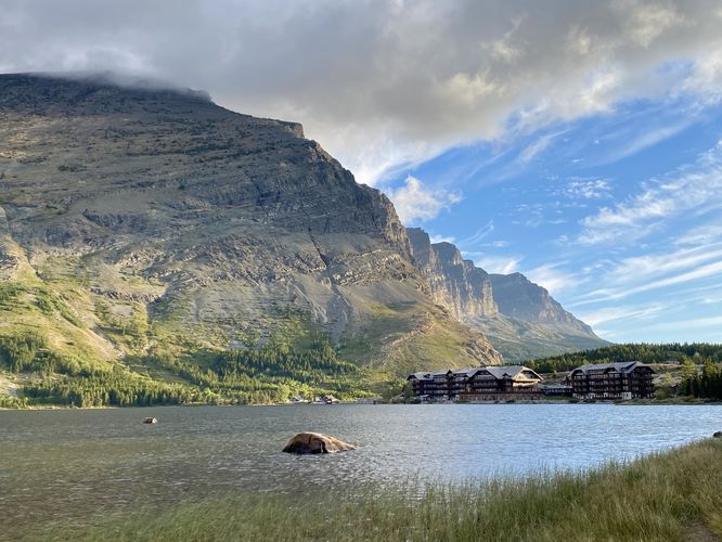
Swiftcurrent Lake Loop Trail, located just south of the Many Glacier Hotel. The reason for this start is both for the scenery and the Swiftcurrent Lake area construction during September 2024, which closed down the west side of the lake to driving and trailhead access. Hikers will first follow the
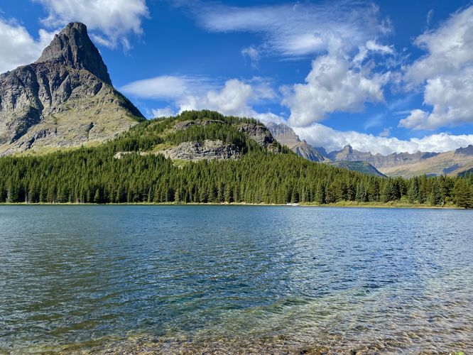
Swiftcurrent Lake Loop Trail as it runs along the southern shore of the lake and provides hikers with several beautiful views of the water and surrounding mountains like Grinnell Mountain and Altyn Peak.
N Shore Lake Josephine Trail to Grinnell Lake Trail - Mile 0.95 to 2.5
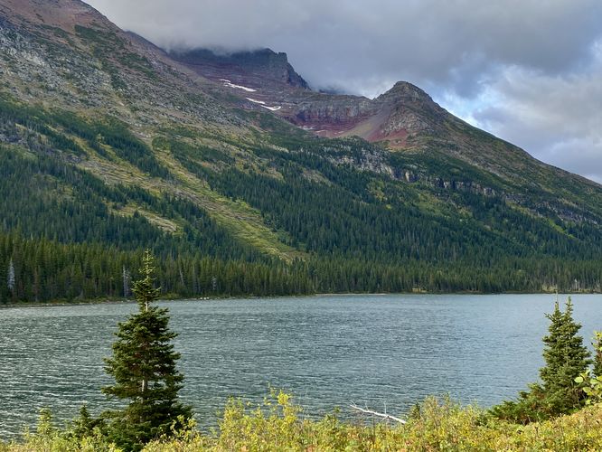
At mile 0.95, hikers will reach a junction with the North Shore Josephine Lake Trail -- take this left-hand turn to hike south along the north shore of the lake. Along the way, hikers will find more breathtaking views of the surrounding mountains including the towering ramparts of Mount Gould and Angel Wing. This route keeps left at the junction with the
Grinnell Glacier Trail to continue lower, closer to Lake Josephine's shoreline. The trail then passes the
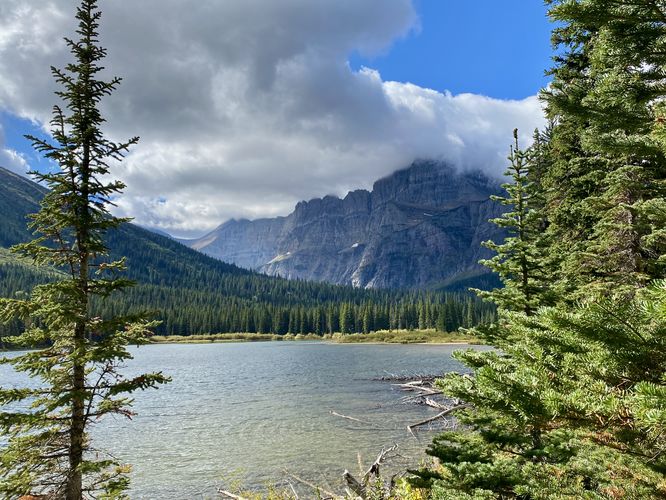
Grinnell Glacier Trail once more before it leads out across a series of boardwalks and a footbridge that spans Grinnell Creek. At the footbridge, hikers will find beautiful views of Angle Wing (peak) and Salamander Glacier sitting up high in an alpine hanging valley. The trail then continues along skinny raised boardwalks to reach the Grinnell Lake Trail around mile 2.5.
Grinnell Lake Trail to Hidden Falls - Mile 2.5 to 3.5
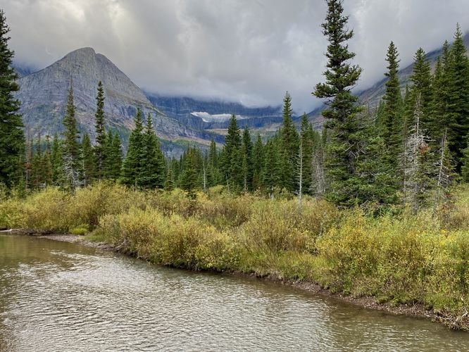
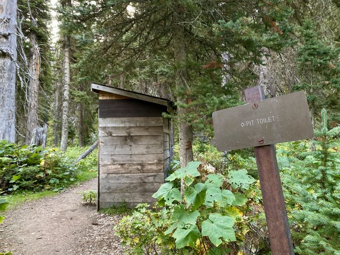
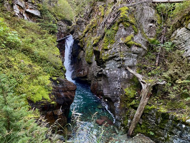
The hike to Hidden Falls is fairly straight forward from the junction with the South Shore Josephine Lake Trail -- hikers will head south as the trail passes through a mostly open forest with low-growing plants and shrubs and towering trees that provide abundant shade. The trail includes a privy (backcountry toilet) around mile 3.3. At mile 3.4, you'll find a suspension footbridge that spans Cataract Creek. Before crossing this super-scenic suspension bridge, you can explore Hidden Falls which sits in a mossy gorge located just 0.1-miles from this junction. The Hidden Falls Trail is not easy as it leads uphill at least 100-feet or so in elevation to reach a viewing platform for Hidden Falls, located around mile 3.5. Hidden Falls is a short but scenic waterfall with crystal clear deep turquoise waters. The pool of Hidden Falls is filled with rocks of variing shades of white, blue-gray, and red, which add to the scenery of the water.
Hidden Falls to Grinnell Lake - Mile 3.5 to 4
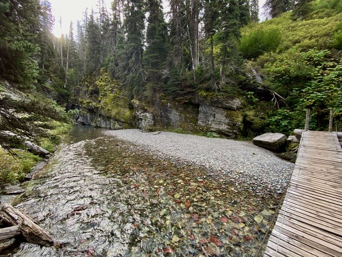
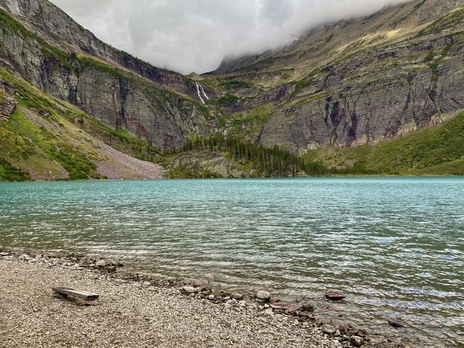
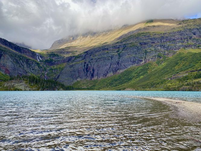
After exploring Hidden Falls, hikers will head back downhill to reach the suspension bridge that crosses Cataract Creek. The suspension bridge is very wobbly, so hold on tight as you cross (one hiker at a time). The bridge spans the creek with crystal-clear water and colorful rocks below. The trail then ascends a small hill before following an undulating path that leads to Grinnell Lake. Just before the lake is a junction with a horse trail -- keep right here to hike downhill to the water. Hikers will first approach the northern end of Grinnell Lake, with its turquoise glacial waters popping through the brown tree bark around mile 3.8. The trail then follows a raised boardwalk out to the shore of Grinnell Lake. From the shore, hikers can choose to walk a bit further to get away from other hikers to reach the "end" of the trail around mile 4. Here, you'll find seclusion at Glacier National Park, which can be hard to find at times. Sitting along the shore of Grinnell Lake, hikers will find the 960-foot tall Grinnell Falls cascading down the mountain from Upper Grinnell Lake where
Grinnell Glacier is slowly (but surely) melting away and feeding this lake. You'll also find Angel Wing peak towering overhead. The lake is a great spot to hang out for a while before hiking back and provides, arguably, the best view and scenery along this route.
Hiking back from Grinnell Lake - Mile 4 to 7.8
The hike back to parking follows the identical but opposite route (skipping Hidden Falls) to complete this 7.8-mile out-and-back adventure. There isn't much noteworthy to mention about the hike out except for noting the proper turns (downloading the MyHikes app with offline maps helps with this). Be sure to stop at viewpoints on your hike out as some vantage points provide different views from what you saw on the way in, depending on which direction you were facing. Enjoy the last of the hike as you stroll along Swiftcurrent Lake before the hike ends at the Many Glacier Hotel for 7.8-miles.
Vehicle Reservations
Depending on what time of year you visit, you may need to
reserve a vehicle entrance pass
to get into the park, in addition to a park entry fee (or annual
National Parks pass). Before planning this hike, ensure you've checked
the
NPS website for when and where Glacier NP vehicle reservations are required.
Parking at Many Glacier Hotel
This trail guide leads
hikers to the parking lot at Many Glacier Hotel to start their hike,
which is located at the coordinates provided. The parking lot is large
enough to fit many dozens of vehicles as of September 2024. Note that if
you plan to park here when the hotel is open for the season, the
parking lot may be mostly-full from the visitors who are staying at the
hotel.
Parking Construction (Sept 2024 - May 2026)
Additional
parking note: The park began construction west of the Many Glacier
Hotel access road on September 16, 2024. This closed down the road and
the western parking lot for the
Swiftcurrent Lake Loop Trail
/ Grinnell Glacier Trail trailheads, forcing hikers to use the Many
Glacier Hotel parking lot until the road reopens in May 2026. For the
time being, this parking lot and trailhead will be the main access to
Grinnell Glacier until construction is completed. Due to this, parking
is even-more limited for this hike. If you show-up before the Many
Glacier Hotel closes for the season, you'll have to battle for parking
spaces or show-up super early in the morning to claim a spot. We woke up
at 4AM to do the 2.5-hour drive from West Glacier to snag a spot around
6:30AM to start our hike -- at the time, the hotel was closing the same
day so hotel guests had filled 90% of the parking lot, leaving
very-little room for day hikers traveling from other places. For more
details, please see the
official page for the Swiftcurrent area construction.
Pets
Dogs are
not allowed on any trails at Glacier National Park.
Wildlife
This trail is great for possible wildlife viewing opportunities
including mountain goats and longhorn sheep high in the cliffs or near trail grazing, moose,
elk, deer, and even grizzly bears on occasion. On this particular hike, we found a moose located off of the Grinnell Lake Trail and Longhorn Sheep grazing along the North Shore Josephine Lake Trail.
Warning
Grizzly bears:
This trail is frequented often by grizzly bears, especially in late
Summer and early Fall as they scrounge for 20 hours/day bulking for the
winter. Always give wild animals plenty of space, including several
hundred feet for grizzlies. It's best to bring bear spray on this hike
as a last defense just in case a grizzly were to charge at you. Always make plenty of noise while hiking to alert animals to your
presence long before you see them. It's also smart to hike with another
person.