Johnson Cliff Vista via the Mid State Trail (MST) at Tioga State Forest in Blackwell, Pennsylvania is a difficult 2.3-mile out-and-back hike that leads to a beautiful vista point called Johnson Cliff.
Trail Names
This hike follows several named trails. First, the hike follows the Pine Creek Trail. The second trail the hike follows has three names: Fork Hill Trail (on the Tioga State Forest map), Mid State Trail, and finally the Great Eastern Trail. The local trail name is the Fork Hill Trail; however, both the Mid State Trail and the Great Eastern Trail follow along the same route.
Trail Description
This hike begins at the Pine Creek Trail trailhead at Blackwell and follows the Pine Creek Trail for about 0.3-miles before entering Tioga State Forest. Just after the hiker enters Tioga State Forest, there will be a trailhead sign on the right-hand side labeled "Mid State Trail Johnson Cliff 1.4 km" with a series of steps heading up a steep hillside.
As of August, 2020 these steps did not have any dirt filled between the steps, so hikers (and dogs) must watch their footing. Just after the staircase, the trail will continue heading up the mountain at a similar but slightly easier grade, which makes this hike difficult but not strenuous.
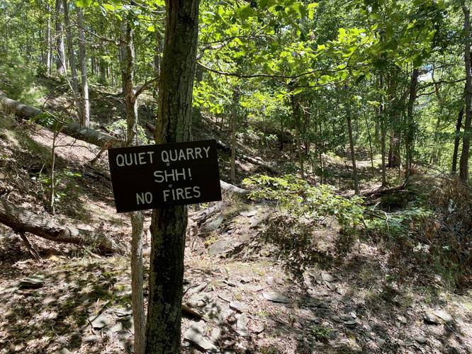
Quiet Quarry - Mile 0.58
Around mile 0.58, hikers will reach the Quiet Quarry. This is an old private quarry that was once mined. There's not much to see other than mining tailings (or large rock sides heading down the mountain) and some 6-foot high rock ledges that sit in front of what looks like old dug-out holes.
After passing the Quiet Quarry, the Mid State Trail will follow several switchbacks heading up the mountain. One of these switchbacks gives the hiker the feel that they've reached the top -- however, if you see a black plastic cable (an old cable TV line that serviced Blackwell) heading up the mountain near here, you are close, but not yet done climbing the mountain. The old cable TV line can be found running up the mountain spine, but it's a good indicator for hikers that they're about 0.3 miles away from Johnson Cliff.
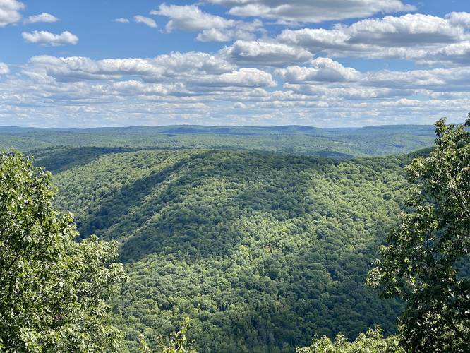
After hiking the 1.2-miles from the Pine Creek Trail trailhead, hikers will reach Johnson Cliff, with views facing southeast toward Morris, Pennsylvania.
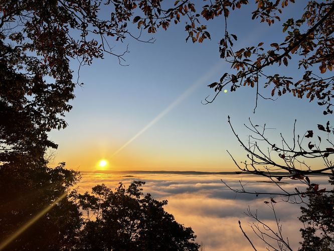
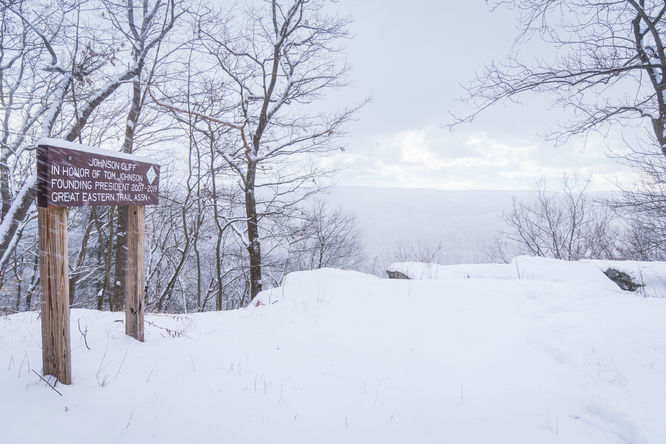
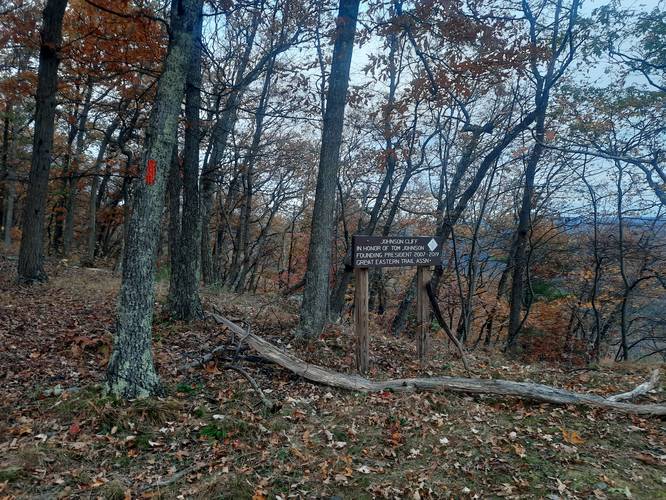
Johnson Cliff Vista
This vista point, located along a short rocky cliff on the mountainside, is named after Tom Johnson who was the founding president of the Great Eastern Trail Association from 2007 - 2019. Tom Johnson passed away while hiking in Virginia on December 5, 2020.
Parking
Hikers will find parking at the Blackwell Access Area for the Pine Creek Trail (Pine Creek Rail Trail) in Blackwell. The parking lot is large enough to fit about 12 cars, but the lot often fills up quickly on weekends along with weekdays during the Summer. There is no off-road parking nearby, so if you cannot find a parking space, check back later.
Pets
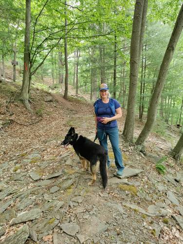
Dogs are allowed if leashed
Camping and Backpacking
This trail allows camping and backpacking within the state forest boundaries if backpackers follow the state forest rules and regulations. Please note that there are no good places to setup a tent until after you've reached the top of the mountain, after reaching Johnson Cliff.
Warning
Hikers may find Timber Rattlesnakes near the rocky vista point during warmer months. Keep your distance and give them space.
Pine Creek Pinnacles (PCP20)
This hike is part of the Pine Creek Pinnacles hiking challenge. For more information, details, and FAQs, please visit our Pine Creek Pinnacles (PCP20) page.
Trail Names
This hike follows several named trails. First, the hike follows the Pine Creek Trail. The second trail the hike follows has three names: Fork Hill Trail (on the Tioga State Forest map), Mid State Trail, and finally the Great Eastern Trail. The local trail name is the Fork Hill Trail; however, both the Mid State Trail and the Great Eastern Trail follow along the same route.
Trail Description
This hike begins at the Pine Creek Trail trailhead at Blackwell and follows the Pine Creek Trail for about 0.3-miles before entering Tioga State Forest. Just after the hiker enters Tioga State Forest, there will be a trailhead sign on the right-hand side labeled "Mid State Trail Johnson Cliff 1.4 km" with a series of steps heading up a steep hillside.
As of August, 2020 these steps did not have any dirt filled between the steps, so hikers (and dogs) must watch their footing. Just after the staircase, the trail will continue heading up the mountain at a similar but slightly easier grade, which makes this hike difficult but not strenuous.
Quiet Quarry - Mile 0.58
Around mile 0.58, hikers will reach the Quiet Quarry. This is an old private quarry that was once mined. There's not much to see other than mining tailings (or large rock sides heading down the mountain) and some 6-foot high rock ledges that sit in front of what looks like old dug-out holes.
After passing the Quiet Quarry, the Mid State Trail will follow several switchbacks heading up the mountain. One of these switchbacks gives the hiker the feel that they've reached the top -- however, if you see a black plastic cable (an old cable TV line that serviced Blackwell) heading up the mountain near here, you are close, but not yet done climbing the mountain. The old cable TV line can be found running up the mountain spine, but it's a good indicator for hikers that they're about 0.3 miles away from Johnson Cliff.
After hiking the 1.2-miles from the Pine Creek Trail trailhead, hikers will reach Johnson Cliff, with views facing southeast toward Morris, Pennsylvania.
Johnson Cliff Vista
This vista point, located along a short rocky cliff on the mountainside, is named after Tom Johnson who was the founding president of the Great Eastern Trail Association from 2007 - 2019. Tom Johnson passed away while hiking in Virginia on December 5, 2020.
Parking
Hikers will find parking at the Blackwell Access Area for the Pine Creek Trail (Pine Creek Rail Trail) in Blackwell. The parking lot is large enough to fit about 12 cars, but the lot often fills up quickly on weekends along with weekdays during the Summer. There is no off-road parking nearby, so if you cannot find a parking space, check back later.
Pets
Dogs are allowed if leashed
Camping and Backpacking
This trail allows camping and backpacking within the state forest boundaries if backpackers follow the state forest rules and regulations. Please note that there are no good places to setup a tent until after you've reached the top of the mountain, after reaching Johnson Cliff.
Warning
Hikers may find Timber Rattlesnakes near the rocky vista point during warmer months. Keep your distance and give them space.
Pine Creek Pinnacles (PCP20)
This hike is part of the Pine Creek Pinnacles hiking challenge. For more information, details, and FAQs, please visit our Pine Creek Pinnacles (PCP20) page.