Located near Wrightsville in York County, Pennsylvania sits the grassy knoll of
Highpoint Scenic Vista & Recreation Area where visitors and hikers will find a short, but ultra-scenic viewpoint high above the Susquehanna River.
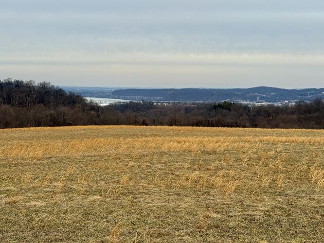
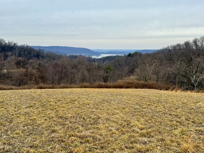
This easy, family-friendly 1.5 mile loop hike leads to the top of Highpoint where you'll find panoramic views of the river with picturesque Pennsylvania farmlands that surround the hill.
Exploring Highpoint Scenic Vista
This short hike begins at the main trailhead for Highpoint. Visitors will find a universally-accessible path that leads from the parking lot directly to the top of Highpoint, but this route follows both the universal path and various grassy, hillside trails that encompass the park.
The hike up to the top of Highpoint is relatively easy. Follow the smooth, paved path as it curves up to the top of the hill, passing beautiful views of the Susquehanna River along the way. If you're looking for a bit more exercise and want to explore the entire park, like we did, then you can easily hop off of the universally-accessible path to follow the grass trails that lead up to the top of Highpoint.
Highpoint Scenic Vista & Summit - Mile 0.35
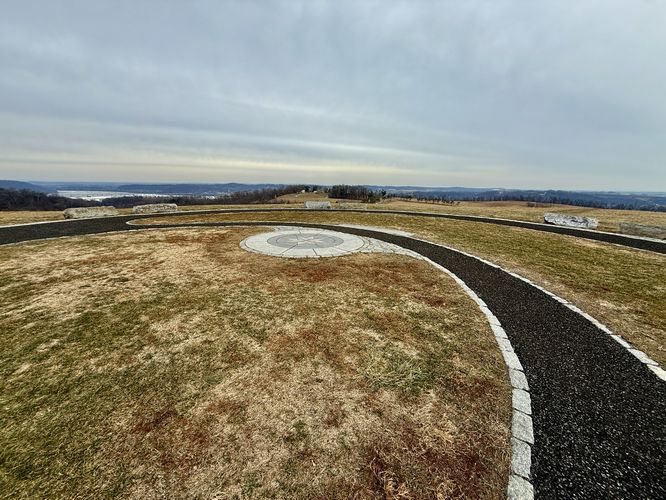
Along this route, visitors will reach the summit of Highpoint where you'll find some of the best views in the entire park. Rock benches and a smooth, paved trail lead around the top where you'll find 360-degree, panoramic views from the Highpoint Scenic Vista. Here, you'll also find a large sign for the Mason-Dixon Trail (blue blazes) that hikers can follow in either direction through the park.
Hiking the Grassy Trails with Views - Mile 0.35 to 1.5
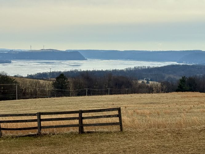
After exploring the summit of Highpoint Scenic Vista and the panoramic views of the Susquehanna River, this route leads visitors back down the universally-accessible path before veering off along the grass trails to circle the park for more scenic views. Near mile 0.45, the route leads to the southwest corner before passing another scenic, south-facing view of the river and its steep bluffs. Next, the trail leads north along Long Level Road before it curves around the park's edge. During cold months, the grasses in the park turn a vibrant golden color which adds to the scenery, but during warm months would instead be filled with lush greenery. The trail then curves south to reach the main, universally-accessible pathway once more. Follow the smooth trail back to parking to wrap up this short, but scenic 1.5 mile hike.
Parking & How to Get to Highpoint Scenic Vista
Visitors and hikers will find a large parking lot along the east side of Hilt Road in Wrightsville, PA at the coordinates provided: 40.0012, -76.519749. The lot is large enough to fit about 20 vehicles as of January 2026.
Pets
Dogs are allowed only if leashed and must be cleaned up after.
Universal Access
Please note that the route provided is not fully universally-accessible; however, the park (as of January 2026) provides a fully accessible path that leads from the parking lot to the summit of Highpoint. If you wish to follow the universally-accessible path, the walk is shorter than 1.5 miles and significantly easier than what's depicted here. To do so, simply stay on the paved, smooth path instead of hiking through the grass trails!
Explore More River Views!
The Susquehanna River
offers endless opportunities for hikers and nature lovers to discover
breathtaking vistas. Whether you are chasing the golden hour or looking
for a rugged trek, the river hills of Central Pennsylvania never
disappoint. Before you leave the area, consider exploring these short,
family-friendly and stunning river views in York and Lancaster Counties:
Schull's Rock Overlook,
Chickies Rock Overlook,
Breezyview Overlook,
Star Rock Overlook,
House Rock Overlook, and
Hawk Point & Wissler Run Overlooks.