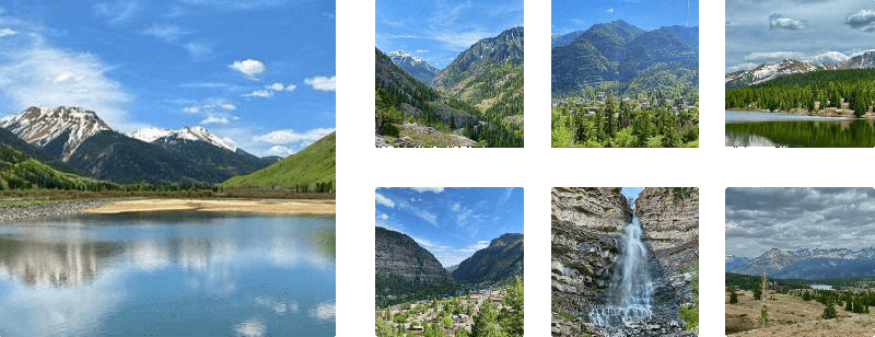
The High Bridge Trail at Box Cañon Falls Park
in Ouray, Colorado is an moderate 0.3-mile out-and-back hike that leads to breathtaking views of Ouray, Lower Cascade Falls, Creek Canyon, and reaches an old tunnel that leads to the top of Box Canyon Falls.
Hike
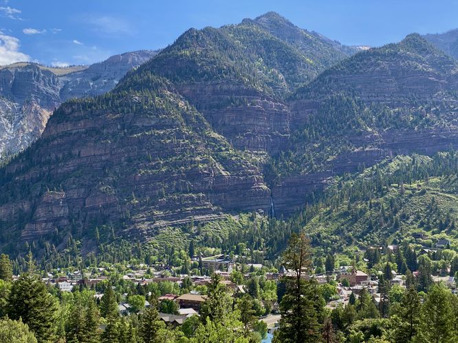
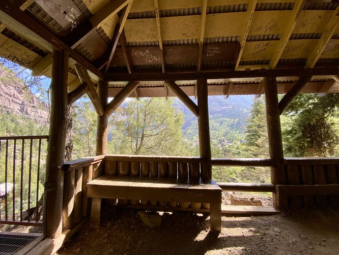
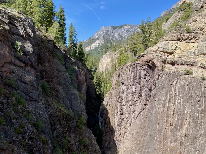
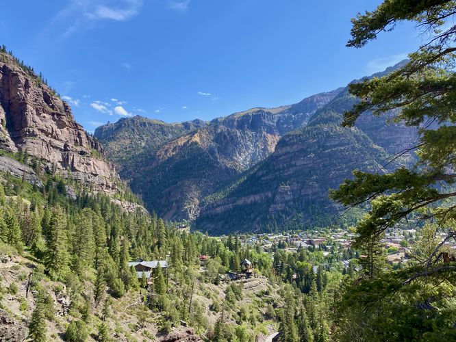
This hike begins just beyond the main trailhead sign and office for the park at a large staircase that sits to the south side of the Box Canyon Falls Trail. The High Bridge Trail is moderate, at the easiest difficulty, and follows steep stairs for a short period of time before the trail follows a rocky dirt path. Luckily, the trail has plenty of stopping points, including a small pavilion located around mile 0.02 (~100-feet) from the trailhead to help catch your breath before hiking onward. Here, you can take-in the views of Ouray and its surrounding mountains. While stopped at the pavilion, you'll find a great view of Lower Cascade Falls when its flowing especially during the Spring snow melt season. The trail then follows a dirt path as it ascends the cliffs toward High Bridge. The trail will pass rocky areas with hand-holds on each side, which help hikers traverse the rock. Finally, the trail will reach High Bridge with a view into Canyon Creek from high above -- facing west. To the east lies the town of Ouray and Lower Cascade Falls spilling down the mountains across the valley. During this hike, we skipped the tunnel to Box Canyon Falls section of the trail and ended at High Bridge; however, if you wish to extend the hike by a few-hundred feet you can (apparently) get a top-down view of Box Canyon Falls from the far-end of the trail after passing through a rock tunnel.
After exploring the top of the trail, the sweeping views of Ouray, or the top of Box Canyon Falls, the trail leads back down to the parking area for a moderate 0.3-mile out-and-back hike.
Other Trails at the Park
Don't forget to explore the Box Canyon Nature Trail and or the Box Canyon Falls Trail before you leave the park.
Parking
Hikers will find a large parking lot at the coordinates provided, located at Box Canyon Falls Park in Ouray. The lot is large enough to fit a couple dozen vehicles as of June 2024.
Restrooms
There are restrooms at the park, located north of the main parking lot.
Hours
You can find more information about the park's hours on their website. As of June 2024, the park is closed during the Winter (November - March) each year. Otherwise the park is open from 9AM - 5PM each day. Memorial Day through Labor Day the park is open from 8AM - 8PM each day.
Fees
There's a minimal fee to enter the park, per person. As of June 2024, adults are $7/person and children are $5/person. You can read more about their fees on the park's website.
Hike
This hike begins just beyond the main trailhead sign and office for the park at a large staircase that sits to the south side of the Box Canyon Falls Trail. The High Bridge Trail is moderate, at the easiest difficulty, and follows steep stairs for a short period of time before the trail follows a rocky dirt path. Luckily, the trail has plenty of stopping points, including a small pavilion located around mile 0.02 (~100-feet) from the trailhead to help catch your breath before hiking onward. Here, you can take-in the views of Ouray and its surrounding mountains. While stopped at the pavilion, you'll find a great view of Lower Cascade Falls when its flowing especially during the Spring snow melt season. The trail then follows a dirt path as it ascends the cliffs toward High Bridge. The trail will pass rocky areas with hand-holds on each side, which help hikers traverse the rock. Finally, the trail will reach High Bridge with a view into Canyon Creek from high above -- facing west. To the east lies the town of Ouray and Lower Cascade Falls spilling down the mountains across the valley. During this hike, we skipped the tunnel to Box Canyon Falls section of the trail and ended at High Bridge; however, if you wish to extend the hike by a few-hundred feet you can (apparently) get a top-down view of Box Canyon Falls from the far-end of the trail after passing through a rock tunnel.
After exploring the top of the trail, the sweeping views of Ouray, or the top of Box Canyon Falls, the trail leads back down to the parking area for a moderate 0.3-mile out-and-back hike.
Other Trails at the Park
Don't forget to explore the Box Canyon Nature Trail and or the Box Canyon Falls Trail before you leave the park.
Parking
Hikers will find a large parking lot at the coordinates provided, located at Box Canyon Falls Park in Ouray. The lot is large enough to fit a couple dozen vehicles as of June 2024.
Restrooms
There are restrooms at the park, located north of the main parking lot.
Hours
You can find more information about the park's hours on their website. As of June 2024, the park is closed during the Winter (November - March) each year. Otherwise the park is open from 9AM - 5PM each day. Memorial Day through Labor Day the park is open from 8AM - 8PM each day.
Fees
There's a minimal fee to enter the park, per person. As of June 2024, adults are $7/person and children are $5/person. You can read more about their fees on the park's website.