The Box Canyon Nature Trail at Box Cañon Falls Park in Ouray, Colorado is
an easy 0.1-mile one-way trail that features views of the mountains that surround the town of Ouray.
Walk
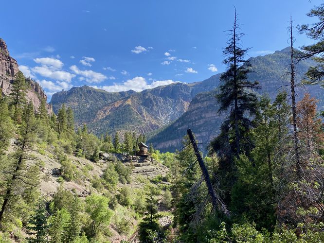
This is less of a hike and rather a short walk that you can tack-on to exploring Box Canyon Falls while visiting the park. This route begins on the western terminus and follows the nature trail as it runs along the steep slopes above Canyon Creek. From the northwest part of the trail, visitors will find beautiful views of Ouray and its surrounding mountains. After passing views, the trail then tucks back into the forest passing interpretive signs about the local native plants. The trail then ends at the visitors center for a short 0.1-mile one-way walk.
Other Trails at the Park
Don't forget to explore the Box Canyon Falls Trail and or the High Bridge Trail before you leave the park.
Parking
Hikers will find a large parking lot at the coordinates provided, located at Box Canyon Falls Park in Ouray. The lot is large enough to fit a couple dozen vehicles as of June 2024.
Restrooms
There are restrooms at the park, located north of the main parking lot.
Hours
You can find more information about the park's hours on their website. As of June 2024, the park is closed during the Winter (November - March) each year. Otherwise the park is open from 9AM - 5PM each day. Memorial Day through Labor Day the park is open from 8AM - 8PM each day.
Fees
There's a minimal fee to enter the park, per person. As of June 2024, adults are $7/person and children are $5/person. You can read more about their fees on the park's website.
Walk
This is less of a hike and rather a short walk that you can tack-on to exploring Box Canyon Falls while visiting the park. This route begins on the western terminus and follows the nature trail as it runs along the steep slopes above Canyon Creek. From the northwest part of the trail, visitors will find beautiful views of Ouray and its surrounding mountains. After passing views, the trail then tucks back into the forest passing interpretive signs about the local native plants. The trail then ends at the visitors center for a short 0.1-mile one-way walk.
Other Trails at the Park
Don't forget to explore the Box Canyon Falls Trail and or the High Bridge Trail before you leave the park.
Parking
Hikers will find a large parking lot at the coordinates provided, located at Box Canyon Falls Park in Ouray. The lot is large enough to fit a couple dozen vehicles as of June 2024.
Restrooms
There are restrooms at the park, located north of the main parking lot.
Hours
You can find more information about the park's hours on their website. As of June 2024, the park is closed during the Winter (November - March) each year. Otherwise the park is open from 9AM - 5PM each day. Memorial Day through Labor Day the park is open from 8AM - 8PM each day.
Fees
There's a minimal fee to enter the park, per person. As of June 2024, adults are $7/person and children are $5/person. You can read more about their fees on the park's website.