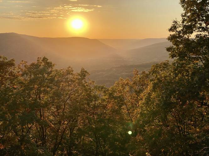
The Dry Hollow Trail at Tioga State Forest in Gaines, Pennsylvania is an easy 2.9-mile out-and-back trail that features two beautiful vistas with views of the mountains surrounding Pennsylvania's Route-6. Note that this hike includes an optional off-trail view and both vista areas have a high-chance for rattlesnake sightings.
Hike Description
This trail begins at the end of Goodall Road and follows a well-maintained snowmobile trail out to a stunning vista point. The trail first passes a yellow service road gate and then heads downhill for almost the entire hike, while first following red blazes, then follows blue ribbons, and passes a couple of other blaze colors along the way (orange, yellow). Hikers will find arrow markers along the trail - these should be ignored. If you stay right at each trail junction, you'll make your way to the on-trail vista point easily.
The trail follows the ridge of this mountain and eventually runs along a skinnier ridge with glimpses of views between the trees to both sides of the trail. During the winter and with no leaves on the trees, the view is likely more interesting as you hike out to the lookout point.
On-Trail Vista (Route 6 west-facing view) - Mile 1.25
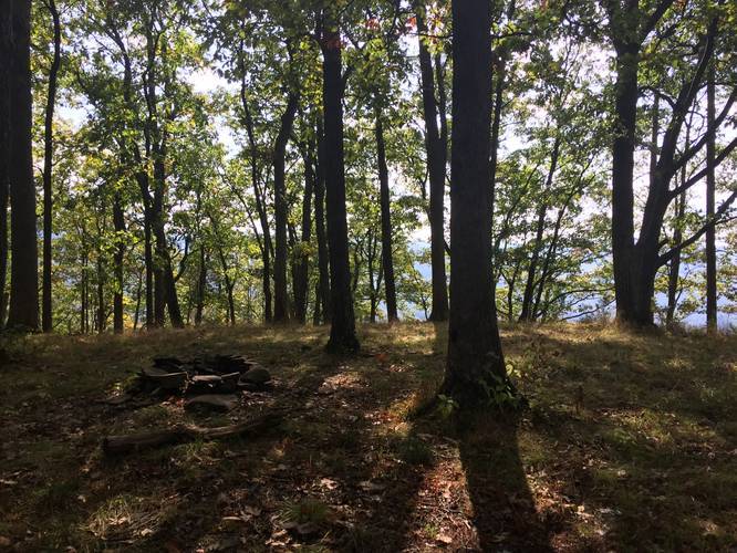
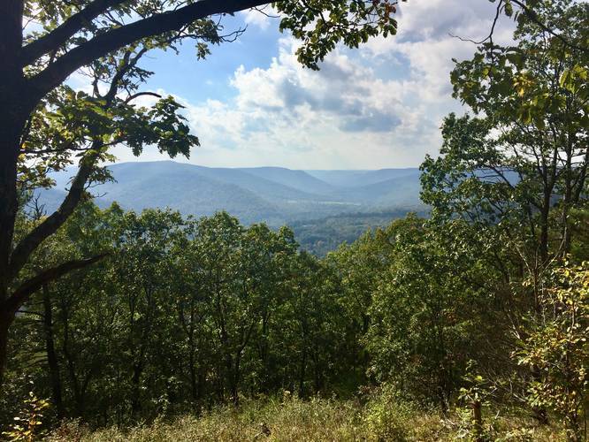
If you skip the bushwhack vista (most people should), then at mile 1.2, hikers will reach the campsite, which features a fire pit. Just behind the campsite, around mile 1.25, is a rattlesnake den clearing with an amazing view of PA Route-6 and Elephant Mountain in the distance, which are mostly westerly and south-facing. To the left-hand side, just before Elephant Mountain, is the mountain range that holds more trails at Tioga State Forest, including the Bee Tree Ski Trail and the Deadman Hollow Run Trail.
Off-Trail Ansonia Ridge Vista (Bushwhack) - Mile 0.9 to 1.1
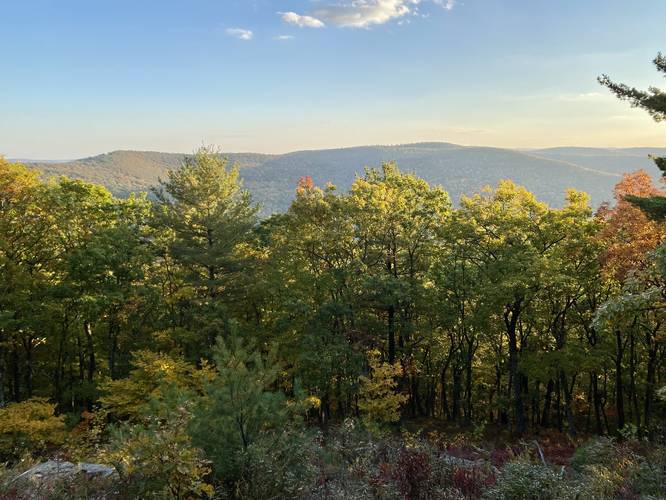
For the experienced hikers, if you wish to explore a lesser-known vista that lies off-trail, you can do that at mile 0.9 on the hike in. Around 0.9, hikers will want to head southeast toward the mountain ridge and walk for about 0.25 miles to reach another rattlesnake den vista at mile 1.1. This vista provides hikers with views of the Ansonia Ridge and a small glimpse into the PA Grand Canyon. Again, watch out for rattlers and come prepared during the proper season to enjoy this view.
Camping
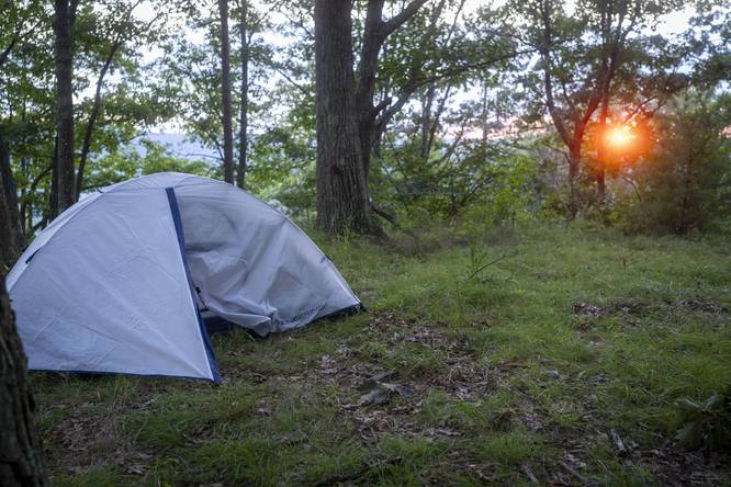
Dispersed / backcountry / primitive camping is permitted, but please follow the Tioga State Forest rules. Backpackers will find a campsite near the lookout point.
Blaze Colors
This trail is tricky as the blaze colors change multiple times. The hike starts off with red blazes at the trailhead; however, the red blazes, further down the trail, appear to follow a snowmobile trail (not the trail you want to take). Basically, if you see an arrow sign, do not follow it - stick to the skinnier trail, especially at the yellow arrow signs as this leads to the lookout point.
Parking
Hikers can find parking at the end of Goodall Road, at the coordinates provided. There's enough room for about a dozen cars.
Pets
Dogs are allowed if leashed and their waste must be carried out by the hiker.
Biking
Mountain biking is permitted on this trail.
Snowmobiling
During the winter, this trail is open for snowmobiling; however, all of the colored signs and arrows are for snowmobiles, not hikers.
Winter Road Conditions
Tioga State Forest does not maintain this road during the winter. Do not attempt driving on this road without proper equipment including snow tires and/or chains unless the road is clear. High wind storms may also cause trees to fall across the road, making the road impassible. If you plan to visit during the winter, plan accordingly.
Warnings
Timber Rattlesnakes: Both vistas are known to have rattlesnakes living in the rocks below. It's best to avoid these areas during warm weather or at high-noon during the Summer. Rattlesnakes are known to be active between the end of April and early October, with some exceptions on very warm sunny days otherwise. Be on the lookout and give any rattlesnake you find plenty of room.
Bushwhacking: To reach the eastern vista, with views of the Ansonia Ridge and some glimpses into the PA Grand Canyon, hikers will have to bushwhack off-trail for about 0.25-miles before reaching the view. Remember, rattlesnakes live in these parts and could be roaming anywhere on the mountain tops and in the brush.
Hike Description
This trail begins at the end of Goodall Road and follows a well-maintained snowmobile trail out to a stunning vista point. The trail first passes a yellow service road gate and then heads downhill for almost the entire hike, while first following red blazes, then follows blue ribbons, and passes a couple of other blaze colors along the way (orange, yellow). Hikers will find arrow markers along the trail - these should be ignored. If you stay right at each trail junction, you'll make your way to the on-trail vista point easily.
The trail follows the ridge of this mountain and eventually runs along a skinnier ridge with glimpses of views between the trees to both sides of the trail. During the winter and with no leaves on the trees, the view is likely more interesting as you hike out to the lookout point.
On-Trail Vista (Route 6 west-facing view) - Mile 1.25
If you skip the bushwhack vista (most people should), then at mile 1.2, hikers will reach the campsite, which features a fire pit. Just behind the campsite, around mile 1.25, is a rattlesnake den clearing with an amazing view of PA Route-6 and Elephant Mountain in the distance, which are mostly westerly and south-facing. To the left-hand side, just before Elephant Mountain, is the mountain range that holds more trails at Tioga State Forest, including the Bee Tree Ski Trail and the Deadman Hollow Run Trail.
Off-Trail Ansonia Ridge Vista (Bushwhack) - Mile 0.9 to 1.1
For the experienced hikers, if you wish to explore a lesser-known vista that lies off-trail, you can do that at mile 0.9 on the hike in. Around 0.9, hikers will want to head southeast toward the mountain ridge and walk for about 0.25 miles to reach another rattlesnake den vista at mile 1.1. This vista provides hikers with views of the Ansonia Ridge and a small glimpse into the PA Grand Canyon. Again, watch out for rattlers and come prepared during the proper season to enjoy this view.
Camping
Dispersed / backcountry / primitive camping is permitted, but please follow the Tioga State Forest rules. Backpackers will find a campsite near the lookout point.
Blaze Colors
This trail is tricky as the blaze colors change multiple times. The hike starts off with red blazes at the trailhead; however, the red blazes, further down the trail, appear to follow a snowmobile trail (not the trail you want to take). Basically, if you see an arrow sign, do not follow it - stick to the skinnier trail, especially at the yellow arrow signs as this leads to the lookout point.
Parking
Hikers can find parking at the end of Goodall Road, at the coordinates provided. There's enough room for about a dozen cars.
Pets
Dogs are allowed if leashed and their waste must be carried out by the hiker.
Biking
Mountain biking is permitted on this trail.
Snowmobiling
During the winter, this trail is open for snowmobiling; however, all of the colored signs and arrows are for snowmobiles, not hikers.
Winter Road Conditions
Tioga State Forest does not maintain this road during the winter. Do not attempt driving on this road without proper equipment including snow tires and/or chains unless the road is clear. High wind storms may also cause trees to fall across the road, making the road impassible. If you plan to visit during the winter, plan accordingly.
Warnings
Timber Rattlesnakes: Both vistas are known to have rattlesnakes living in the rocks below. It's best to avoid these areas during warm weather or at high-noon during the Summer. Rattlesnakes are known to be active between the end of April and early October, with some exceptions on very warm sunny days otherwise. Be on the lookout and give any rattlesnake you find plenty of room.
Bushwhacking: To reach the eastern vista, with views of the Ansonia Ridge and some glimpses into the PA Grand Canyon, hikers will have to bushwhack off-trail for about 0.25-miles before reaching the view. Remember, rattlesnakes live in these parts and could be roaming anywhere on the mountain tops and in the brush.