Elephant Mountain at State Game Lands 208 in Gaines, Pennsylvania is a difficult 8.5-mile out-and-back trail that reaches the summit of Elephant Mountain and features some seasonal views along the way.
Private Land
Please note that this trail cuts across private land. As of April 2022, this land is owned by Patterson Lumber Co, LLC. I personally reached out to them to inquire about the logging road (right of way) that passes through their property. They confirmed this is a right of way for the State Game Lands and for logging purposes. The public may use this shared access right of way to hike or hunt on Elephant Mountain's public lands, but do not leave the trail within the private land section. Also note that this land is leased to a private hunting club, so wearing blaze orange is smart.
Hike Description
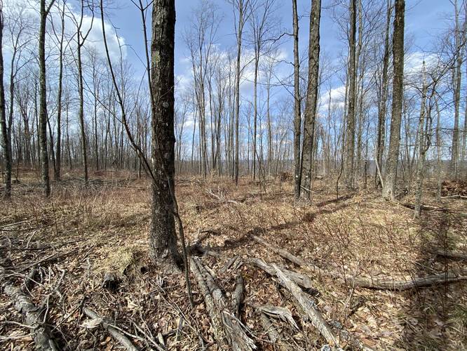
This hike begins along Lick Run Rd in Gaines, PA at the entrance for the State Game Lands 208 / logging road right of way near the coordinates provided. The trail starts off somewhat steep, but this is one of the steepest sections of the trail. Shortly after the initial steeper section ends, the trail will enter private land. As the trail runs through Deer Lick Hollow, it actually follows a very moderate grade as it ascends the mountain. For the most part, this mountain road is sun-baked and exposed, so wearing sunscreen is a must.
Back to Game Lands (SGL 208) - Mile 0.95
Eventually, the trail will exit the private land around mile 0.95, where the hiker will find themselves back in State Game Lands 208 territory. From here on out, until hiking back, the hiker will be on public land. The trail will continue heading up Elephant Mountain, reaching a major hairpin turn, before reaching a clear cut opening, as of April 2022.
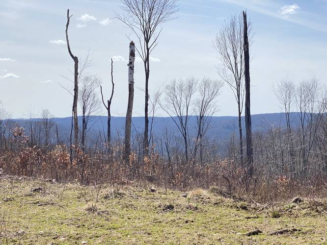
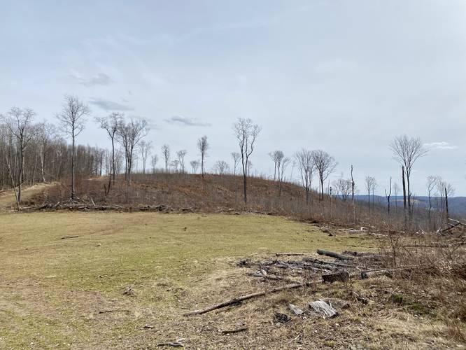
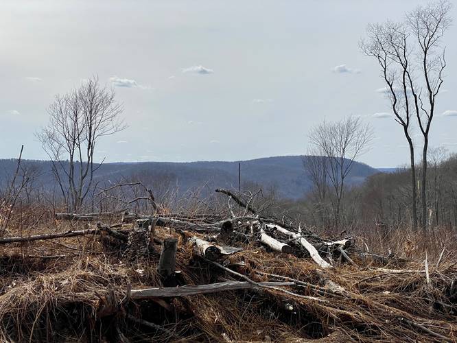
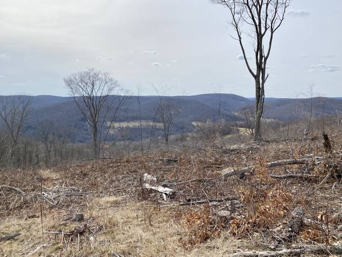
Clear Cut Vista - Mile 1.8
Around mile 1.8, hikers will reach the clear cut area, as of April 2022. This section of land is open, allowing the hiker to view the mountains west of Elephant Mountain. Here, the GPS data provided continues north to summit Elephant Mountain before returning to explore the southern section of this clear-cut area; however, as of April 2022, the southern section had a better view.
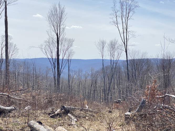
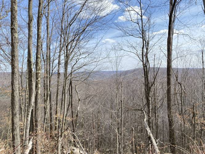
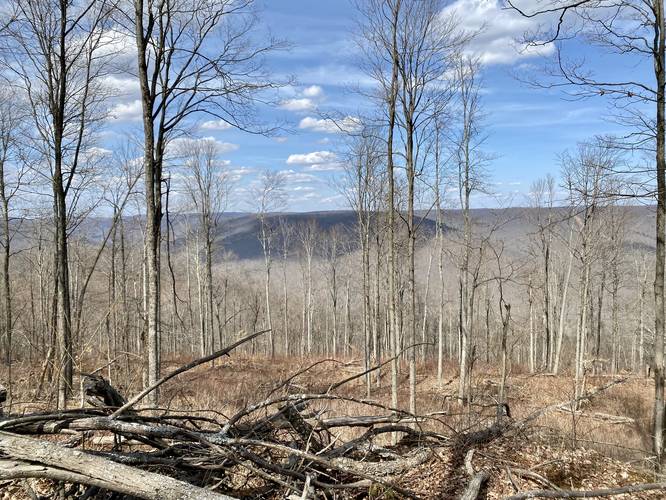
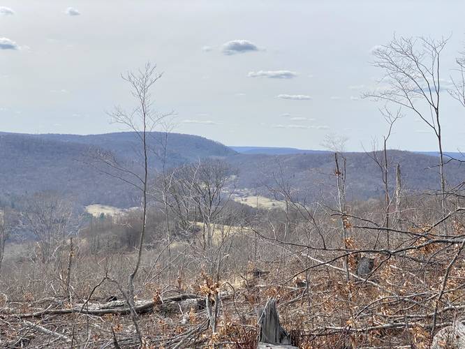
Mountain Ridge Road Mile 1.8 to 3.35
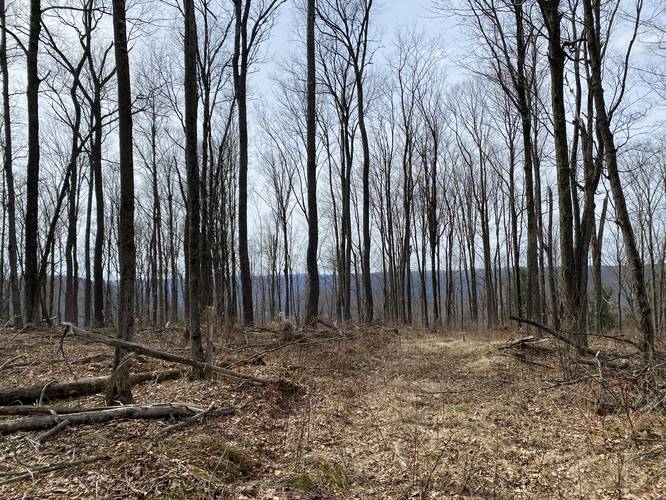
From the clear cut area until mile 3.25, the trail follows a very wide and open service / logging road until the maintained portion ends. Between those two points (mile 1.8 to 3.25), hikers will undulate a bit in elevation as the trail follows the mountain ridge heading north. Along the way are plenty of very obstructed seasonal views of the mountains east of Elephant Mountain, albeit they're not great views, but give the hiker an understanding of their surroundings. When I tracked this, Jax (my dog) and I actually ran into a bear whom we spooked hiding off-trail. The bear scurried down the mountain in a hurry. I mention this because this area sees very little people-traffic, hence, the higher chances to run into wildlife. We also ran into a family of ~4 large deer near the clear-cut opening.
Overgrown Path to Summit - Mile 3.25
At mile 3.25, the hiker must follow a less-than-maintained trail that leads to the summit of Elephant Mountain. This section of the trail can be found on the western side of the large clear-cut opening on the north side of the mountain (see the pictures for more details). On this hike, I took a left-hand turn approximately 0.1-miles after leaving the service road opening; however, it's unclear where this path goes, so I turned back (see the GPS turn-around point in the data). Hikers should stay to the right-hand side if they wish to summit Elephant Mountain at that junction.
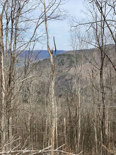
Summit Vista / Gaines Center Vista - Mile 3.9
Around mile 3.9, hikers will pass a somewhat-open view area which peers into the center of Gaines, PA - with obstructed views of the surrounding mountains. This "vista" point is the only view I found on the summit of Elephant Mountain and it was mostly obstructed and seasonal.
Elephant Mountain Summit - Mile 4.2
Around mile 4.2, hikers will get close to the summit. If they wish to reach the USGS marker on their offline map, it's not difficult - just wade through the sea of thorn bushes to reach it! No seriously, it's not worth reaching the summit, since there did not appear to be any USGS marker; however, it may exist in the sea of thorns.
Hiking Out
This GPS data shot westward from the summit before hiking out, just to see what was over there. Essentially, the trail ends and a bushwhack begins. After hiking ~4+ miles to reach this point, knowing I had 4+ miles to hike back, I opted-out of the bushwhack; however, there may be interesting things on the other parts of this mountain that I did not explore / report back on. Last, note that this GPS data explores the southern section of the clear-cut area on the south side of Elephant Mountain before fully descending.
Difficulty
Note that the elevation is not the most difficult part of this hike, in fact it should be considered moderate; however, the trail length and the exposure to the sun make this hike more difficult than expected, hence the "hard" rating.
Parking
Hikers will find a tiny parking turnout by the coordinates provided. Do not block the gate, Lick Run Road, and please respect the very-close neighboring private property.
Pets
Dogs are allowed if leashed and their waste should be carried out by the hiker.
Warnings
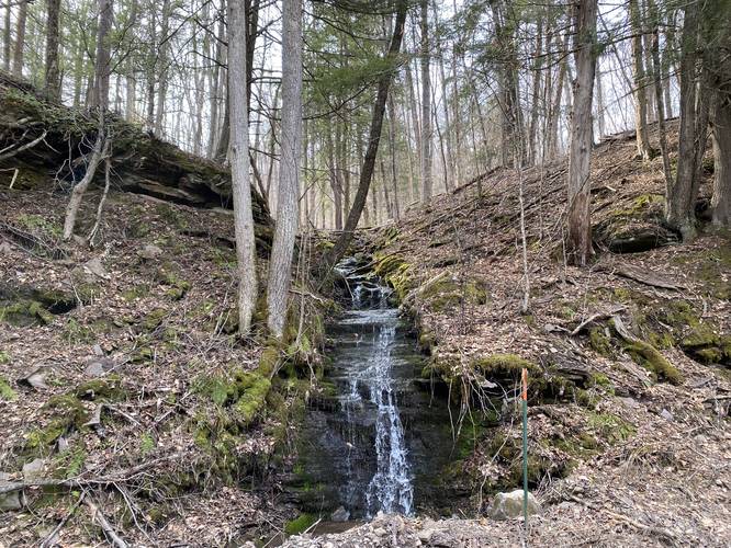
No water: There's absolutely no water along this hike, especially during the Summer.
Sun exposure: This hike follows a service road that, for the most part, has very little shade. It's easy to overheat on this hike, even in sunny 60-degree weather. With the lack of water and over-exposure to the sun, this hike should not be taken lightly during hot months.
Hunting: Wearing blaze orange is smart since hunting is allowed here on both the public and private lands.
Camping and Backpacking
Note that camping is not allowed on State Game Lands (SGL 208). Please respect the rules and try dispersed / backcountry / primitive camping at Tioga State Forest instead.
Private Land
Please note that this trail cuts across private land. As of April 2022, this land is owned by Patterson Lumber Co, LLC. I personally reached out to them to inquire about the logging road (right of way) that passes through their property. They confirmed this is a right of way for the State Game Lands and for logging purposes. The public may use this shared access right of way to hike or hunt on Elephant Mountain's public lands, but do not leave the trail within the private land section. Also note that this land is leased to a private hunting club, so wearing blaze orange is smart.
Hike Description
This hike begins along Lick Run Rd in Gaines, PA at the entrance for the State Game Lands 208 / logging road right of way near the coordinates provided. The trail starts off somewhat steep, but this is one of the steepest sections of the trail. Shortly after the initial steeper section ends, the trail will enter private land. As the trail runs through Deer Lick Hollow, it actually follows a very moderate grade as it ascends the mountain. For the most part, this mountain road is sun-baked and exposed, so wearing sunscreen is a must.
Back to Game Lands (SGL 208) - Mile 0.95
Eventually, the trail will exit the private land around mile 0.95, where the hiker will find themselves back in State Game Lands 208 territory. From here on out, until hiking back, the hiker will be on public land. The trail will continue heading up Elephant Mountain, reaching a major hairpin turn, before reaching a clear cut opening, as of April 2022.
Clear Cut Vista - Mile 1.8
Around mile 1.8, hikers will reach the clear cut area, as of April 2022. This section of land is open, allowing the hiker to view the mountains west of Elephant Mountain. Here, the GPS data provided continues north to summit Elephant Mountain before returning to explore the southern section of this clear-cut area; however, as of April 2022, the southern section had a better view.
Mountain Ridge Road Mile 1.8 to 3.35
From the clear cut area until mile 3.25, the trail follows a very wide and open service / logging road until the maintained portion ends. Between those two points (mile 1.8 to 3.25), hikers will undulate a bit in elevation as the trail follows the mountain ridge heading north. Along the way are plenty of very obstructed seasonal views of the mountains east of Elephant Mountain, albeit they're not great views, but give the hiker an understanding of their surroundings. When I tracked this, Jax (my dog) and I actually ran into a bear whom we spooked hiding off-trail. The bear scurried down the mountain in a hurry. I mention this because this area sees very little people-traffic, hence, the higher chances to run into wildlife. We also ran into a family of ~4 large deer near the clear-cut opening.
Overgrown Path to Summit - Mile 3.25
At mile 3.25, the hiker must follow a less-than-maintained trail that leads to the summit of Elephant Mountain. This section of the trail can be found on the western side of the large clear-cut opening on the north side of the mountain (see the pictures for more details). On this hike, I took a left-hand turn approximately 0.1-miles after leaving the service road opening; however, it's unclear where this path goes, so I turned back (see the GPS turn-around point in the data). Hikers should stay to the right-hand side if they wish to summit Elephant Mountain at that junction.
Summit Vista / Gaines Center Vista - Mile 3.9
Around mile 3.9, hikers will pass a somewhat-open view area which peers into the center of Gaines, PA - with obstructed views of the surrounding mountains. This "vista" point is the only view I found on the summit of Elephant Mountain and it was mostly obstructed and seasonal.
Elephant Mountain Summit - Mile 4.2
Around mile 4.2, hikers will get close to the summit. If they wish to reach the USGS marker on their offline map, it's not difficult - just wade through the sea of thorn bushes to reach it! No seriously, it's not worth reaching the summit, since there did not appear to be any USGS marker; however, it may exist in the sea of thorns.
Hiking Out
This GPS data shot westward from the summit before hiking out, just to see what was over there. Essentially, the trail ends and a bushwhack begins. After hiking ~4+ miles to reach this point, knowing I had 4+ miles to hike back, I opted-out of the bushwhack; however, there may be interesting things on the other parts of this mountain that I did not explore / report back on. Last, note that this GPS data explores the southern section of the clear-cut area on the south side of Elephant Mountain before fully descending.
Difficulty
Note that the elevation is not the most difficult part of this hike, in fact it should be considered moderate; however, the trail length and the exposure to the sun make this hike more difficult than expected, hence the "hard" rating.
Parking
Hikers will find a tiny parking turnout by the coordinates provided. Do not block the gate, Lick Run Road, and please respect the very-close neighboring private property.
Pets
Dogs are allowed if leashed and their waste should be carried out by the hiker.
Warnings
No water: There's absolutely no water along this hike, especially during the Summer.
Sun exposure: This hike follows a service road that, for the most part, has very little shade. It's easy to overheat on this hike, even in sunny 60-degree weather. With the lack of water and over-exposure to the sun, this hike should not be taken lightly during hot months.
Hunting: Wearing blaze orange is smart since hunting is allowed here on both the public and private lands.
Camping and Backpacking
Note that camping is not allowed on State Game Lands (SGL 208). Please respect the rules and try dispersed / backcountry / primitive camping at Tioga State Forest instead.