Loading...

🎉 Enjoy a Free 7-Day Supporter Trial and Unlock Exclusive Perks — No Credit Card Required. Learn more.

Wilderness Way Trail

Directions
Map
Pictures
Send to App
Distance:
0.6 Miles / 1.0 km
Type:
Out-and-Back
Difficulty:
Easy
Time to Hike:
~18 minutes
Features:
Surface Type:
Dirt
Park:
Canaan Valley National Wildlife Refuge
Town:
Davis, West Virginia
Directions:
39.024147, -79.398721
Added:
July 29, 2018
Updated:
March 18, 2025
Copy Trail Link Hiking this trail? Send a friend or family member a link to this trail guide for your own safety. Hike at your own risk (disclaimer)
Loading...
Loading...
54'

Total Change
71'

Ascent
71'

Descent

Download the Trail Route for Offline Use

Supporters get exclusive access to download trail routes to the MyHikes app for offline use. Stay prepared on your adventure, even without an internet connection! Become a Supporter today to unlock this feature and hike with confidence.

Send to App

Wilderness Way Trail

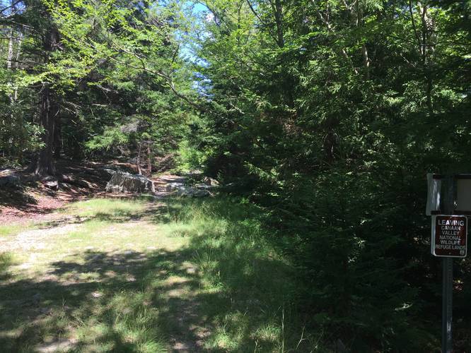
The Wilderness Way Trail at Canaan Valley National Wildlife Refuge in Davis, West Virginia is an easy 0.6 mile out-and-back trail that leads to the edge of the Dolly Sods Wilderness and mainly to the Dolly Sods FR-80 Trail. The trailhead can be found along FR-80 with a small parking lot available to day hikers. You'll notice there's signage at this parking lot stating "No motor vehicles beyond this point" as the rest of FR-80 east of here is not a road.

Along the trail you can find wild cranberries growing during the summer to the sides of the trail. Just before you reach the Dolly Sods Wilderness, you'll find a wooden structure with signage for the wilderness.

Backpacking / Parking: All backpackers headed for Dolly Sods, utilizing overnight parking at this trailhead, must get an overnight parking permit from the wildlife refuge - information on how to do so can be found here; however, they request at least 4 days notice to ensure you get your parking permit.

To continue on to Dolly Sods from this trail, just continue hiking along the Dolly Sods FR-80 Trail.
Explore 46 trails near Davis, WV
  1. Parking

    39.024147, -79.398721
  2. Main Trailhead

    39.024127, -79.398312
  3. Leaving wildlife refuge / entering Dolly Sods

    39.024578, -79.392831
    Leaving wildlife refuge / entering Dolly Sods
No community routes found. To add your own hike as a Community Route for this Trail guide, leave a Trip Report with an attached GPX file.

Hazards

Ticks - Lyme Disease More Info (CDC)

Seasons

All

Photo Albums

Trip Reports

Trail Guide By:
Admin user profile picture
0.6 miles / 1.0 km
0.6 miles / 1.0 km
July 28, 2018
Hiking

Weather Forecast

In Davis, WV

Explore Hiking Trails

You May Also Like

Colorado's Million Dollar Highway - Plan a day's drive adventure along the iconic Million Dollar Highway in Colorado. Explore the best short trails, roadside stops, waterfalls, vistas, ghost towns, and hot springs within a ~6 hour road trip.
Explore

Colorado's Million Dollar Highway

Plan a day's drive adventure along the iconic Million Dollar Highway in Colorado. Explore the best short trails, roadside stops, waterfalls, vistas, ghost towns, and hot springs within a ~6 hour road trip.

Read
New York's Best Waterfalls - Whether you're planning a day hike, roadside stop, or a leisurely short walk, this guide provides hikers, travelers, and locals alike with 63 different locations to over 100 scenic waterfalls to help plan your next adventure!
Explore

New York's Best Waterfalls

Whether you're planning a day hike, roadside stop, or a leisurely short walk, this guide provides hikers, travelers, and locals alike with 63 different locations to over 100 scenic waterfalls to help plan your next adventure!

Read

Before you boogie...

Find our trail guides useful? Consider becoming a Supporter to unlock perks!

MyHikes is an indie platform that makes exploring public trails easier for everyone. The platform has no investors, no ads, and is owned and operated by one person, Dave Miller. Dave has personally mapped and written over 1,800 trail guides on MyHikes for the public to explore. MyHikes has helped millions outdoor enthusiasts plan their next adventure.

But it takes a lot of time 🕦, money 💰, work, and espresso shots ☕ to run MyHikes, including hiking , mapping , writing , and publishing new trails with high-quality (accurate) information... along with software engineering (coding) the platform like building new features, website and mobile app development (iOS and Android), site maintainance . and much much more.

Supporters unlock website and mobile app perks with an annual one-time payment of $25 (you renew) 😎👍. Or you can simply make a Donation of your choice. Otherwise, you can support us by telling your friends about MyHikes - both quick and free 🎉

Admin user profile picture

Dave Miller
MyHikes Founder