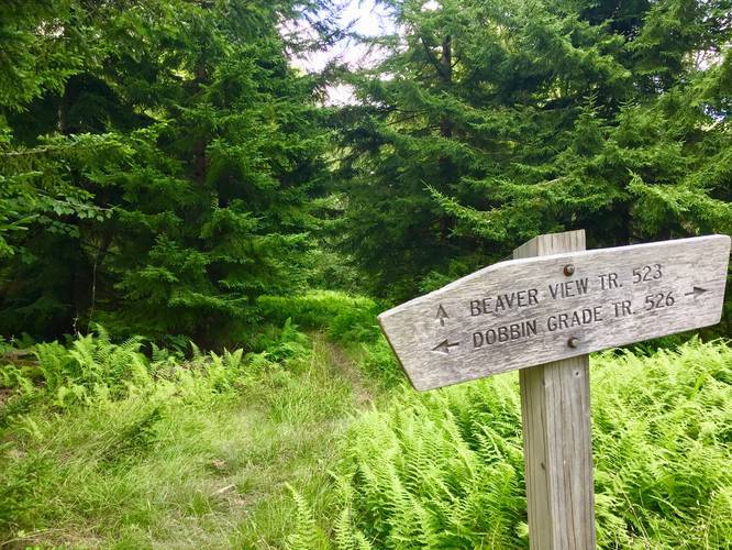
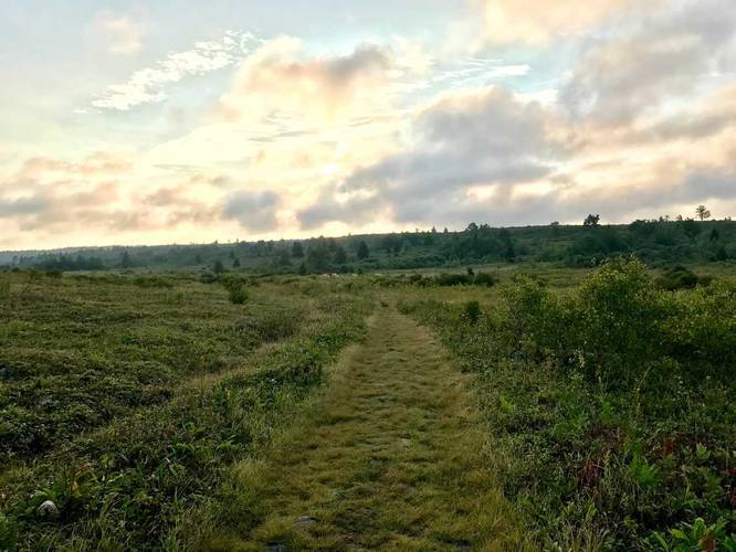
The Dobbin Grade Trail within the Dolly Sods Wilderness at the Monongahela National Forest is an easy 4.5 mile one-way trail that connects the Bear Rocks Trail to the Rocky Ridge Trail and cuts across almost the entirety of the Sods.
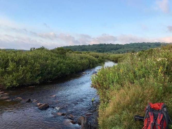
Depending on where you start the hike, the trail will be easy, until you hit the wet portion of the trail near Red Creek where you can often sink knee-deep in mud. This recording starts at the trailhead along the Bear Rocks Trail where the trail is essentially flat for the next two miles until you reach the Raven Ridge Trail.
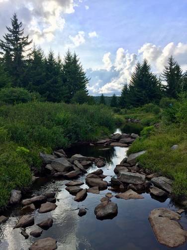
This trail is notorious for Red Creek flooding the trail or the trail just being overly saturated with water, so prepare to possibly get muddy, wet, or both. Also note that crossing Red Creek is usually a foot deep or so, but sometimes has some rocks you can use to cross without getting your feet wet.
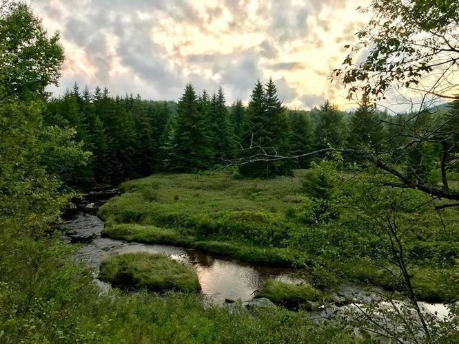
Water Source: Red Creek runs along the trail until you cross it around mile 1.8. There's another creek, Left Fork Red Creek, at mile 3.5 as well.
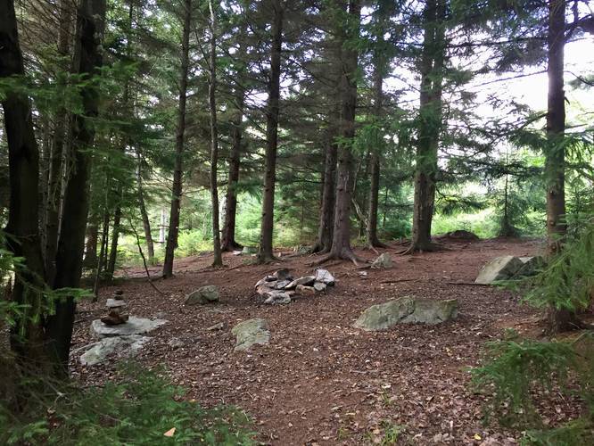
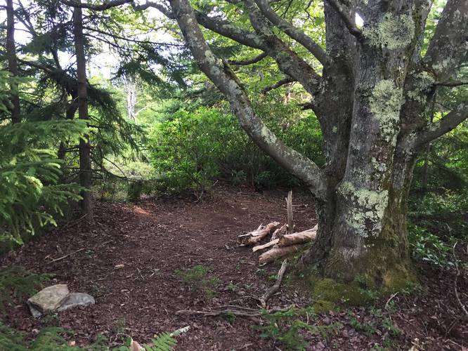
Campsites: There are plenty of campsites along the trail and the most popular spots are close to the Red Creek crossing, about 1.8 miles in. There's a campsite near the northern terminus within a conifer grove and then another small campsite tucked away (near mile 0.8) in another conifer grove just before the trail leads into the open valley near Red Creek. After you pass the Raven Ridge Trail, there will be some campsites along the hillside before the trail passes into the trees again. Once you pass the Left Fork Red Creek, there will be at least two campsites along the trail before you get to the Rocky Ridge Trail.
Parking: Parking can be found at the Bear Rocks Trail or Beaver Dam Trail parking areas.
Warning: Dolly Sods was used for military bombing training during WWII and there are still unexploded ordinances in the ground out in the wilderness. Most of these trails and the areas around them have been combed and searched, but not everything has been found. If you find any strange metal objects, especially bomb-shaped, do not tamper with them. Make a note of where you found it and alert the proper authorities. More information can be found at the wilderness trailheads.
Dolly Sods trail map PDF
Depending on where you start the hike, the trail will be easy, until you hit the wet portion of the trail near Red Creek where you can often sink knee-deep in mud. This recording starts at the trailhead along the Bear Rocks Trail where the trail is essentially flat for the next two miles until you reach the Raven Ridge Trail.
This trail is notorious for Red Creek flooding the trail or the trail just being overly saturated with water, so prepare to possibly get muddy, wet, or both. Also note that crossing Red Creek is usually a foot deep or so, but sometimes has some rocks you can use to cross without getting your feet wet.
Water Source: Red Creek runs along the trail until you cross it around mile 1.8. There's another creek, Left Fork Red Creek, at mile 3.5 as well.
Campsites: There are plenty of campsites along the trail and the most popular spots are close to the Red Creek crossing, about 1.8 miles in. There's a campsite near the northern terminus within a conifer grove and then another small campsite tucked away (near mile 0.8) in another conifer grove just before the trail leads into the open valley near Red Creek. After you pass the Raven Ridge Trail, there will be some campsites along the hillside before the trail passes into the trees again. Once you pass the Left Fork Red Creek, there will be at least two campsites along the trail before you get to the Rocky Ridge Trail.
Parking: Parking can be found at the Bear Rocks Trail or Beaver Dam Trail parking areas.
Warning: Dolly Sods was used for military bombing training during WWII and there are still unexploded ordinances in the ground out in the wilderness. Most of these trails and the areas around them have been combed and searched, but not everything has been found. If you find any strange metal objects, especially bomb-shaped, do not tamper with them. Make a note of where you found it and alert the proper authorities. More information can be found at the wilderness trailheads.
Dolly Sods trail map PDF