Benjamin Hollow Falls and Clay Mine Falls at Tioga State Forest near Blackwell, Pennsylvania is an easy 6.4-mile out-and-back hike that leads to two waterfalls within the PA Grand Canyon via the Pine Creek Trail (rail trail).
Falling rocks: The rocks located high above the trail can sometimes break loose and tumble down long distances to reach the rail trail. During our hike here, we noticed several spots of rockfall that were scattered across both sides of the trail. While rare, it's good to be aware.
Timber Rattlesnakes: This area is home to the Timber Rattlesnake which can be found roaming the forest between the end of April and early October each year. While rare, it's best to be on the lookout for rattlers. Give any you find plenty of space for your own safety.
Hiking to Clay Mine Falls
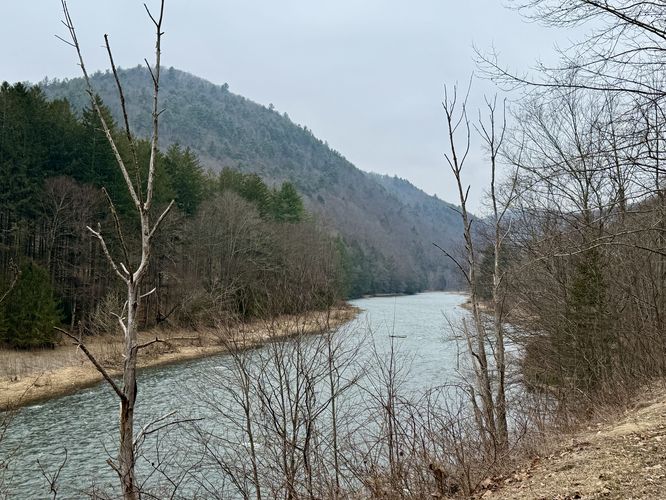
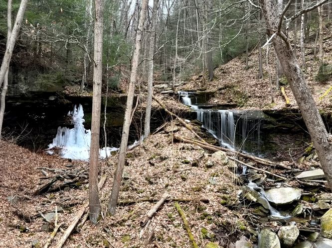
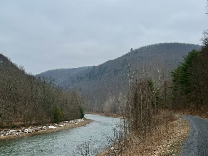
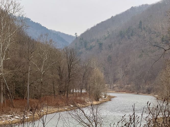
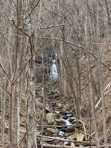
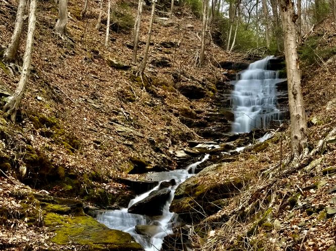
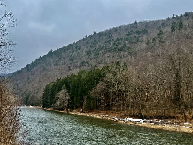
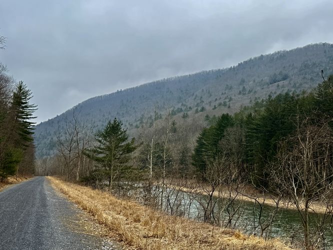
Hikers will begin in the center of Blackwell where you'll find the Pine Creek Trail cuts through town just east of the Robert McCullough Jr Pine Creek Access parking lot. The Pine Creek Trail follows an old flat railroad bed that leads through Pine Creek Gorge and is easy to follow. Along the way, you'll pass the uphill hike along the Mid State Trail that leads to the Johnson Cliff Vista (mile 0.28), Stone Quarry Falls (mile 1.15), Water Tank Falls (mile 2.32), and several nice views of Pine Creek and the steep gorge walls that surround it. Note that Stone Quarry Falls can be viewed in full from the Pine Creek Trail, but Water Tank Falls' lower cascade and upper tiers are best appreciated if bushwhacking upstream. Eventually, around mile 2.75, hikers will reach the start to the off-trail bushwhack that leads up to the base of the lower tier of Clay Mine Falls. Here, I traversed the north side of Clay Mine Run as it leads off-trail through terrain of loose rocks and small trees and bushes. Around mile 2.8 is the base of the lower tier of Clay Mine Falls which cascades down the bedrock at about 15-feet tall. Along the hike up to Clay Mine Falls are several short 3 and 4-foot tall cascades that add to the scenery of Clay Mine Run.Hiking to Benjamin Hollow Falls
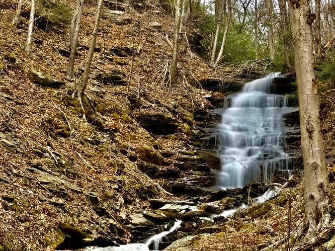
After exploring Clay Mine Falls, whether from the Pine Creek Trail (rail trail) or from the off-trail bushwhack, the hike leads north along the Pine Creek Trail to reach Benjamin Hollow and Benjamin Hollow Falls. During our hike here, in March 2025, we noticed several sections of large rocks sitting on both sides of the trail -- an indication that rock slides have occurred here recently, hence the falling rock hazard. While this occurrence is rare, it's a good reminder that the gorge randomly sends rocks flying down its steep flanks from time to time. Finally, around mile 3.13 hikers will reach the Benjamin Hollow Run crossing along the Pine Creek Trail. Here, you can appreciate Benjamin Hollow Falls from the rail trail if you wish -- the main cascade is about 35 to 40-feet tall at most with several 3 and 4-foot tall cascades that lead up to its base. Here, I decided to bushwhack upstream closer to the main waterfall, which was arguably not easy. I hiked-in along the north side of Benjamin Hollow and followed the banks of the creek upstream until I was forced to cross to the other side (south). From here, I scrambled a bit upstream along some steep slopes to reach a decent spot to photograph the ~35-foot tall Benjamin Hollow Falls. I wish I had gone further, but I felt I had scrambled and risked falling injuries enough for the day. I snapped a few photos and bushwhacked my way back to the Pine Creek Trail. Reaching the base of Benjamin Hollow Falls is not easy, a bit sketchy, and should be done by experienced hikers only. Oh and watch out for Rattlesnakes if its warm out, they love drinking and hunting along creek water!Hiking Out
After exploring Clay Mine Falls (15-feet tall) and the 35-foot tall Benjamin Hollow Falls, the hike back to parking is simple -- just follow the Pine Creek Trail south until you reach the trailhead at the center of Blackwell. Along the way, you can appreciate the south-facing views of the Pine Creek Gorge, the lower tier of Water Tank Falls, and Stone Quarry Falls.Parking
Hikers will find a large parking lot at the coordinates provided, located on the east side of Pine Creek in Blackwell at the Robert McCullough Jr Pine Creek Access lot. As of March 15, the parking lot is large enough to fit about 15 vehicles max.Pets
Dogs are allowed only if leashed and should be cleaned up after.Warnings
Bushwhacking: To reach the base of these waterfalls, hikers much bushwhack to them. This can be risky and dangerous depending on which route you take.Falling rocks: The rocks located high above the trail can sometimes break loose and tumble down long distances to reach the rail trail. During our hike here, we noticed several spots of rockfall that were scattered across both sides of the trail. While rare, it's good to be aware.
Timber Rattlesnakes: This area is home to the Timber Rattlesnake which can be found roaming the forest between the end of April and early October each year. While rare, it's best to be on the lookout for rattlers. Give any you find plenty of space for your own safety.