The Wetland Bluff Trail at Boyce Mayview Park in Upper Saint Clair, Pennsylvania is an easy 0.3-mile one-way trail that features an obstructed vista labeled the Valley View Point.
Hike Description
This trail begins along the Field Trail and heads west to connect with the Wetland Trail and passes the Valley View Point along the way. The trail passes several sections of ravines where the path becomes a lot skinnier, so watch your step.
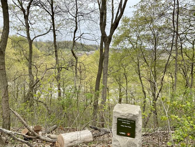
Around mile 0.1 hikers will reach the Valley View Point, which is an obstructed vista of the valley below. As of April 2021, the valley below appears to be a brand new housing development that’s under construction, so unfortunately what likely used to be a view of a nice empty green-space is now becoming more housing. The view here is just as obstructed as the “views” along the Queen Maple Trail or from the top of the Sylvan Ridge Trail - it’s not all that impressive, but it’s still a nice change of scenery.
Pets
Dogs are allowed on this trail.
Parking
Hikers will find parking at the coordinates provided along Birds Meadow Drive, right off of Boyce Road in Upper St. Clair. The parking lot is large enough to fit about a dozen vehicles.
Biking
Biking is not allowed along this trail.
Connecting Trails
This trail connects with Wetlands Trail and the Field Trail.
Hike Description
This trail begins along the Field Trail and heads west to connect with the Wetland Trail and passes the Valley View Point along the way. The trail passes several sections of ravines where the path becomes a lot skinnier, so watch your step.
Around mile 0.1 hikers will reach the Valley View Point, which is an obstructed vista of the valley below. As of April 2021, the valley below appears to be a brand new housing development that’s under construction, so unfortunately what likely used to be a view of a nice empty green-space is now becoming more housing. The view here is just as obstructed as the “views” along the Queen Maple Trail or from the top of the Sylvan Ridge Trail - it’s not all that impressive, but it’s still a nice change of scenery.
Pets
Dogs are allowed on this trail.
Parking
Hikers will find parking at the coordinates provided along Birds Meadow Drive, right off of Boyce Road in Upper St. Clair. The parking lot is large enough to fit about a dozen vehicles.
Biking
Biking is not allowed along this trail.
Connecting Trails
This trail connects with Wetlands Trail and the Field Trail.