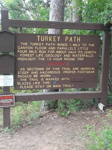
The Turkey Path at Leonard Harrison State Park in Wellsboro, Pennsylvania is a difficult 2-mile out-and-back trail that leads down switchbacks to massive waterfalls that cascade down Little Four-Mile Run and eventually reaches the Pine Creek Trail, within the Grand Canyon of Pennsylvania.
Trail Description
The trail starts just beyond the visitors center - the trailhead can be found on your right-hand side as you walk towards the first lookout area. As stated on the sign at the trailhead, this is a dangerous trail and you must be careful hiking.
The trail follows a moderate grade along switchbacks, but considering the elevation gain over the total distance, this is certainly a difficult hike as you work your way down the eastern side of the Grand Canyon of Pennsylvania.
Mile 0 to 0.2
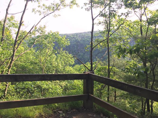
From the beginning of the hike you'll pass through coniferous forests as you make your way downhill. On the 2nd switchback you'll find a lookout point with honestly not much to see but the mountains on the other side of Pine Creek.
Mile 0.2 to 0.55
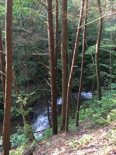
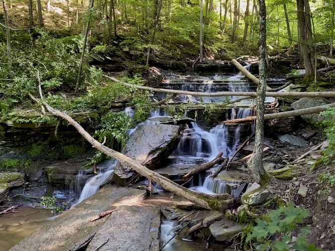
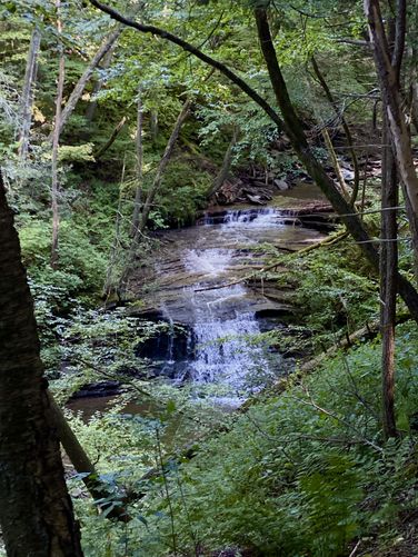
After hitting the lookout point, hike further until you reach a wooden platform - here you can find a large waterfall that cascades down into Little Four-Mile Run; however, this waterfall is difficult to see unless the leaves are not on the trees. Just after the first wooden platform, you'll find your first truly visible waterfall that cascades about 20-feet down Little Four-Mile Run creek.
Mile 0.55 to 0.9
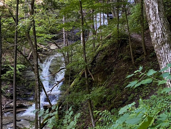
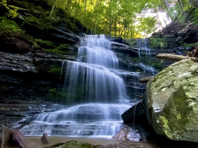
During this section of the hike you'll come across some of the most dangerous portions of the trail. Watch your footing and do not step on slippery rocks as this area has plenty of small creeks that rush down the side of the mountain. Continue hiking down past one switchback before reaching yet another wooden platform with a viewing point for the Upper Falls.
Mile 0.9 to 1
After viewing the upper falls along Little Four-Mile Run, continue hiking down the staircases to more amazing waterfall lookout points. From here you'll be hiking all the way down each set of staircases until you reach Lower Falls and then eventually the Pine Creek Trail where this hike ends (one-way).
Waterfalls
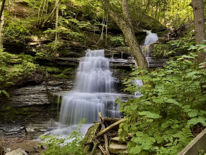
The creek that the trail runs along is called Little Four-Mile Run / Little Four Mile Run. This creek has several very large waterfalls that cascade at least over 50-feet high, if not closer to 80-feet or so, in combination named Little Four Mile Run Falls. You can reach the Upper Little Four Mile Run Falls by stopping just over half-way down the trail, which makes it an easier hike; however, to fully enjoy the entirety of this trail, your best bet is to hike all the way to the end where it intersects with the Pine Creek Trail. Side note: this trail literally feels like Rivendell out of Lord of the Rings - if you're into that kind of thing, this is your trail.
Parking
Hikers will find parking at the main lot at the coordinates provided. The parking lot is large enough to fit several dozen vehicles; however, during the Summer weekends the parking lot may fill up quickly.
Pets
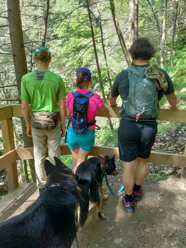
Dogs are allowed on this trail and their waste must be carried out.
Hazards
This trail can be extremely steep and skinny with no fence or railing. There's one part of the trail where if you fall, you'll tumble over 100-feet into Little Four-Mile Run creek below. Watch your footing along this trail and do not rush your hike in dangerous sections.
Resting Areas
Along this trail are plenty of benches and areas to rest where you can catch your breath heading back uphill with amazing views of the massive waterfalls.
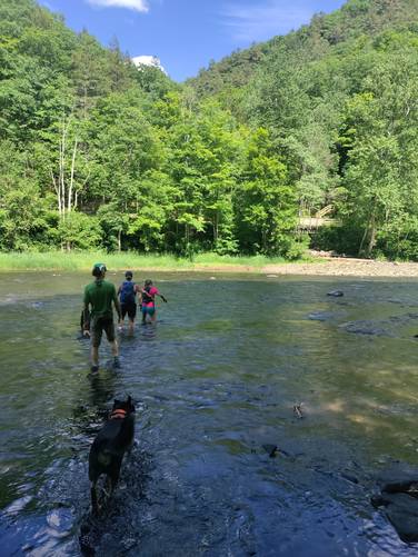
Connecting to Colton Point State Park
If you want a longer day-hike and don't mind getting wet while crossing Pine Creek, you can plan to continue the hike along the Turkey Path Trail at Colton Point State Park. You'll need to wade across Pine Creek, where the water can be over 1-foot deep; however depending on the time of year, the current is often not very strong after Spring, so the crossing is not too difficult. Most people end up hiking out-and-back along each side of the Turkey Path instead of crossing Pine Creek though. The total mileage for both hikes is about 5.1 miles out-and-back with at least 2,000 feet of elevation gain.
Warnings
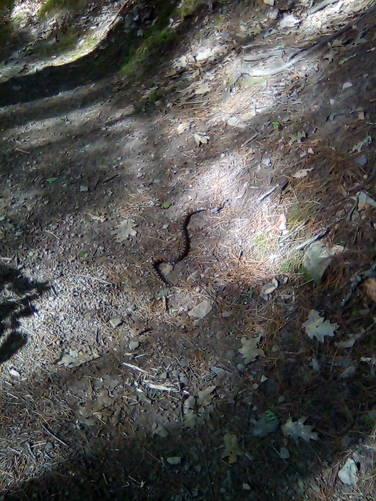
Rattlesnakes: While rare, the Timber Rattlesnake lives in this area and tends to come down to creeks to cool down or hunt between the end of April through the end of September. Watch your step and give any rattlesnake you see some space.
Pine Creek Pinnacles (PCP20)
This hike is part of the Pine Creek Pinnacles hiking challenge. For more information, details, and FAQs, please visit our Pine Creek Pinnacles (PCP20) page.
Trail Description
The trail starts just beyond the visitors center - the trailhead can be found on your right-hand side as you walk towards the first lookout area. As stated on the sign at the trailhead, this is a dangerous trail and you must be careful hiking.
The trail follows a moderate grade along switchbacks, but considering the elevation gain over the total distance, this is certainly a difficult hike as you work your way down the eastern side of the Grand Canyon of Pennsylvania.
Mile 0 to 0.2
From the beginning of the hike you'll pass through coniferous forests as you make your way downhill. On the 2nd switchback you'll find a lookout point with honestly not much to see but the mountains on the other side of Pine Creek.
Mile 0.2 to 0.55
After hitting the lookout point, hike further until you reach a wooden platform - here you can find a large waterfall that cascades down into Little Four-Mile Run; however, this waterfall is difficult to see unless the leaves are not on the trees. Just after the first wooden platform, you'll find your first truly visible waterfall that cascades about 20-feet down Little Four-Mile Run creek.
Mile 0.55 to 0.9
During this section of the hike you'll come across some of the most dangerous portions of the trail. Watch your footing and do not step on slippery rocks as this area has plenty of small creeks that rush down the side of the mountain. Continue hiking down past one switchback before reaching yet another wooden platform with a viewing point for the Upper Falls.
Mile 0.9 to 1
After viewing the upper falls along Little Four-Mile Run, continue hiking down the staircases to more amazing waterfall lookout points. From here you'll be hiking all the way down each set of staircases until you reach Lower Falls and then eventually the Pine Creek Trail where this hike ends (one-way).
Waterfalls
The creek that the trail runs along is called Little Four-Mile Run / Little Four Mile Run. This creek has several very large waterfalls that cascade at least over 50-feet high, if not closer to 80-feet or so, in combination named Little Four Mile Run Falls. You can reach the Upper Little Four Mile Run Falls by stopping just over half-way down the trail, which makes it an easier hike; however, to fully enjoy the entirety of this trail, your best bet is to hike all the way to the end where it intersects with the Pine Creek Trail. Side note: this trail literally feels like Rivendell out of Lord of the Rings - if you're into that kind of thing, this is your trail.
Parking
Hikers will find parking at the main lot at the coordinates provided. The parking lot is large enough to fit several dozen vehicles; however, during the Summer weekends the parking lot may fill up quickly.
Pets
Dogs are allowed on this trail and their waste must be carried out.
Hazards
This trail can be extremely steep and skinny with no fence or railing. There's one part of the trail where if you fall, you'll tumble over 100-feet into Little Four-Mile Run creek below. Watch your footing along this trail and do not rush your hike in dangerous sections.
Resting Areas
Along this trail are plenty of benches and areas to rest where you can catch your breath heading back uphill with amazing views of the massive waterfalls.
Connecting to Colton Point State Park
If you want a longer day-hike and don't mind getting wet while crossing Pine Creek, you can plan to continue the hike along the Turkey Path Trail at Colton Point State Park. You'll need to wade across Pine Creek, where the water can be over 1-foot deep; however depending on the time of year, the current is often not very strong after Spring, so the crossing is not too difficult. Most people end up hiking out-and-back along each side of the Turkey Path instead of crossing Pine Creek though. The total mileage for both hikes is about 5.1 miles out-and-back with at least 2,000 feet of elevation gain.
Warnings
Rattlesnakes: While rare, the Timber Rattlesnake lives in this area and tends to come down to creeks to cool down or hunt between the end of April through the end of September. Watch your step and give any rattlesnake you see some space.
Pine Creek Pinnacles (PCP20)
This hike is part of the Pine Creek Pinnacles hiking challenge. For more information, details, and FAQs, please visit our Pine Creek Pinnacles (PCP20) page.