Loading...

๐ŸŽ† 50% off 4th of July sale on Supporter Accounts โ€” now through July 6! Learn More.

Sun Point Nature Trail

Directions
Map
Pictures
Send to App
Distance:
0.4 Miles / 0.6 km
Type:
Loop
Difficulty:
Easy
Time to Hike:
~12 minutes
Features:
Surface Type:
Dirt
Park:
Glacier National Park
Town:
Saint Mary, Montana
Directions:
48.67621, -113.580527
Added:
September 19, 2024
Updated:
January 19, 2025
Copy Trail Link Hiking this trail? Send a friend or family member a link to this trail guide for your own safety. Hike at your own risk (disclaimer)
Loading...
Loading...
93'

Total Change
103'

Ascent
61'

Descent

Download the Trail Route for Offline Use

Supporters get exclusive access to download trail routes to the MyHikes app for offline use. Stay prepared on your adventure, even without an internet connection! Become a Supporter today to unlock this feature and hike with confidence.

Send to App

Sun Point Nature Trail

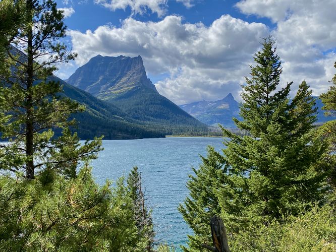
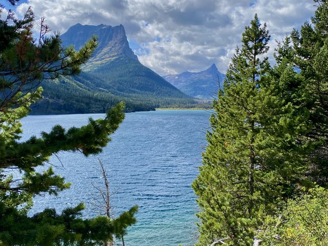
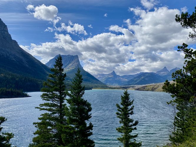
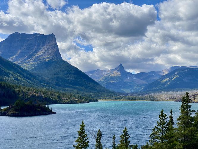
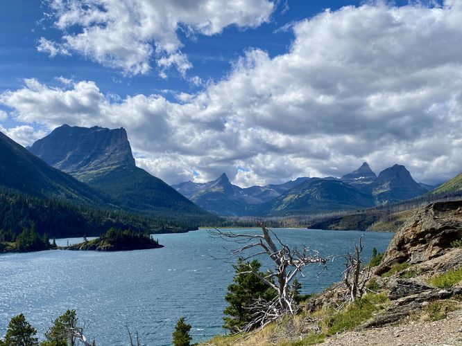
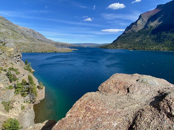
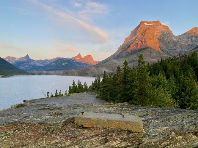
The Sun Point Nature Trail at Glacier National Park near Saint Mary, Montana is an easy 0.4-mile loop hike that features views of St. Mary Lake and its surrounding alpine mountains.

Hiking to Sun Point

Hikers can start the hike to Sun Point on either side of the loop located on the east and west side of the main parking lot. This route begins at the western side, which is technically the trailhead for the "Three Falls Hike" (aka Baring Falls, St. Mary Falls and Virginia Falls). The Sun Point Nature Trail leads down to the Piegan Pass Trail before heading east. As the path runs along the north shore of Saint Mary Lake, you'll find views of the light blue water and nearby towering alpine mountains.

Sun Point - Mile 0.25

Around mile 0.25, hikers will have ascended the highest point along the trail -- this is Sun Point. Back when the park was first opened to the public, the Going-to-the-Sun Chalets once stood on the bedrock but were demolished in 1947 after losing profitability. Hikers can still find scarce remnants of the old chalets with one concrete footing located at the very-top of Sun Point. There may be others located nearby but we didn't find more than one footing on our hike here. Views of Saint Mary Lake from Sun Point are panoramic from east to west and include distant views of Wild Goose Island.

Hiking Back - Mile 0.25 to 0.4

The hike back to parking from Sun Point is relatively easy, but mostly all uphill as the trail leads through a dense spruce forest. You'll reach the Sun Point Nature Trail trailhead around mile 0.4 at the parking lot to complete the hike.

Vehicle Reservations

Depending on what time of year you visit, you may need to reserve a vehicle entrance pass to get into the park, in addition to a park entry fee (or annual National Parks pass). Before planning this hike, ensure you've checked the NPS website for when and where Glacier NP vehicle reservations are required.

Parking

Visitors will find a very large parking lot at the coordinates provided, located on the south side of Going-to-the-Sun Road at Sun Point. The lot is large enough to fit several dozen vehicles but fills up quickly.

Pets

Dogs are not allowed on any trails at Glacier National Park.

Warning

Grizzly bears: This trail can be frequented by grizzly bears, especially in late Summer and early Fall as they scrounge for 20 hours/day bulking for the winter. Always give wild animals plenty of space, including several hundred feet for grizzlies. It's best to bring bear spray on this hike as a last defense just in case a grizzly were to charge at you. Always make plenty of noise while hiking to alert animals to your presence long before you see them. It's also smart to hike with another person. 
Explore 38 trails near Saint Mary, MT
  1. Parking

    48.67621, -113.580527
  2. Main Trailhead

    48.676209, -113.581158
  3. View / Overlook / Vista

    48.676003, -113.581619
    View / Overlook / Vista
  4. View / Overlook / Vista

    48.675872, -113.580886
    View / Overlook / Vista
  5. View / Overlook / Vista

    48.675714, -113.580572
    View / Overlook / Vista
  6. View / Overlook / Vista

    48.675147, -113.578483
    View / Overlook / Vista
  7. View / Overlook / Vista

    48.674969, -113.577661
    View / Overlook / Vista
  8. View / Overlook / Vista

    48.675172, -113.577636
    View / Overlook / Vista
  9. Footing from a long-gone chalet that once stood at Sun Point

    48.675114, -113.577864
    Footing from a long-gone chalet that once stood at Sun Point
No community routes found. To add your own hike as a Community Route for this Trail guide, leave a Trip Report with an attached GPX file.

Seasons

Spring, Summer, Fall

Trip Reports

Trail Guide By:
Admin user profile picture
0.4 miles / 0.6 km
0.4 miles / 0.6 km
September 21, 2024
Sun Point for sunrise was a beautiful way to end our trip
Hiking
0.4 miles / 0.6 km
September 21, 2024
Hiked out before sunrise to capture the morning light on nearby mountain peaks and over the lake. It was chilly but worth the walk for our last morning at the park. The night before sprinkled snow in the higher elevations which made for an even more scenic sunrise.
Hiking
0.4 miles / 0.6 km
September 19, 2024
Hiking

Weather Forecast

In Saint Mary, MT

Explore Hiking Trails

You May Also Like

Colorado's Million Dollar Highway - Plan a day's drive adventure along the iconic Million Dollar Highway in Colorado. Explore the best short trails, roadside stops, waterfalls, vistas, ghost towns, and hot springs within a ~6 hour road trip.
Explore

Colorado's Million Dollar Highway

Plan a day's drive adventure along the iconic Million Dollar Highway in Colorado. Explore the best short trails, roadside stops, waterfalls, vistas, ghost towns, and hot springs within a ~6 hour road trip.

Read
Glacier's Going-to-the-Sun Road - Discover the breathtaking beauty of Glacier National Park along the iconic Going-to-the-Sun Road. From stunning roadside stops to picturesque waterfalls and vistas, this engineering marvel offers endless opportunities for exploration.
Explore

Glacier's Going-to-the-Sun Road

Discover the breathtaking beauty of Glacier National Park along the iconic Going-to-the-Sun Road. From stunning roadside stops to picturesque waterfalls and vistas, this engineering marvel offers endless opportunities for exploration.

Read
New York's Best Waterfalls - Whether you're planning a day hike, roadside stop, or a leisurely short walk, this guide provides hikers, travelers, and locals alike with 63 different locations to over 100 scenic waterfalls to help plan your next adventure!
Explore

New York's Best Waterfalls

Whether you're planning a day hike, roadside stop, or a leisurely short walk, this guide provides hikers, travelers, and locals alike with 63 different locations to over 100 scenic waterfalls to help plan your next adventure!

Read

Before you boogie...

Find our trail guides useful? Consider becoming a Supporter to unlock perks!

MyHikes is an indie platform that makes exploring public trails easier for everyone. The platform has no investors, no ads, and is owned and operated by one person, Dave Miller. Dave has personally mapped and written over 1,800 trail guides on MyHikes for the public to explore. MyHikes has helped millions outdoor enthusiasts plan their next adventure.

But it takes a lot of time ๐Ÿ•ฆ, money ๐Ÿ’ฐ, work, and espresso shots โ˜• to run MyHikes, including hiking , mapping , writing , and publishing new trails with high-quality (accurate) information... along with software engineering (coding) the platform like building new features, website and mobile app development (iOS and Android), site maintainance . and much much more.

Supporters unlock website and mobile app perks with an annual one-time payment of $25 (you renew) ๐Ÿ˜Ž๐Ÿ‘. Or you can simply make a Donation of your choice. Otherwise, you can support us by telling your friends about MyHikes - both quick and free ๐ŸŽ‰

Admin user profile picture

Dave Miller
MyHikes Founder