The St. Mary Falls and Virginia Falls Hike at Glacier National Park is a moderate 3.8-mile out-and-back hike that leads to the turquoise-colored waterfall, St. Mary Falls and the 80-foot tall waterfall, Virginia Falls.
Slippery rocks: To enjoy these waterfalls, you may need to traverse bedrock that might be wet. Normally, wet bedrock can be very slippery. Most of the deaths at Glacier National Park are water-related and thus, it's smart to be cautious when walking on potentially wet and slippery bedrock.
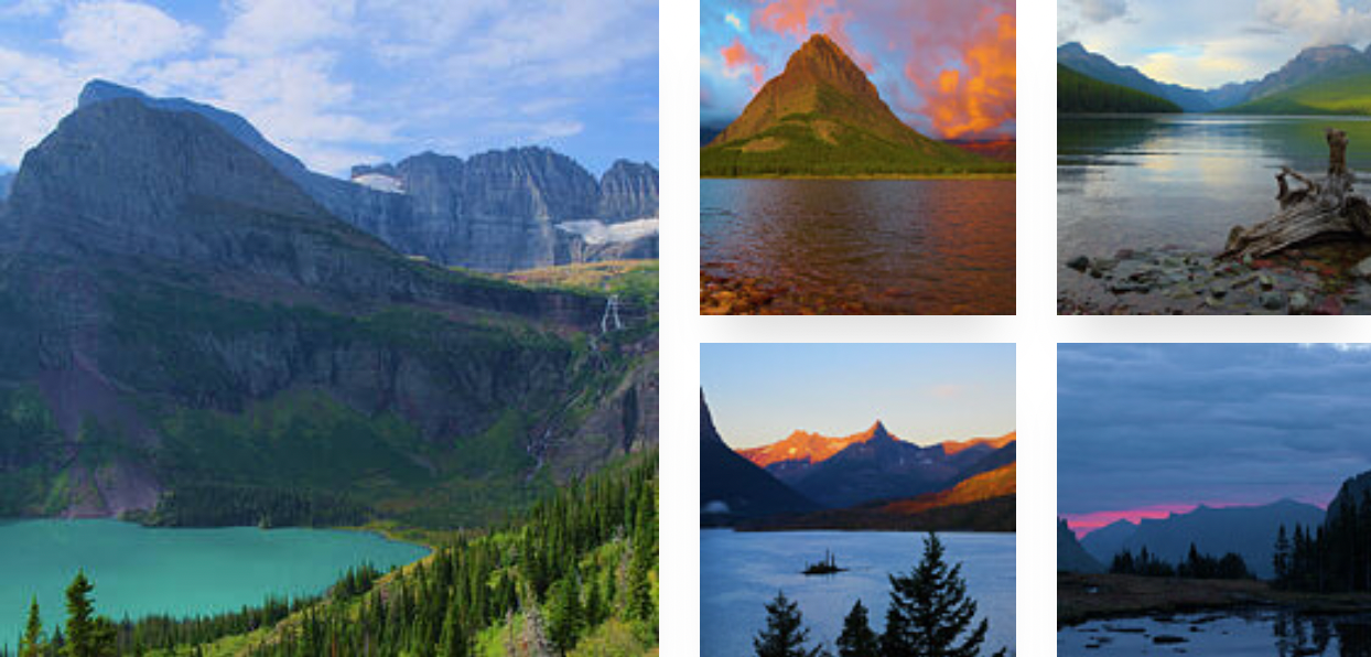
Hiking to St. Mary Falls & Virginia Falls
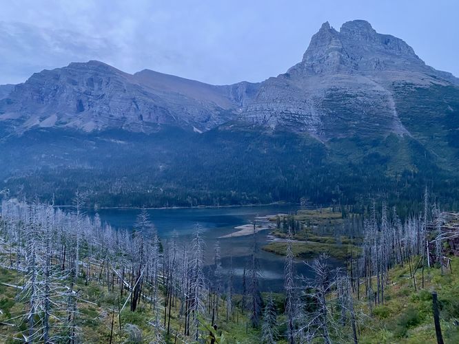
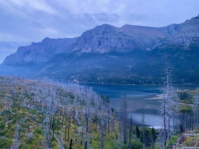
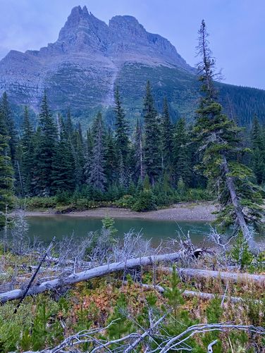
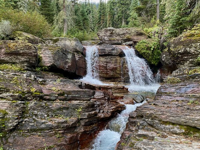
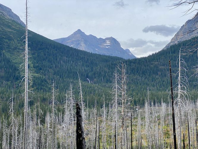
This hike, which is often referred to as the "Three Falls Hike", includes just two named waterfalls, but you'll end up passing at least three other unnamed cascades along the way. This trail begins at the main parking lot labeled "St. Mary Falls" along the Going-to-the-Sun Road where the dirt trail descends from the parking lot to reach the Piegan Pass Trail below. The Piegan Pass Trail runs along the northern hills of St. Mary Lake with views of the turquoise-tinted waters below -- as of September 2024 (and earlier) due to a wildfire that burnt most of the evergreen forests that once stood here. Despite the dead-standing trees, hikers will find Virginia Falls far in the distance, sitting on the evergreen-filled mountain side between Little Chief Mountain and Dusty Star Mountain. The trail eventually reaches a junction, around mile 0.55 from the trailhead where you'll want to head due-south taking a left-hand turn to hike toward St. Mary Falls to follow the St. Mary Lake Trail. After taking this turn, the terrain follows a gradual grade downhill a bit further before the path levels out.St. Mary Falls' Turquoise Waters - Mile 1 to 1.1
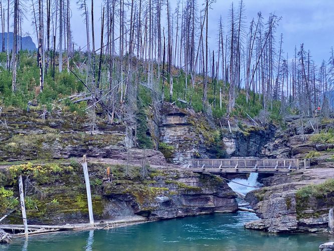
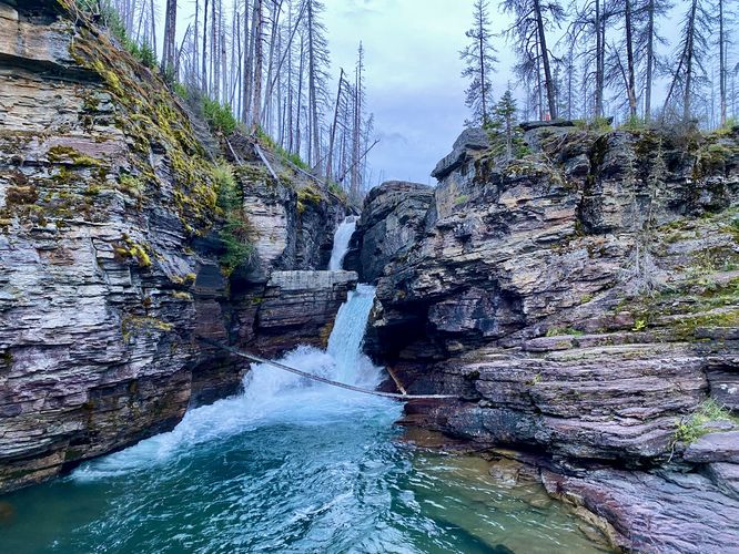
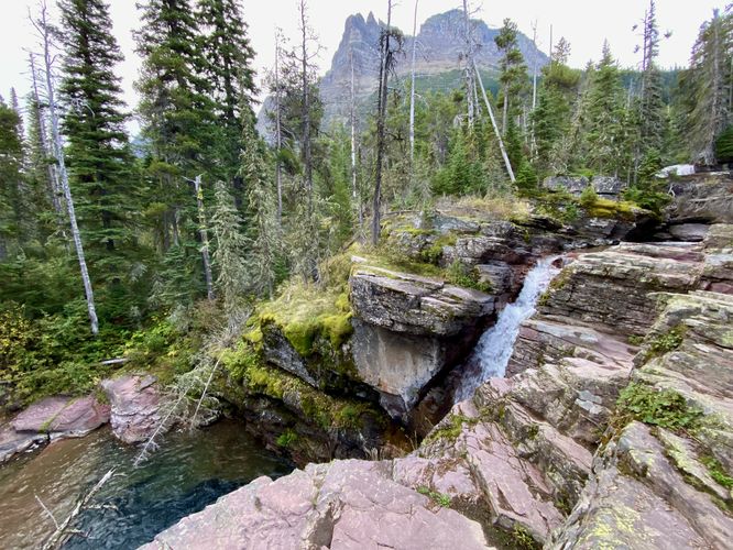
Just before reaching St. Mary Falls, hikers will notice the waterfall from the trail in the distance. In the foreground, however, is a footbridge that spans a gap in the bedrock where the Saint Mary River flows underneath. The pool of water here is a deep turquoise that sits below the red-tinted, tan bedrock where you'd be fooling to not stop and take-in the views. The trail leads around the bend and reaches St. Mary Falls around mile 1.1 from the trailhead where you can enjoy the two-tiers of the waterfall spill down the bedrock. St. Mary Falls is about 35-feet in total and cascades down three main tiers, but generally only two tiers of the waterfall are visible to hikers. You'll find that not only is the pool of water at St. Mary Falls a deep turquoise color, but even the water that spills over within the cascade itself is a similar hue, making this one of the most unique and spectacular waterfalls in the park and personally, one of the most unique that I've hiked to thus far.More Waterfalls - Mile 1.3 to 1.55
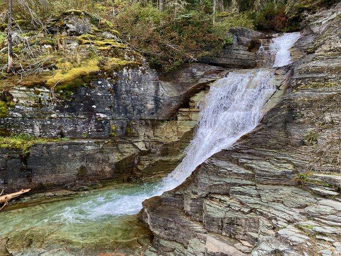
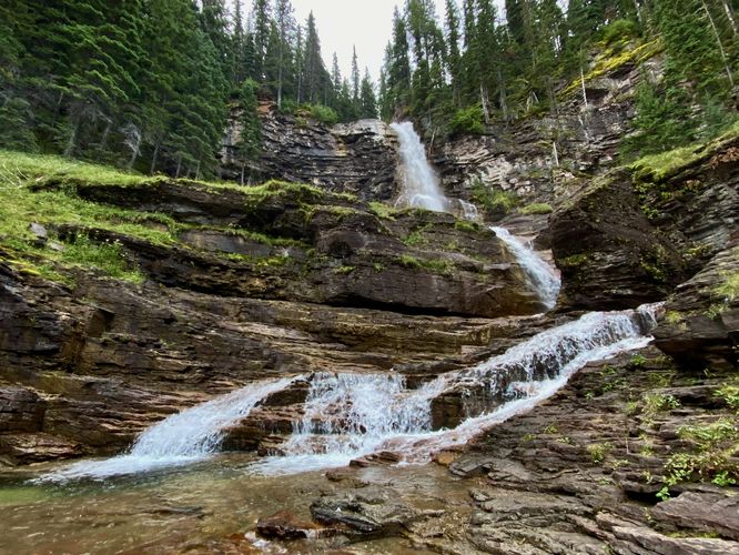
After visiting St. Mary Falls, the trail leads back uphill as it heads toward the ~80-foot tall Virginia Falls. On the way, you'll find more unnamed waterfalls. At mile 1.3, sits a beautiful multi-tiered waterfall that spills over at least three main tiers of bedrock at approximately 22-feet tall in total. This waterfall can be viewed best from the bedrock located just off-trail. A keen-eyed hiker may even notice that this waterfall is the main photograph for the "Three Falls Hike" trailhead located at the Sun Point parking lot. Just upstream from this cascade is a small ~6-foot tall red-rock waterfall located just off-trail and is easy to spot and photograph. At mile 1.55 sits the fourth main waterfall along this hike, which plummets over a rock cliff near your feet at approximately 15-feet tall or higher. This fourth cascade is a bit difficult (and dangerous) to photograph well.Reaching Virginia Falls (Upper & Lower) - Mile 1.95
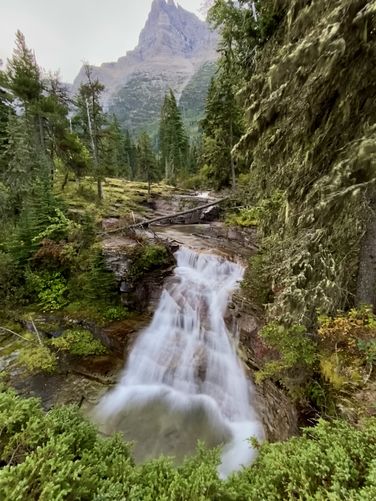
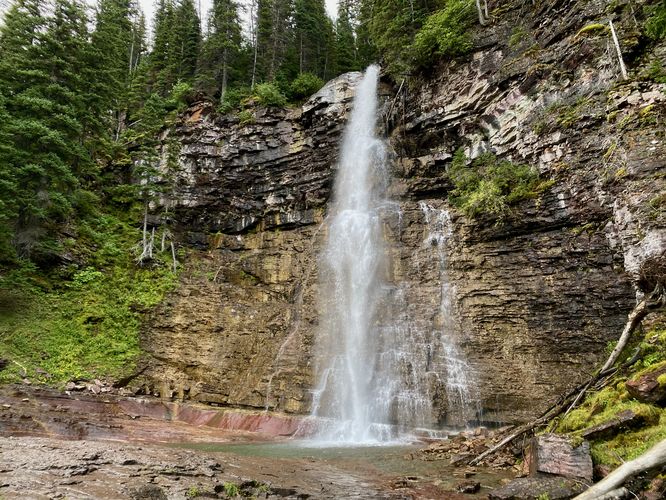
Around mile 1.8, hikers will reach a horse ford (left-hand turn) that leads to a footbridge and crosses Virginia Creek. I accidentally hiked down here before turning back to continue uphill to reach Virginia Falls which is included in the route. The waterfall is accessed by eventually crossing two or three wooden footbridges that span a small off-shoot of the main creek, where hikers will finally reach the base of Virginia Falls at mile 1.95. Virginia Falls has two main tiers -- the Upper Virginia Falls section, which plummets over a mountain cliff at about 80-feet high -- and Lower Virginia Falls, which is a series of shorter waterfalls that spills down the bedrock. This route first leads to the 80-foot tall free-falling Upper Virginia Falls. Here, you can cool down from your hike by standing in the spray of Virginia Falls or just enjoy the plummeting water from afar. This route then leads back downhill, located less than ~100-feet from Upper Falls, to reach Lower Virginia Falls. The view from Lower Virginia Falls is spectacular as well and includes the smaller lower waterfalls in the foreground with the free-falling plummet of Upper Virginia Falls in the background; however, capturing the whole scale of both waterfalls is difficult without someone standing in your photograph or view.Hiking Out - Mile 1.95 to 3.8
The hike back to parking obviously follows the same route you hiked in on; however, this provides you with an opportunity to explore the waterfalls one more time before you're off of the trail. Luckily, on this day, we were the first hikers out to St. Mary Falls and Virginia Falls, so the hike back was less interesting as St. Mary Falls, and the cascades along the way, had plenty of hikers already hanging out and enjoying the sights. Regardless, it was nice seeing Virginia Falls plummet over the mountain side as we made our way back to parking to wrap up this amazing 3.8-mile out-and-back hike.Three Falls Hike
Please note that this out-and-back hike is part of the very-popular "Three Falls Hike" at Glacier National Park. Many people start this hike at the Sun Point trailhead (aka Three Falls Hike Trailhead) and opt to explore Baring Falls along the way, making for a longer day hike. We, however, decided to explore Baring Falls separately for a short 0.8-mile out-and-back hike. To each their own, however, if you choose to explore these waterfalls separately note that you may need to be savvy when it comes to finding a parking spot -- whether that means you show up early or late in the day or you stick around and wait for a parking space to open, as these lots fill up quickly each morning.Vehicle Reservations
Depending on what time of year you visit, you may need to reserve a vehicle entrance pass to get into the park, in addition to a park entry fee (or annual National Parks pass). Before planning this hike, ensure you've checked the NPS website for when and where Glacier NP vehicle reservations are required.Parking
Visitors will find a medium-sized parking lot at the coordinates provided, located along the Going-to-the-Sun Road at a sign labeled "St. Mary Falls". The parking lot is large enough to accommodate about 15 vehicles as of September 2024. This parking lot is extra-popular so it fills up quickly each morning. We arrived before sunrise and by the time we ended the hike, around 8:30AM, the lot was 100% full.Pets
Dogs are not allowed on any trails at Glacier National Park.Warning
Grizzly bears: This trail is frequented often by grizzly bears, especially in late Summer and early Fall as they scrounge for 20 hours/day bulking for the winter. Always give wild animals plenty of space, including several hundred feet for grizzlies. It's best to bring bear spray on this hike as a last defense just in case a grizzly were to charge at you. Always make plenty of noise while hiking to alert animals to your presence long before you see them. It's also smart to hike with another person.Slippery rocks: To enjoy these waterfalls, you may need to traverse bedrock that might be wet. Normally, wet bedrock can be very slippery. Most of the deaths at Glacier National Park are water-related and thus, it's smart to be cautious when walking on potentially wet and slippery bedrock.