The Baring Falls Hike at Glacier National Park near Saint Mary, Montana is an easy 0.7-mile out-and-back hike that leads to two waterfalls within Baring Creek -- the 25-foot tall Baring Falls and shorter multi-tiered waterfall, Upper Baring Falls. Upper Baring Falls - Mile 0.06
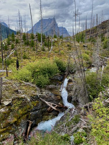
After exploring a bit of Sunrift Gorge, this route leads hikers downhill along the northern side of Baring Creek as it follows the Siyeh Pass Trail. Just a couple-hundred feet from the parking lot is Upper Baring Falls, located around mile 0.06 (318-feet) from the trailhead. Upper Baring Falls is a multi-tiered waterfall with three cascades that spills down the creek at about 12-feet tall. At the bottom of the waterfall is light-colored bedrock that creates a turquoise-tinted pool of water. Hikers will find a nice downstream view of the same waterfall located just down the Siyeh Pass Trail.
The hike back to parking is simple, just hike back the same way you came in. Enjoy the views of Saint Mary Lake and its surrounding alpine mountains as you make your way back.
Trails
This hike follows two named trails to reach Baring Falls in the following order: Siyeh Pass Trail, Piegan Pass Trail.Hiking to Baring Falls
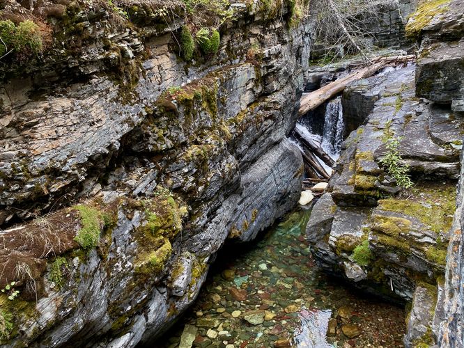
This hike begins along the Going-to-the-Sun Road at the Sunrift Gorge parking area. Hikers will find the trailhead, a stone staircase, adjacent to the Baring Creek Bridge. Head down the stairs to reach a quick hit to view small waterfalls within Sunrift Gorge, located underneath the bridge. Within Sunrift Gorge are colorful rocks at the bottom of the crystal-clear creek which starts the hike off with beautiful scenery, so it's worth it to explore the gorge for a few minutes before you hike downstream.Upper Baring Falls - Mile 0.06
After exploring a bit of Sunrift Gorge, this route leads hikers downhill along the northern side of Baring Creek as it follows the Siyeh Pass Trail. Just a couple-hundred feet from the parking lot is Upper Baring Falls, located around mile 0.06 (318-feet) from the trailhead. Upper Baring Falls is a multi-tiered waterfall with three cascades that spills down the creek at about 12-feet tall. At the bottom of the waterfall is light-colored bedrock that creates a turquoise-tinted pool of water. Hikers will find a nice downstream view of the same waterfall located just down the Siyeh Pass Trail. Hiking the Piegan Pass Trail - Mile 0.25
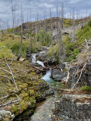
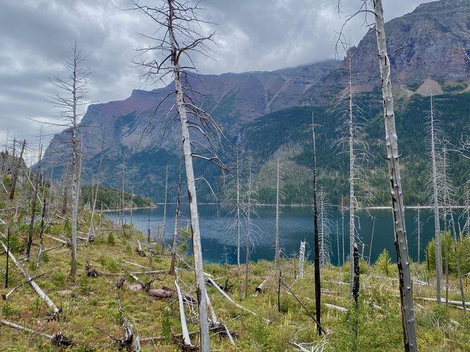
As you make your way down the Siyeh Pass Trail, you'll find views of Saint Mary Lake and Mahtotopa Mountain straight ahead. Around mile 0.25, you'll reach a trail junction with the Piegan Pass Trail. Here, take a right-hand turn to head directly to Baring Falls. Along the way to the waterfall, you'll find views of Little Chief Mountain and Dusty Star Mountain towering over Saint Mary Lake and the wildfire-destroyed evergreen forest. Just before Baring Falls, hikers will cross a wooden footbridge with a scenic view of the creek's colorful rocks an crystal-clear water below and towering ramparts of alpine mountains overhead.Baring Falls (approx. 25-feet tall) - Mile 0.37
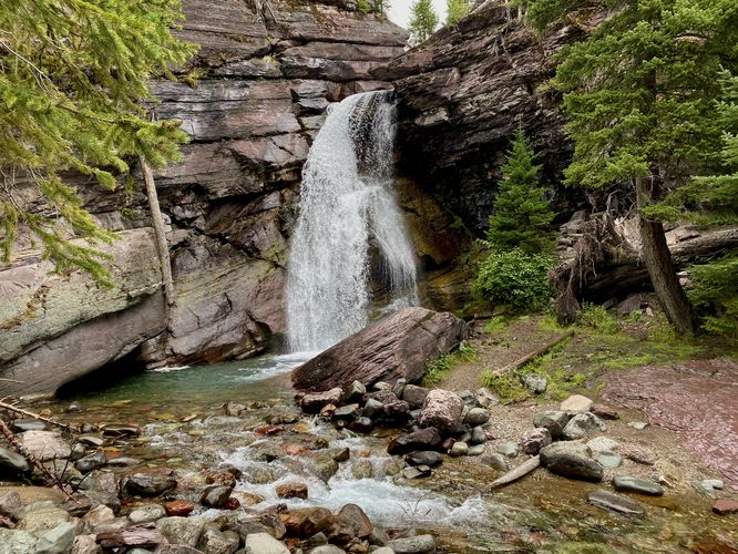
Around mile 0.37 in the route provided, hikers will reach the 25-foot tall Baring Falls as it plunges over a cliff of red-tinted bedrock. Like other nearby waterfalls in Glacier National Park, the crystal-clear water along with the light-colored bedrock in the cascade's pool reflects with a turquoise-colored tint. The colors create a beautiful juxtaposition of red-tinted bedrock and blue-hued water and makes for one of the easiest and most-scenic waterfall hikes in the park. You can choose to hang around Baring Falls to enjoy its natural beauty as there's plenty of space to spread out from other hikers below the cascade or you can choose to hike to Saint Mary Falls and Virginia Falls, located to the west for a longer day hike. We chose to explore those waterfalls on a separate hike instead of following the "Three Falls Hike" that many visitors do.The hike back to parking is simple, just hike back the same way you came in. Enjoy the views of Saint Mary Lake and its surrounding alpine mountains as you make your way back.