The Poe Lake Trail at Poe Valley State Park
near Coburn, Pennsylvania is an easy universally-accessible 0.4-mile out-and-back trail that runs along Poe Lake, featuring views of the water and the lake's surrounding mountains.
Walk
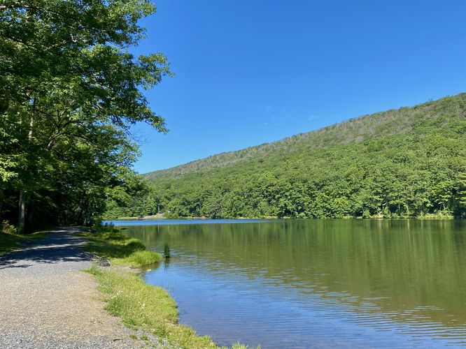
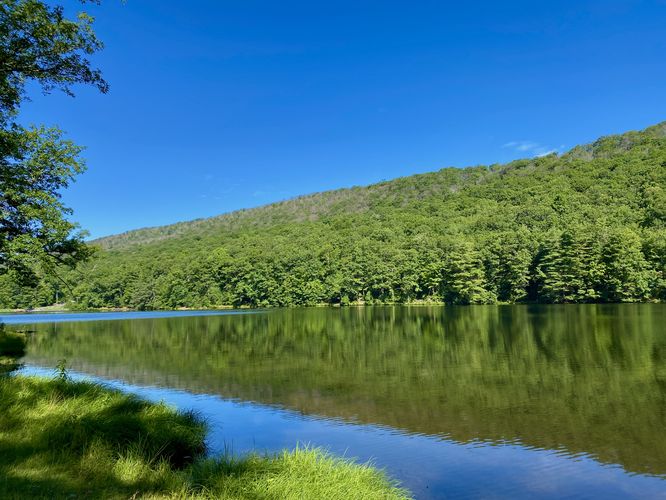
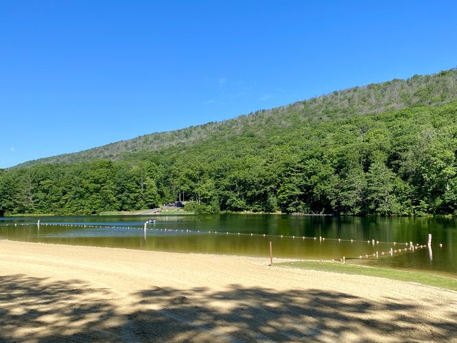
This is not a hike, but rather a short walk along the southern shore of Poe Lake. Hikers will find the trailhead at two starting areas -- the lake's concession stand or this trailhead, located near the end of the one-way road in the park. The trail leads downhill from the Poe Lake Dam Trail to reach a dirt path that runs westward along the southern shore of the lake. Along the way are views of the water and the lake's neighboring mountains. During warm months, especially during the summer, you may find folks fishing, swimming, or paddling around the lake. The trail ends at the concession stand where the walk leads back to parking for a short 0.4-mile walk.
Before leaving the park, if you wish to explore further consider taking a short walk along the Poe Lake Dam Trail or experience the woodlands of Poe Valley State Park by hiking the Poe Valley Nature Trail.
Universally-Accessible
This trail is universally-accessible and follows a crushed stone pathway as of July 2024.
Parking
Hikers will find parking along the main entrance road to the park. This one-way road curves around the bend at the far-side of the park (near the campground). Where the road turns a hairpin turn is the dam and located just beyond the "no parking" signs along the road are some on-road parking turnouts.
Pets
Dogs are allowed only if leashed and must be cleaned up after.
Walk
This is not a hike, but rather a short walk along the southern shore of Poe Lake. Hikers will find the trailhead at two starting areas -- the lake's concession stand or this trailhead, located near the end of the one-way road in the park. The trail leads downhill from the Poe Lake Dam Trail to reach a dirt path that runs westward along the southern shore of the lake. Along the way are views of the water and the lake's neighboring mountains. During warm months, especially during the summer, you may find folks fishing, swimming, or paddling around the lake. The trail ends at the concession stand where the walk leads back to parking for a short 0.4-mile walk.
Before leaving the park, if you wish to explore further consider taking a short walk along the Poe Lake Dam Trail or experience the woodlands of Poe Valley State Park by hiking the Poe Valley Nature Trail.
Universally-Accessible
This trail is universally-accessible and follows a crushed stone pathway as of July 2024.
Parking
Hikers will find parking along the main entrance road to the park. This one-way road curves around the bend at the far-side of the park (near the campground). Where the road turns a hairpin turn is the dam and located just beyond the "no parking" signs along the road are some on-road parking turnouts.
Pets
Dogs are allowed only if leashed and must be cleaned up after.