Penns View at Bald Eagle State Forest
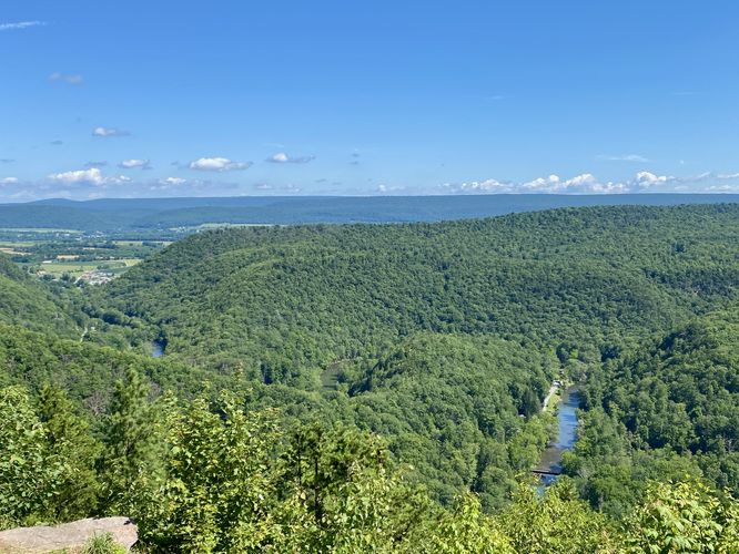
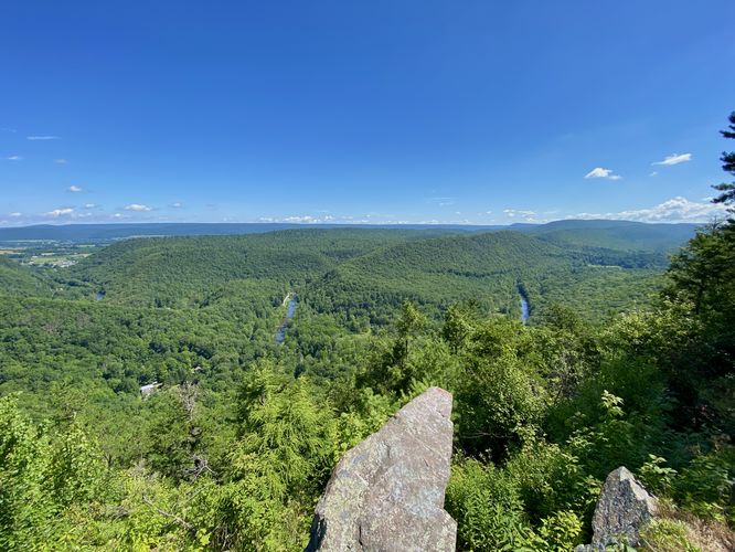
near Coburn, Pennsylvania is an easy 0.1-mile out-and-back vista walk that provides visitors one of the best roadside mountain views in Pennsylvania featuring Penns Creek, Rupp Mountain, and Elk Gap.
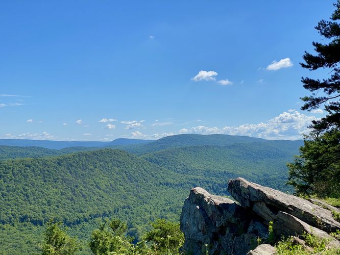
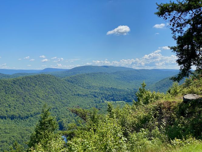
This is not a hike but rather a short roadside stop to scenic mountain views in the state forest. Very-little walking is required if you wish to enjoy this view from your vehicle. Within just a few steps from your car, you'll find Penns Creek cutting through the mountain valley below. Walking further east along the view are rock outcroppings and evergreen trees that add to the scenery. Facing northeast is Rupp Mountain and Elk Gap.
Universal Accessibility
The best views from this trail are outside of the parking area; however, you can still appreciate Penns View from your vehicle or from the dirt/gravel parking lot. Hence, Penns View is universally accessible, but the pathway that leads uphill toward the rock outcroppings is not accessible.
Exploring Nearby
Despite not being a hike, this is a great roadside view to stop at if you plan to explore the mountains within Bald Eagle State Forest near Poe Paddy State Park and Poe Valley State Park. Additionally, you shouldn't miss out on the cool old railroad tunnel, Poe Paddy Tunnel located just down the street.
Parking
Visitors will find a small parking turnout at the coordinates provided, located on Poe Paddy Drive within the forest. The road to reach Penns View is a dirt road with some skinny corners and rough spots.
Pets
Dogs are allowed only if leashed and must be cleaned up after.