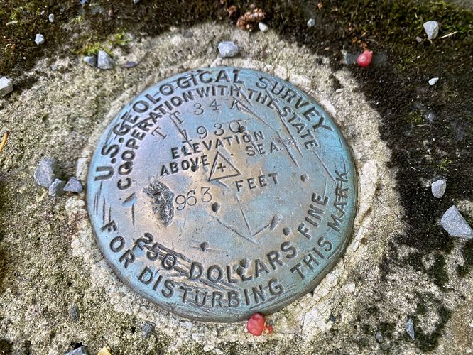
The Poe Paddy Tunnel Trail at Bald Eagle State Forest near Woodward, Pennsylvania is an easy 0.8-mile out-and-back hike that leads to views of Penn's Creek via an old railroad tunnel known as the Poe Paddy Tunnel.
Hike
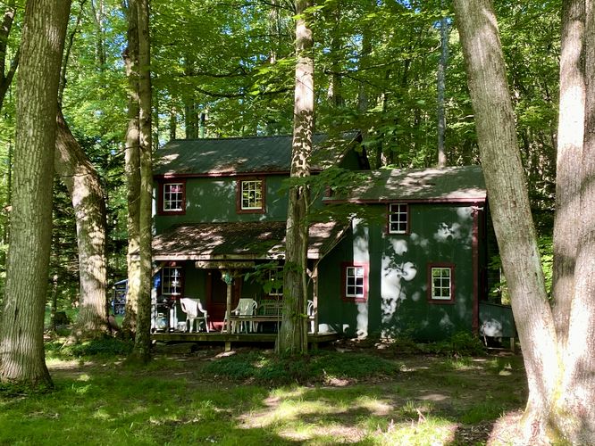
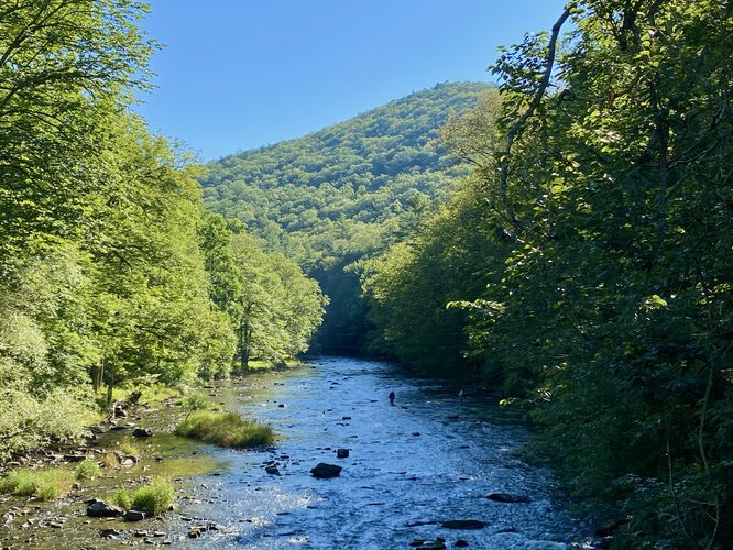
This hike begins along Spur Tunnel Road at the coordinates provided. Hikers will find a trailhead sign for the Poe Paddy Tunnel at the trailhead. The trail leads southward before it crosses Penn's Creek where hikers will enter the Penn's Creek Wild Area. Despite this section of the forest being a Wild Area, there are several state-leased camps (private cottages) that are located on the south side of Penn's Creek. As you cross the bridge (old railroad bridge), you'll find a nice view of Paddy Mountain to the east. On the south side of the bridge are the private camps that sit just before the Poe Paddy Tunnel - please be respectful of these privately-owned houses.
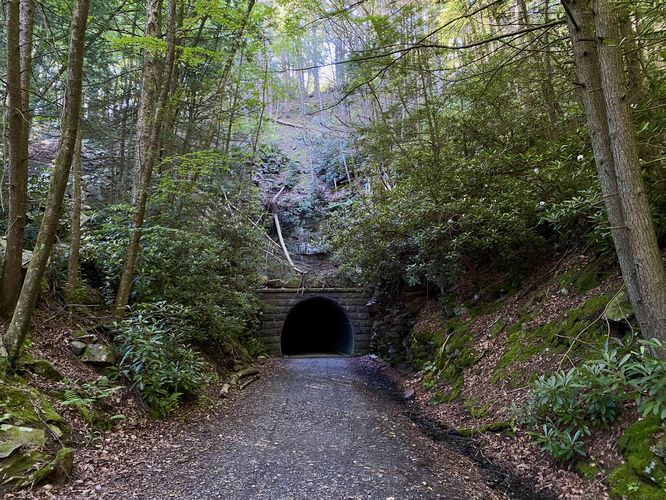
Poe Paddy Tunnel - Mile 0.2 to 0.25
Hikers will reach the Poe Paddy Tunnel around mile 0.2. This tunnel is pretty short, lasting just a few-hundred feet. While you walk the tunnel, you can listen to the reverberation of your footsteps on the trail as it bounces around the tunnel. You'll reach the opposite site of the Poe Paddy Tunnel around mile 0.25. Both sides of the tunnel are scenic, but the southern side has large rhododendron growing on the sides of the tunnel entrances and mountain slopes which provides additional scenery especially when in-bloom.
Hike to (Private) Trail's End Camp - Mile 0.38
After exploring the tunnel, hikers may want to check out the views from the banks of Penn's Creek. To do so, hop off of the rail trail and onto a dirt path located just south of the tunnel. This trail leads out to a private camp known as Trail's End Camp. Please be respectful and simply hike by if you decide to walk through.
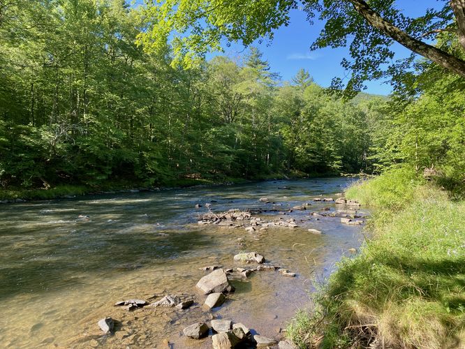
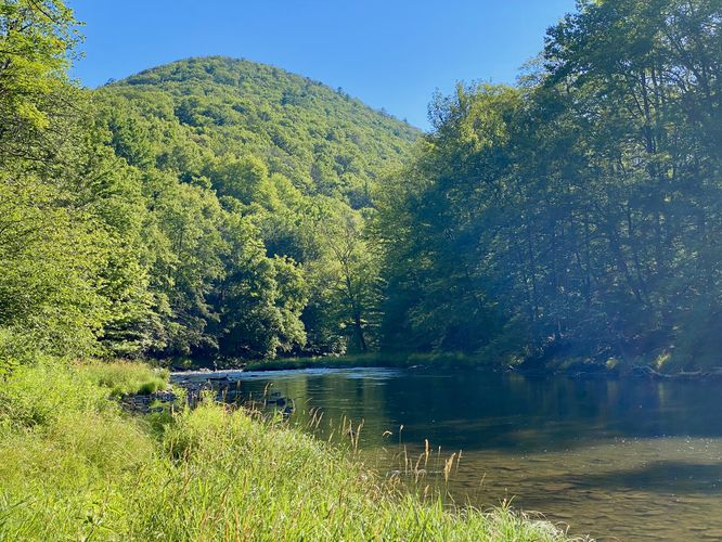
Penn's Creek - Mile 0.4
Just beyond Trail's End Camp is Penn's Creek. From its banks, you'll find views of the water and Poe Mountain sitting overhead to the northeast. This is where the hike ends and the walk back to parking begins (if following this route).
Hikers can choose to follow the main path further for a much-longer hike, though when we were exploring this area in early July 2024, we decided to check out other trails and POI in the area instead, hence the short hike back to parking for a 0.8-mile out-and-back hike.
Parking
Hikers will find parking turnouts near the coordinates provided. The turnouts are large enough to fit less than a dozen vehicles as of July 2024. Some folks park alongside the road, if you do so, please do not block any traffic. This area is also full of privately-owned camps so be respectful of the camp visitors and owners.
Pets
Dogs are allowed only if leashed and must be cleaned up after.
Hike
This hike begins along Spur Tunnel Road at the coordinates provided. Hikers will find a trailhead sign for the Poe Paddy Tunnel at the trailhead. The trail leads southward before it crosses Penn's Creek where hikers will enter the Penn's Creek Wild Area. Despite this section of the forest being a Wild Area, there are several state-leased camps (private cottages) that are located on the south side of Penn's Creek. As you cross the bridge (old railroad bridge), you'll find a nice view of Paddy Mountain to the east. On the south side of the bridge are the private camps that sit just before the Poe Paddy Tunnel - please be respectful of these privately-owned houses.
Poe Paddy Tunnel - Mile 0.2 to 0.25
Hikers will reach the Poe Paddy Tunnel around mile 0.2. This tunnel is pretty short, lasting just a few-hundred feet. While you walk the tunnel, you can listen to the reverberation of your footsteps on the trail as it bounces around the tunnel. You'll reach the opposite site of the Poe Paddy Tunnel around mile 0.25. Both sides of the tunnel are scenic, but the southern side has large rhododendron growing on the sides of the tunnel entrances and mountain slopes which provides additional scenery especially when in-bloom.
Hike to (Private) Trail's End Camp - Mile 0.38
After exploring the tunnel, hikers may want to check out the views from the banks of Penn's Creek. To do so, hop off of the rail trail and onto a dirt path located just south of the tunnel. This trail leads out to a private camp known as Trail's End Camp. Please be respectful and simply hike by if you decide to walk through.
Penn's Creek - Mile 0.4
Just beyond Trail's End Camp is Penn's Creek. From its banks, you'll find views of the water and Poe Mountain sitting overhead to the northeast. This is where the hike ends and the walk back to parking begins (if following this route).
Hikers can choose to follow the main path further for a much-longer hike, though when we were exploring this area in early July 2024, we decided to check out other trails and POI in the area instead, hence the short hike back to parking for a 0.8-mile out-and-back hike.
Parking
Hikers will find parking turnouts near the coordinates provided. The turnouts are large enough to fit less than a dozen vehicles as of July 2024. Some folks park alongside the road, if you do so, please do not block any traffic. This area is also full of privately-owned camps so be respectful of the camp visitors and owners.
Pets
Dogs are allowed only if leashed and must be cleaned up after.