Loading...

Distance:
0.1 Miles / 0.2 km
Type:
Out-and-Back
Difficulty:
Easy
Time to Hike:
~5 minutes
Features:
Surface Type:
Dirt
Park:
Capitol Reef National Park
Town:
Torrey, Utah
Directions:
38.30722, -111.295825
Added:
September 26, 2023
Updated:
October 04, 2023
Loading...
Loading...
13 '

Total Change
13 '

Ascent
13 '

Descent

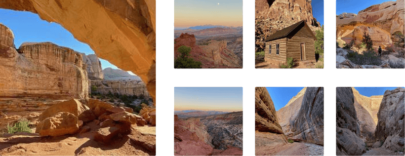
Panorama Point Overlook at Capitol Reef National Park near Torrey, Utah is an easy 0.1-mile out-and-back trail that leads to a 360-degree view of the western part of the park which also includes views of Chimney Rock and The Castle.

Trail Description
This is not a hike but rather a short walk that leads up a gradual hill to reach the panoramic view of Capitol Reef National Park. The trail follows a dirt path where at the top of the hill, visitors and hikers have a chance to explore a bit further atop the rock outcropping if they wish; however, the official trail ends within about 0.1-miles from the trailhead. From the top of the rock outcropping, hikers will get views of The Castle, which is located to the East and views of Chimney Rock which is can be found to the West toward Torrey, Utah.

Parking
Hikers will find a large parking at the coordinates provided.

Pets
Dogs are not allowed on this trail.

Explore 20 trails near Torrey, UT
  1. Parking

    38.30722, -111.295825
  2. Main Trailhead

    38.307116, -111.295838
  3. View of The Castle from Panorama Point Overlook (Capitol Reef NP)

    38.306236, -111.296006
    View of The Castle from Panorama Point Overlook (Capitol Reef NP)
No community routes found. To add your own hike as a Community Route for this Trail guide, leave a Trip Report with an attached GPX file.

Hazards

Snakes

Seasons

All

Photo Albums

2 Trip Reports

No Star-Ratings
Write-up by:
Admin user profile picture
0.1 miles / 0.2 km
Trail added
September 26, 2023
Hiked on
September 26, 2023
Updated on
October 04, 2023
0.1 miles / 0.2 km
September 26, 2023
Hiking

Weather Forecast

In Torrey, UT

Explore Hiking Trails

New Hikes

Mt. Morris Dam Overlook
3.3 Miles
5.3 km
Easy
Out-and-Back
Cold Run Waterfalls & Vista Loop
3.1 Miles
5 km
Moderate
Loop
Weston Lake Loop
3.2 Miles
5.1 km
Easy
Loop
Larry's Creek Trail
3.6 Miles
5.8 km
Moderate
Out-and-Back

Before you leave...

MyHikes is an indie web platform aimed to make exploring public trails easier for everyone. The site has no investors and is owned and operated by one person, Dave Miller (Founder & Admin). As the Founder, main contributor, and doer-of-all-things for MyHikes, I share my trips with over-detailed write-ups for fun on a volunteer basis and I believe that public trail information should be available to everyone.

It takes a lot of time 🕦, money 💰, and effort (including espresso shots ☕) to run MyHikes, including hiking , mapping , writing , and publishing new trails with high-quality content... along with building new features, moderating, site maintainance, and app development for iOS and Android . I simply ask that if you find MyHikes' trail guides helpful to please consider becoming a Supporter to help keep the site, iOS, and Android apps available to everyone.

Supporters unlock website and in-app perks with a one-time payment of $25 (you renew) 😎👍. Or you can simply make a Donation of your choice without a MyHikes user account. Otherwise, telling your friends about MyHikes is the next-best thing - both quick and free 🎉

Thanks for visiting MyHikes and have a great hike!️

Admin user profile picture

Dave Miller
MyHikes Founder & Admin