The Old Flat Top Falls winter hike next to Tioga State Forest in Wellsboro, Pennsylvania is an easy 1.2-mile out-and-back walk that follows a public dirt road to three waterfalls, including a 15-foot tall waterfall named Old Flat Top Falls.
Winter Hike
This is mostly a winter hike since Campbell Run Road is not maintained during the winter. The road is generally clear to drive between mid-April through mid-November, weather depending.
Hike Description
The hike begins just north of the junction of Campbell Run Road and Tiadaghton Road in Wellsboro, PA and follows Campbell Run Road heading south. Along the road, hikers will find several 5-foot tall waterfalls that cascade down Campbell Run creek; however, there are "no trespassing" signs all along this road, including along the land that slopes down to the creek. Some waterfalls that lie within the creek were not worth photographing, but there's at least one, if not two other, waterfalls that hikers can see from the road when no leaves are on the trees.
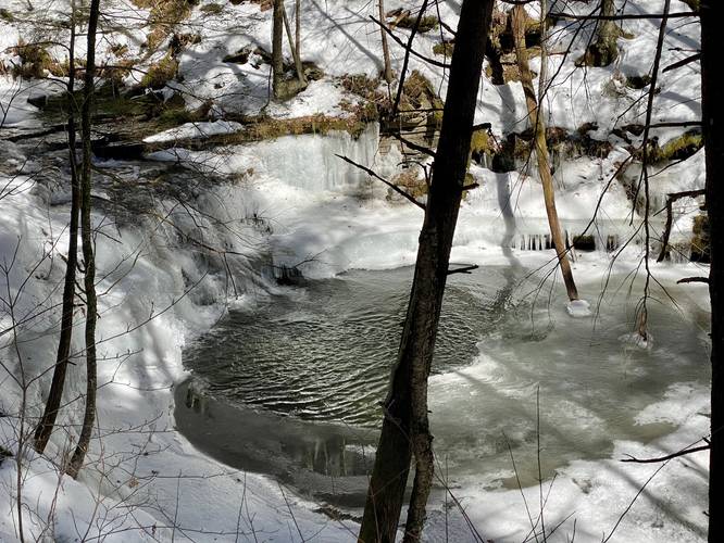
Around mile 0.4, hikers will reach a large culvert that passes underneath the road, where Campbell Run continues heading south. Here, hikers will find 2 waterfalls within sight - the ~8-foot waterfall cascading down, which sits no more than 20-feet from the road, and the other 5-foot tall waterfall that cascades down the creek, located about 100-feet upstream.
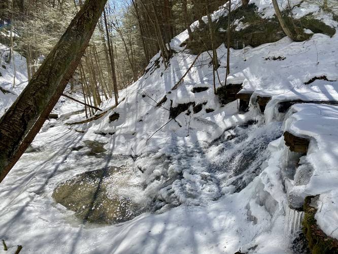
After checking out these two waterfalls, hikers will want to see Old Flat Top Falls before heading back. To reach Old Flat Top Falls, hikers will want to walk beyond the culvert (where Campbell Run creek passes under the road) no more than 100-feet. If hikers look to their right-hand side, they'll notice the top of Old Flat Top Falls as it sends water down Campbell Run. Here, hikers can enjoy the waterfall from the road or take a quick detour to check it out. The walk down to the top of Old Flat Top Falls is a very short 100-foot walk. Be careful as the slopes alongside the waterfall are very steep.
Old Flat Top Falls
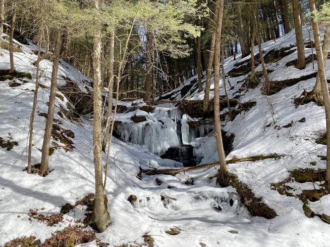
This waterfall is about 15-feet tall and approximately 15-feet wide or slightly less. The waterfall has extremely steep slopes that run all the way to the creek and the base, so it can be dangerous to approach it from above. Alternatively, hikers might be able to hike up Campbell Run from the Pine Creek Trail to reach this waterfall as well, which would bring you to the base of it instead.
Private Property Warning
Please note that this trail follows a public road, but there are private property signs on both sides of the road heading down to where Campbell Run crosses the road. As hikers approach Old Flat Top Falls, the "no trespassing" signs disappear; however, that does not mean hikers are permitted on this property. Hikers can technically see all waterfalls from the road. Hike at your own risk and please respect the land owners.
Parking
The parking location listed here is a small parking turnout located along Tiadaghton Road in Wellsboro, PA. It's large enough to fit about 3 vehicles max.
Pets
Dogs are allowed if leashed.
Winter Hike
This is mostly a winter hike since Campbell Run Road is not maintained during the winter. The road is generally clear to drive between mid-April through mid-November, weather depending.
Hike Description
The hike begins just north of the junction of Campbell Run Road and Tiadaghton Road in Wellsboro, PA and follows Campbell Run Road heading south. Along the road, hikers will find several 5-foot tall waterfalls that cascade down Campbell Run creek; however, there are "no trespassing" signs all along this road, including along the land that slopes down to the creek. Some waterfalls that lie within the creek were not worth photographing, but there's at least one, if not two other, waterfalls that hikers can see from the road when no leaves are on the trees.
Around mile 0.4, hikers will reach a large culvert that passes underneath the road, where Campbell Run continues heading south. Here, hikers will find 2 waterfalls within sight - the ~8-foot waterfall cascading down, which sits no more than 20-feet from the road, and the other 5-foot tall waterfall that cascades down the creek, located about 100-feet upstream.
After checking out these two waterfalls, hikers will want to see Old Flat Top Falls before heading back. To reach Old Flat Top Falls, hikers will want to walk beyond the culvert (where Campbell Run creek passes under the road) no more than 100-feet. If hikers look to their right-hand side, they'll notice the top of Old Flat Top Falls as it sends water down Campbell Run. Here, hikers can enjoy the waterfall from the road or take a quick detour to check it out. The walk down to the top of Old Flat Top Falls is a very short 100-foot walk. Be careful as the slopes alongside the waterfall are very steep.
Old Flat Top Falls
This waterfall is about 15-feet tall and approximately 15-feet wide or slightly less. The waterfall has extremely steep slopes that run all the way to the creek and the base, so it can be dangerous to approach it from above. Alternatively, hikers might be able to hike up Campbell Run from the Pine Creek Trail to reach this waterfall as well, which would bring you to the base of it instead.
Private Property Warning
Please note that this trail follows a public road, but there are private property signs on both sides of the road heading down to where Campbell Run crosses the road. As hikers approach Old Flat Top Falls, the "no trespassing" signs disappear; however, that does not mean hikers are permitted on this property. Hikers can technically see all waterfalls from the road. Hike at your own risk and please respect the land owners.
Parking
The parking location listed here is a small parking turnout located along Tiadaghton Road in Wellsboro, PA. It's large enough to fit about 3 vehicles max.
Pets
Dogs are allowed if leashed.