The Ohai Trail is located along Kahekili Highway, Maui and is an easy 1.3 mile loop hike that features stunning views of two seaside mountain cinder cones known as Kahakuloa Head (Pu'u Koa'e and Pu'ukahuli'anapa).
Hike Description
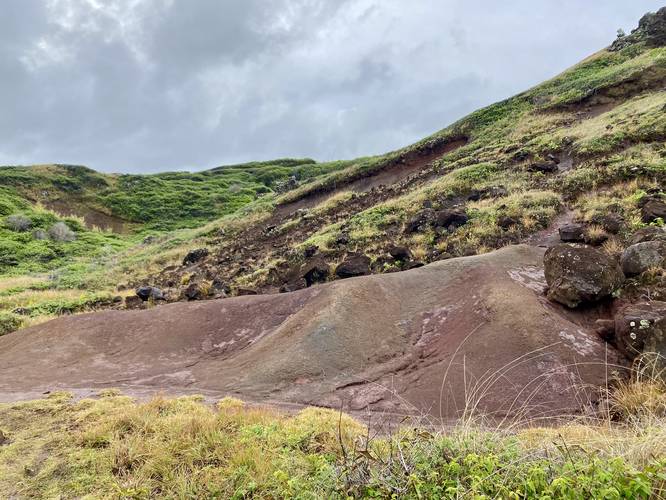
This trail begins at the main entrance that leads in two directions - first to a lookout point that features views of Maui's northern coastline, including the Nakalele Blowhole, before turning immediately back to head toward the main loop. Once at the loop, this track follows it in a clockwise circle, but you can hike it however you wish - each way is a similar difficulty. Since this part of the island is generally rainy and wet, the trail too can be muddy, slippery, and slick at times.
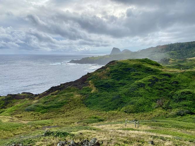
As you hike east, you'll get views of Kahakuloa Head along with turquoise-colored sea waves crashing ashore below your feet. The trail winds around a low-growing shrubland that grows in a windswept pattern, caused by the Krumholtz Effect.
Throughout the hike you get views of Kahakuloa Head (Pu'u Koa'e and Pu'ukahuli'anapa), wildflowers - like Lantana (a non-native species), and Maui's northern cliffs. The loop portion is technically 1.2 miles, but there's an additional spur trail located to the left of the loop trail with views looking west.
Prohibited
Biking, horses, and motor vehicles are not allowed.
Pets
Leashed dogs are allowed as long as their waste is carried out.
Parking Hikers will find a medium-sized parking lot at the coordinates provided. As of February 2023, the lot is large enough to fit less than 12 vehicles.
Warning
Steep cliffs: This hike passes several steep sea-side cliffs where, if the hiker were to fall, there is likely no return. Watch your step and stay back from the large ledges.
Slippery Mud: This trail exists within a very wet part of Maui and thus the trail may be muddy most of the time.
Respecting the Land
Hawaiian land is considered sacred to native Hawaiians and many locals, so please stay on-trail, take nothing but photos, and leave nothing but footprints. Respect the locals - don't stay for long and have a backup hike planned in case the parking lot is full.
Hike Description
This trail begins at the main entrance that leads in two directions - first to a lookout point that features views of Maui's northern coastline, including the Nakalele Blowhole, before turning immediately back to head toward the main loop. Once at the loop, this track follows it in a clockwise circle, but you can hike it however you wish - each way is a similar difficulty. Since this part of the island is generally rainy and wet, the trail too can be muddy, slippery, and slick at times.
As you hike east, you'll get views of Kahakuloa Head along with turquoise-colored sea waves crashing ashore below your feet. The trail winds around a low-growing shrubland that grows in a windswept pattern, caused by the Krumholtz Effect.
Throughout the hike you get views of Kahakuloa Head (Pu'u Koa'e and Pu'ukahuli'anapa), wildflowers - like Lantana (a non-native species), and Maui's northern cliffs. The loop portion is technically 1.2 miles, but there's an additional spur trail located to the left of the loop trail with views looking west.
Prohibited
Biking, horses, and motor vehicles are not allowed.
Pets
Leashed dogs are allowed as long as their waste is carried out.
Parking Hikers will find a medium-sized parking lot at the coordinates provided. As of February 2023, the lot is large enough to fit less than 12 vehicles.
Warning
Steep cliffs: This hike passes several steep sea-side cliffs where, if the hiker were to fall, there is likely no return. Watch your step and stay back from the large ledges.
Slippery Mud: This trail exists within a very wet part of Maui and thus the trail may be muddy most of the time.
Respecting the Land
Hawaiian land is considered sacred to native Hawaiians and many locals, so please stay on-trail, take nothing but photos, and leave nothing but footprints. Respect the locals - don't stay for long and have a backup hike planned in case the parking lot is full.