The Nakalele Blowhole Trail near Kahakuloa, Hawaii (Maui) is a moderate 0.5 mile out-and-back hike that leads to a lava rock formation nicknamed the "Blowhole".
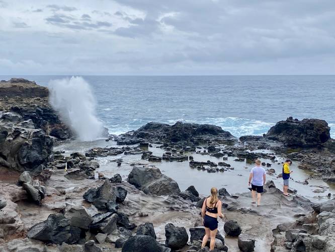
The Nakalele Blowhole is a geyser where seawater gets trapped in an underwater lava tube and shoots straight upward 100 feet into the air. For the best views, plan to hike about 0.25-miles down and back along a rocky and often slippery and muddy trail. For folks who wish to enjoy the blowhole from afar, you can watch it from the top of the hill without having to hike down.
Popularity
This is an extremely popular trail on Maui and most people end up hiking down and back in sandals and flip-flops; however, it's not easy hiking due to the terrain, so if you don't have hiking boots use sneakers.
Parking
Hikers will find a large parking lot at the coordinates provided. As of February 2023, it's large enough to fit a couple dozen vehicles.
Warning
Rocky, slippery terrain: This trail follows a very rocky, bouldery, and often slippery/muddy trail. Watch your step.
Sneaker waves: Despite wanting to enjoy the blowhole up-close, it's best to stay on the 2nd cliff above the blowhole, as a very large sneaker-wave could crash ashore, injuring or killing someone on the lower cliff below.
Respecting the Land
Hawaiian land is considered sacred to native Hawaiians and many locals, so please stay on-trail, take nothing but photos, and leave nothing but footprints. Respect the locals - don't stay for long and have a backup hike planned in case the parking lot is full.