The Oak Ridge Trail at Tioga State Forest in Wellsboro, Pennsylvania is an easy 4-mile out-and-back trail that runs the ridge of Oak Point Mountain and features a beautiful overlook of the Wellsboro area, but also features fracking well sites.
Hike Description
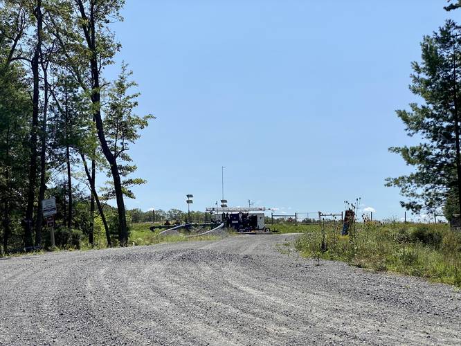
This trail begins along Matson Rd - a service road that leads into the state forest that's mostly used for logging and fracking trucks as of September 2021. The trail itself is literally a road, wide enough for two large trucks to pass each other, so while this hike is entirely in the woods and secluded, you may pass some service trucks along the way. The trail is open to the sun with very little shaded areas, so hiking this in the mid-day sun may not be the best choice depending on the time of year.
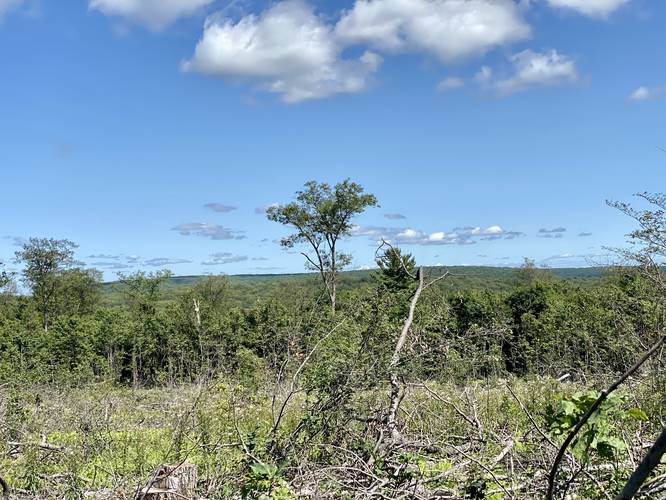
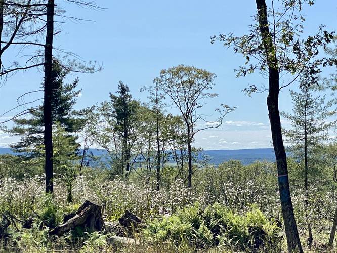
The trail itself is mostly flat and runs west to east along the Oak Point Mountain ridge as it passes a clear cutting (as of September 2021) near the trailhead and another clear cutting about half-way through the hike - both clear cut areas have interesting view opportunities. Wildflowers can be found growing alongside the trail as well.
Fracking Sites
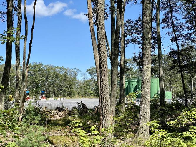
This trail has a couple of fracking sites located just a stones-throw away. One of which was extremely noisy and sounded like several large trucks idling from about 0.25 miles away. One fracking site has large green storage tanks - this is the last fracking site and can be found just before the trail leads down to the overlook. It's advised not to smoke near these fracking wells for obvious reasons - as highlighted by some signage like "high pressure gas"... a chilling reminder that sometimes these things just randomly (albeit very rarely) explode - something to keep in the back of your mind as you hike this trail.
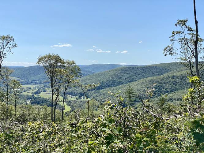
Wellsboro Overlook - Mile 2
Around mile 2, hikers will finally reach the sweeping overlook of the Wellsboro, PA area after hiking down a modest-grade hill just beyond the last fracking site. The overlook has views in the westerly, southern, and easterly directions - giving the hiker amazing views towards Gaines, Morris, and Mansfield, PA - all with beautiful rolling mountain ranges in the distance.
Hiking out is simple - take the trail back to parking and watch for large trucks along the way.
Pets
Dogs are allowed if leashed and their waste should be carried out by the hiker.
Parking
There's a small parking turnout near the coordinates provided. There's not much room to park, so pull over enough to allow the large trucks to pass.
Biking
Biking is permitted along this trail.
Warnings
Lack of shade: This trail does not have much shade along it, making the 4-mile out-and-back trek a bit of a scorcher depending on the time of year.
Rattlesnakes: This area is known for the Timber Rattlesnake and while rare, hikers may encounter them between the months of late April to early October.
Hike Description
This trail begins along Matson Rd - a service road that leads into the state forest that's mostly used for logging and fracking trucks as of September 2021. The trail itself is literally a road, wide enough for two large trucks to pass each other, so while this hike is entirely in the woods and secluded, you may pass some service trucks along the way. The trail is open to the sun with very little shaded areas, so hiking this in the mid-day sun may not be the best choice depending on the time of year.
The trail itself is mostly flat and runs west to east along the Oak Point Mountain ridge as it passes a clear cutting (as of September 2021) near the trailhead and another clear cutting about half-way through the hike - both clear cut areas have interesting view opportunities. Wildflowers can be found growing alongside the trail as well.
Fracking Sites
This trail has a couple of fracking sites located just a stones-throw away. One of which was extremely noisy and sounded like several large trucks idling from about 0.25 miles away. One fracking site has large green storage tanks - this is the last fracking site and can be found just before the trail leads down to the overlook. It's advised not to smoke near these fracking wells for obvious reasons - as highlighted by some signage like "high pressure gas"... a chilling reminder that sometimes these things just randomly (albeit very rarely) explode - something to keep in the back of your mind as you hike this trail.
Wellsboro Overlook - Mile 2
Around mile 2, hikers will finally reach the sweeping overlook of the Wellsboro, PA area after hiking down a modest-grade hill just beyond the last fracking site. The overlook has views in the westerly, southern, and easterly directions - giving the hiker amazing views towards Gaines, Morris, and Mansfield, PA - all with beautiful rolling mountain ranges in the distance.
Hiking out is simple - take the trail back to parking and watch for large trucks along the way.
Pets
Dogs are allowed if leashed and their waste should be carried out by the hiker.
Parking
There's a small parking turnout near the coordinates provided. There's not much room to park, so pull over enough to allow the large trucks to pass.
Biking
Biking is permitted along this trail.
Warnings
Lack of shade: This trail does not have much shade along it, making the 4-mile out-and-back trek a bit of a scorcher depending on the time of year.
Rattlesnakes: This area is known for the Timber Rattlesnake and while rare, hikers may encounter them between the months of late April to early October.