Loading...

Distance:
0.4 Miles / 0.6 km
Type:
One-Way
Difficulty:
Easy
Time to Hike:
~12 minutes
Features:
Surface Type:
Dirt
Park:
Muir Woods National Monument
Town:
Mill Valley, California
Directions:
37.891983, -122.570406
Added:
May 17, 2018
Updated:
June 12, 2018
Loading...
Loading...
68 '

Total Change
73 '

Ascent
131 '

Descent

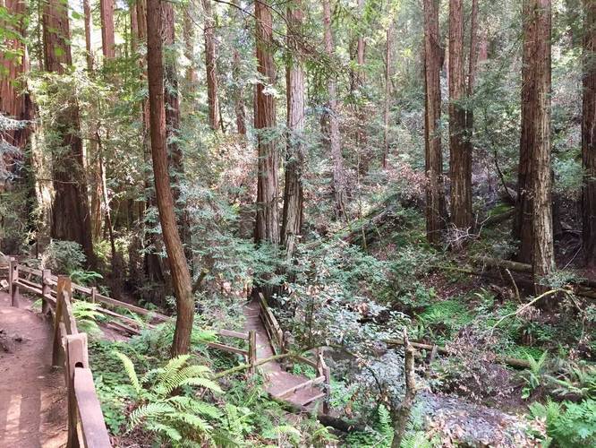
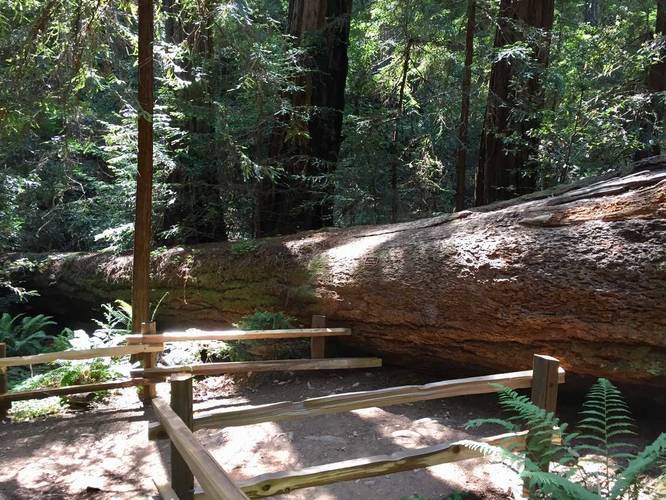
The Fern Creek Trail at Muir Woods National Monument in Mill Valley, California is an easy 0.4 mile one-way trail that leads from the Lost Trail to the Redwood Creek Trail. Please note that this trail is technically longer than 0.4 miles one-way, but as of mid-May 2018, the bridge that crosses Fern Creek has been destroyed by a fallen tree and you cannot go any further than the trail junction with the Lost Trail.

This trail passes yet more ancient coastal redwoods as it winds along Fern Creek. This trail is lightly-trafficked and usually very quiet. You can use this trail to hop on the Lost Trail which meets up with the Canopy View Trail.

Fee: There's a $10 fee to enter Muir Woods for adults. For more information, check out their website.

Explore 28 trails near Mill Valley, CA
  1. Parking

    37.891983, -122.570406
  2. Main Trailhead

    37.906052, -122.579158
  3. Point-of-Interest

    37.905986, -122.579194
    Point-of-Interest
  4. Kent Tree

    37.901467, -122.5782
    Kent Tree
No community routes found. To add your own hike as a Community Route for this Trail guide, leave a Trip Report with an attached GPX file.

Hazards

Ticks - Lyme Disease More Info (CDC)

Seasons

All

Photo Albums

1 Trip Report

No Star-Ratings
Trail Guide By:
Admin user profile picture
0.4 miles / 0.6 km
Trail added
May 17, 2018
Hiked on
May 17, 2018
Updated on
June 12, 2018

Weather Forecast

In Mill Valley, CA

Explore Hiking Trails

New Hikes

Hidden Valley Nature Trail
0.7 Miles
1.1 km
Easy
Loop
Lower Stony Brook Falls
0.2 Miles
0.3 km
Easy
Out-and-Back
Sheep Lakes Lookout
0.1 Miles
0.2 km
Easy
Out-and-Back
Albert Birch Ruins and Cabin Trail
0.4 Miles
0.6 km
Easy
Loop

Before you boogie...

Find our trail guides useful? Consider becoming a Supporter to unlock perks!

MyHikes is an indie platform that makes exploring public trails easier for everyone. The platform has no investors, runs no ads, and is owned and operated by one person, Dave Miller. Dave has personally mapped and written over 1,600 trail guides on MyHikes for the public to explore. As of 2024, MyHikes has helped over 1,300,000 outdoor enthusiasts plan their next adventure.

But it takes a lot of time 🕦, money 💰, and work, and espresso shots ☕ to run MyHikes, including hiking , mapping , writing , and publishing new trails with high-quality (accurate) information... along with software engineering (coding) the platform like building new features, site and mobile app development for iOS and Android, site maintainance . and much much more.

Supporters unlock website and mobile app perks with an annual one-time payment of $25 (you renew) 😎👍. Or you can simply make a Donation of your choice. Otherwise, you can support us by telling your friends about MyHikes - both quick and free 🎉

Admin user profile picture

Dave Miller
MyHikes Founder