The Canopy View Trail at Muir Woods National Monument in Mill Valley, California is a difficult 1.6 mile one-way trail that leads from the Redwood Creek Trail all the way up to Panoramic Highway and some other trails that lead to Mount Tamalpais State Park.
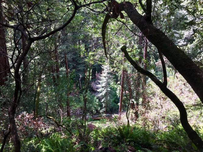
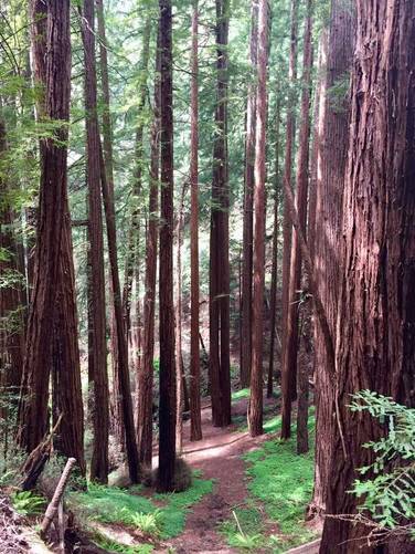
Just as the trail name says, this trail leads up and out of Muir Woods to view the canopy of the ancient coastal redwoods, but this comes at a price of hiking uphill the entire way. The trail starts off on steps which then leads quickly to a gravel trail with plenty of roots along the way. The trail ascends the hills of Muir Woods so you can see the Redwood Creek Trail below as you continue hiking upward.
The trail sits along a steep ridge with no fence along it, so watch your footing and be courteous of the passing by hikers. Along the way you'll also pass the David Sarlin Grove, which sits below the ridge aside the trail with two creeks that pass along the sides of the grove to provide a lush undergrowth for the forest.
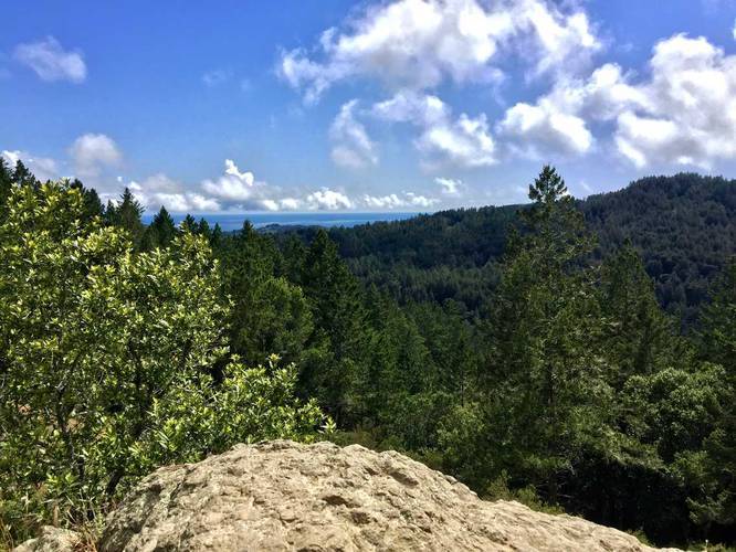
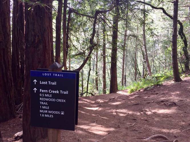
Eventually, after about 1.3 miles, you'll reach the Lost Trail on your left - you can take this trail to loop back to the Redwood Creek Trail later. Continue on from the Lost Trail and you'll end up hiking out of the woods and into the sun where you'll get an amazing lookout point high above the redwoods just below the next trail junction and where this recording ends.
Hike back downhill for about 0.4 miles or so to reach the Lost Trail again to head back to the Redwood Creek Trail.
Fee: There's a $10 fee to enter Muir Woods for adults. For more information, check out their website.
Just as the trail name says, this trail leads up and out of Muir Woods to view the canopy of the ancient coastal redwoods, but this comes at a price of hiking uphill the entire way. The trail starts off on steps which then leads quickly to a gravel trail with plenty of roots along the way. The trail ascends the hills of Muir Woods so you can see the Redwood Creek Trail below as you continue hiking upward.
The trail sits along a steep ridge with no fence along it, so watch your footing and be courteous of the passing by hikers. Along the way you'll also pass the David Sarlin Grove, which sits below the ridge aside the trail with two creeks that pass along the sides of the grove to provide a lush undergrowth for the forest.
Eventually, after about 1.3 miles, you'll reach the Lost Trail on your left - you can take this trail to loop back to the Redwood Creek Trail later. Continue on from the Lost Trail and you'll end up hiking out of the woods and into the sun where you'll get an amazing lookout point high above the redwoods just below the next trail junction and where this recording ends.
Hike back downhill for about 0.4 miles or so to reach the Lost Trail again to head back to the Redwood Creek Trail.
Fee: There's a $10 fee to enter Muir Woods for adults. For more information, check out their website.