The Redwood Creek Trail at Muir Woods National Monument in Mill Valley, California is an easy 1.2 mile one-way hike that leads through the old growth forest of Muir Woods and to more trails.
This trail is by far the most popular hike at Muir Woods, but people tend to trickle off around Bridge 3 (about 0.8 miles into the hike), which makes a loop back to the visitor's center. The trail is paved all the way until the end (where the Hillside Trail begins) and it's wheelchair accessible.
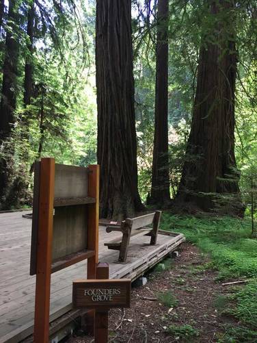
Along the way you'll see the Pinchot tree, which can be found across from the gift shop, and appears to be the widest redwood along this trail. Further up the trail is the Founder's Grove, which boasts an impressive count of redwoods clustered in a fairly large group.
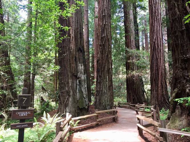
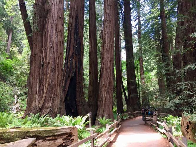
Shortly after hitting the Founder's Grove, you'll end up in the Cathedral Grove which is yet again full of more ancient redwoods. The trail at the Cathedral Grove technically splits, but this trail data does not include the loop portion of where that splits - continue on either side of the split to follow the trail north.
At the end of this trail, you can take the Hillside Trail back towards the gift shop, which will end at Bridge 2, just north of the gift shop and the Pinchot redwood. You can also hop on the Canopy View Trail (aka Ocean View Trail) and the Fern Creek Trail from this one.
Important: You must stay on the designated trails while visiting Muir Woods since the redwood's roots are shallow and wide - this helps prevent any damage to the trees.
Fee: There's a $10 fee to enter Muir Woods for adults. For more information, check out their website.
This trail is by far the most popular hike at Muir Woods, but people tend to trickle off around Bridge 3 (about 0.8 miles into the hike), which makes a loop back to the visitor's center. The trail is paved all the way until the end (where the Hillside Trail begins) and it's wheelchair accessible.
Along the way you'll see the Pinchot tree, which can be found across from the gift shop, and appears to be the widest redwood along this trail. Further up the trail is the Founder's Grove, which boasts an impressive count of redwoods clustered in a fairly large group.
Shortly after hitting the Founder's Grove, you'll end up in the Cathedral Grove which is yet again full of more ancient redwoods. The trail at the Cathedral Grove technically splits, but this trail data does not include the loop portion of where that splits - continue on either side of the split to follow the trail north.
At the end of this trail, you can take the Hillside Trail back towards the gift shop, which will end at Bridge 2, just north of the gift shop and the Pinchot redwood. You can also hop on the Canopy View Trail (aka Ocean View Trail) and the Fern Creek Trail from this one.
Important: You must stay on the designated trails while visiting Muir Woods since the redwood's roots are shallow and wide - this helps prevent any damage to the trees.
Fee: There's a $10 fee to enter Muir Woods for adults. For more information, check out their website.