The Mt. Nessmuk Loop at Tioga State Forest near Wellsboro, Pennsylvania is a difficult 6.3-mile loop hike that features a mountain summit, some off-trail waterfalls, and seasonal obstructed views of the neighboring mountains.
Trails
This hike follows several named trails and forest roads in the following order: Deer Trail (yellow blazes), Stone Trail (yellow blazes), Bee Trail (red blazes), Canada Run Road, Broken Axe Trail (red blazes), Stone Trail (yellow blazes), Jim Close Trail (yellow blazes), and finally Straight Run Road.
Hike Description
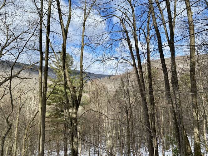
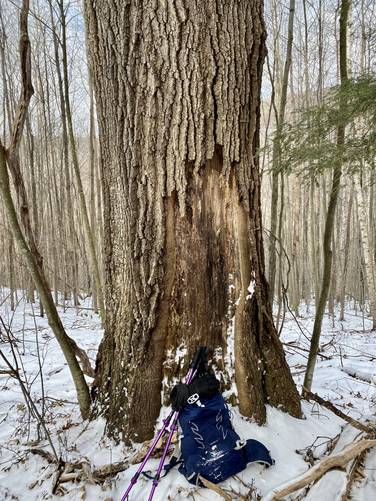
This hike begins at the Deer Trail and immediately heads up the mountain at a moderate grade, first passing through a hemlock grove and then a young forest - as of March 2023. Not long into the hike up Mount Nessmuk, the trail will intersect with what looks like a service path or ATV trail, which connects to the yellow gate along Straight Run Rd - hike through this junction to follow the old yellow blazes of the Deer Trail. Along the hike up, the trail's substrate include several large rocks in the trail that act like steps. Off-trail, hikers can find some interesting large shale (or slate) boulders. During the cold months, there a decent (but obstructed) view of Broad Ridge across the way. Around mile 0.5, hikers can find an old-growth tree; however, I'm unsure of the species.
Steep Grade - Mile 0.76 to 1.24
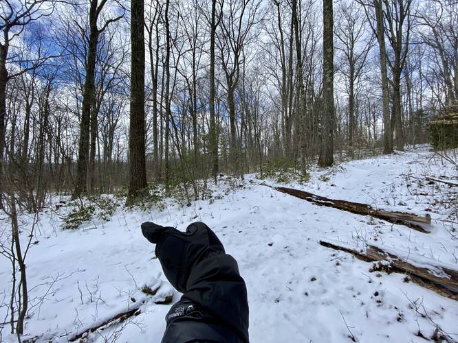
From miles 0.76 to 1.24, the Deer Trail ascends Mount Nessmuk at the steepest grade throughout the entire hike. Take it slow as the trail meanders its way through a forest of hemlock and mountain laurel.
Stone Trail, Left-Turn - Mile 1.24
At mile 1.24, just after the climb up to the top of Mt. Nessmuk, hikers will reach the Stone Trail, which is the popular Mt. Nessmuk hike. Take a left-hand turn here and be on the lookout for a right-hand turn shortly after.
Bee Trail, Right-Turn - Mile 1.3
At mile 1.3, hikers will find the Bee Trail with its trail sign and red blazes. Take the right-hand turn here to follow this trail as it heads east and eventually down the slopes of Mt. Nessmuk. Along the way, you might find a lot of stagnant water in the trail. At mile 1.4, hikers will reach a junction with the Horse Lane Trail (red blazes), just stay left/straight here to stay on the Bee Trail. Not long after passing the Horse Lane Trail, the Bee Trail heads into overgrown mountain laurel and blueberry bushes - which is great for black bears - but makes for interesting hiking. During the Winter, it seems this part of the mountain keeps most of the snow, so while the western slopes had about 2 inches of snow, at most, the eastern slopes along the Bee Trail here had about 5-8 inches despite the lack of snowfall in Jan - March 2023. The Bee Trail will eventually hit several switchbacks as it heads down the mountain.
Canada Run Road - Mile 1.95
Around mile 1.95, hikers will reach Canada Run Road - take a left-hand turn here to hike back up Mt. Nessmuk along this forest road. The hike up along the road is quiet and mostly moderate hiking.
Broken Axe Trail - Mile 2.65
At mile 2.65, hikers will find a red blaze on a tree with a trailhead sign located ~50 feet from the road - take a left-hand turn here to hike back up to the top of Mount Nessmuk along the Broken Axe Trail. This trail has a short ascent before it mostly levels out to reach the flat-top of Mt. Nessmuk's ridge.
Stone Trail, Right-Turn - Mile 2.95
At mile 2.95, hikers will reach the Stone Trail once again. Take a right-hand turn here to head toward the Jim Close Trail. Along the way, you'll pass a pipeline vista around mile 3.1.
Jim Close Trail - Mile 3.2
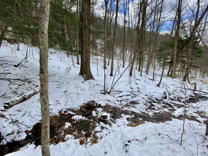
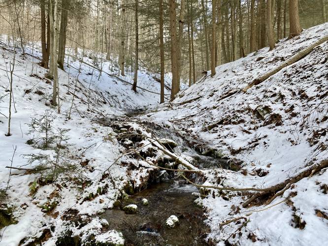
Around mile 3.2, hikers will reach the left-hand turn for the Jim Close Trail which heads back down the western slopes, through a mountain hollow, of Mt. Nessmuk. This trail is a bit odd as it does not immediately head straight down the mountain hollow, but rather follows the curve in a nearby road. The trail then juts outward to form a triangle-like shape, with a sharp left-hand turn that's easy to miss. Once you take the left-hand turn along this sharp curve, the trail finally heads into the mountain hollow and down along a, likely, seasonal creek. There are a couple of small and easy creek crossings along the way. Near the bottom of the trail, located around mile 4.3 is a 3-foot tall waterfall which is a nice place to take a break. Once you hike off of the Jim Close Trail, you'll be hiking down Straight Run Road, which doesn't have much to look at unless you're willing to explore off-trail to see some small waterfalls; however, most hikers won't care to check these out.
Straight Run Waterfalls - Mile 4.37 to Mile 5.6
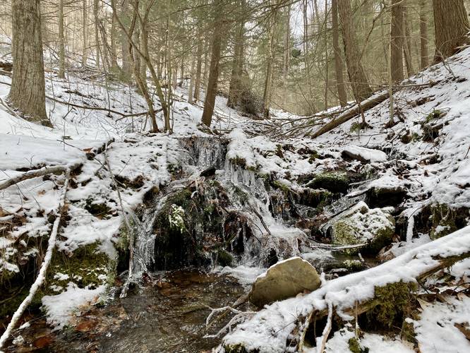
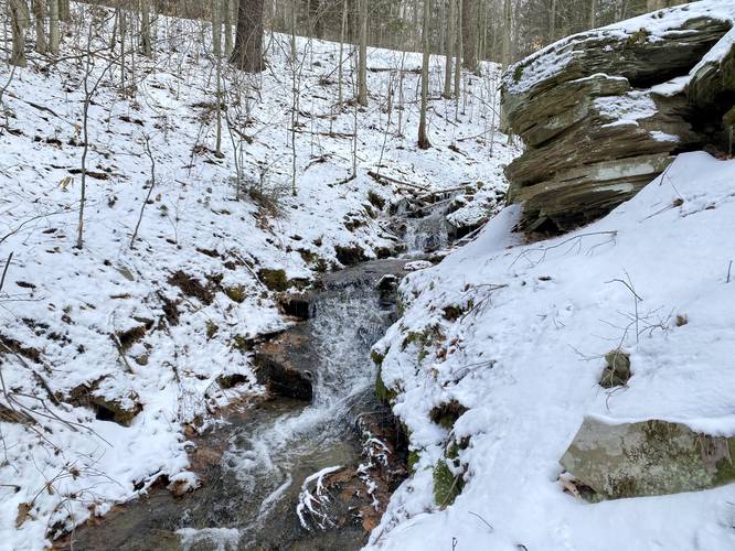
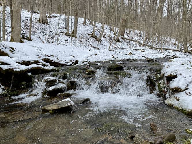
There are several off-trail waterfalls, albeit very short, along Straight Run Road. The first few are located near the Jim Close Trail's western trailhead. The most scenic of them all is located just downstream from that trailhead. At mile 4.37, behind a large rocky outcropping sit two 3-foot tall waterfalls that spill down the rocks. Not much further downstream, located at mile 4.47 is another 3-foot cascade. Both waterfalls are bit tricky to reach as the terrain is very steep here. Watch your footing if you intend to explore them. The last two waterfalls worth noting along the road are also very very short, but scenic. One is located at mile 4.7 down about 50-feet or more from the road - that waterfall is no more tan 1.5-feet tall and about 10-feet wide. The last waterfall worth noting, if you wish to check it out, is an interesting 2-foot tall, 20-foot long, 10-foot wide bedrock cascade, located around mile 5.6 - again off of the road down the hill. This bedrock waterfall has a 1-foot upper cascade that drops off of the bedrock, then slides down ~20-feet or so along a different sloping piece of bedrock, then finally spills into the creek below. Again, nothing too interesting, but scenic nonetheless after exploring a forested mountain hike.
Eventually, the hiker will walk down Straight Run Road far enough to reach the parking turnout. If you skip the waterfall exploration, the hike should be about 6-miles total.
Parking
Hikers will find a small parking turnout located across the street from the Deer Trail, along Straight Run Rd. The turnout is large enough to fit a couple of vehicles.
Pets
Dogs are allowed if leashed and must be cleaned up after.
Camping and Backpacking
While primitive / dispersed / backcountry camping is allowed in Tioga State Forest, this trail had no designated or pre-built campsites. Backpackers will likely find plenty of spots to setup a camp, if need-be, along this route.
Trails
This hike follows several named trails and forest roads in the following order: Deer Trail (yellow blazes), Stone Trail (yellow blazes), Bee Trail (red blazes), Canada Run Road, Broken Axe Trail (red blazes), Stone Trail (yellow blazes), Jim Close Trail (yellow blazes), and finally Straight Run Road.
Hike Description
This hike begins at the Deer Trail and immediately heads up the mountain at a moderate grade, first passing through a hemlock grove and then a young forest - as of March 2023. Not long into the hike up Mount Nessmuk, the trail will intersect with what looks like a service path or ATV trail, which connects to the yellow gate along Straight Run Rd - hike through this junction to follow the old yellow blazes of the Deer Trail. Along the hike up, the trail's substrate include several large rocks in the trail that act like steps. Off-trail, hikers can find some interesting large shale (or slate) boulders. During the cold months, there a decent (but obstructed) view of Broad Ridge across the way. Around mile 0.5, hikers can find an old-growth tree; however, I'm unsure of the species.
Steep Grade - Mile 0.76 to 1.24
From miles 0.76 to 1.24, the Deer Trail ascends Mount Nessmuk at the steepest grade throughout the entire hike. Take it slow as the trail meanders its way through a forest of hemlock and mountain laurel.
Stone Trail, Left-Turn - Mile 1.24
At mile 1.24, just after the climb up to the top of Mt. Nessmuk, hikers will reach the Stone Trail, which is the popular Mt. Nessmuk hike. Take a left-hand turn here and be on the lookout for a right-hand turn shortly after.
Bee Trail, Right-Turn - Mile 1.3
At mile 1.3, hikers will find the Bee Trail with its trail sign and red blazes. Take the right-hand turn here to follow this trail as it heads east and eventually down the slopes of Mt. Nessmuk. Along the way, you might find a lot of stagnant water in the trail. At mile 1.4, hikers will reach a junction with the Horse Lane Trail (red blazes), just stay left/straight here to stay on the Bee Trail. Not long after passing the Horse Lane Trail, the Bee Trail heads into overgrown mountain laurel and blueberry bushes - which is great for black bears - but makes for interesting hiking. During the Winter, it seems this part of the mountain keeps most of the snow, so while the western slopes had about 2 inches of snow, at most, the eastern slopes along the Bee Trail here had about 5-8 inches despite the lack of snowfall in Jan - March 2023. The Bee Trail will eventually hit several switchbacks as it heads down the mountain.
Canada Run Road - Mile 1.95
Around mile 1.95, hikers will reach Canada Run Road - take a left-hand turn here to hike back up Mt. Nessmuk along this forest road. The hike up along the road is quiet and mostly moderate hiking.
Broken Axe Trail - Mile 2.65
At mile 2.65, hikers will find a red blaze on a tree with a trailhead sign located ~50 feet from the road - take a left-hand turn here to hike back up to the top of Mount Nessmuk along the Broken Axe Trail. This trail has a short ascent before it mostly levels out to reach the flat-top of Mt. Nessmuk's ridge.
Stone Trail, Right-Turn - Mile 2.95
At mile 2.95, hikers will reach the Stone Trail once again. Take a right-hand turn here to head toward the Jim Close Trail. Along the way, you'll pass a pipeline vista around mile 3.1.
Jim Close Trail - Mile 3.2
Around mile 3.2, hikers will reach the left-hand turn for the Jim Close Trail which heads back down the western slopes, through a mountain hollow, of Mt. Nessmuk. This trail is a bit odd as it does not immediately head straight down the mountain hollow, but rather follows the curve in a nearby road. The trail then juts outward to form a triangle-like shape, with a sharp left-hand turn that's easy to miss. Once you take the left-hand turn along this sharp curve, the trail finally heads into the mountain hollow and down along a, likely, seasonal creek. There are a couple of small and easy creek crossings along the way. Near the bottom of the trail, located around mile 4.3 is a 3-foot tall waterfall which is a nice place to take a break. Once you hike off of the Jim Close Trail, you'll be hiking down Straight Run Road, which doesn't have much to look at unless you're willing to explore off-trail to see some small waterfalls; however, most hikers won't care to check these out.
Straight Run Waterfalls - Mile 4.37 to Mile 5.6
There are several off-trail waterfalls, albeit very short, along Straight Run Road. The first few are located near the Jim Close Trail's western trailhead. The most scenic of them all is located just downstream from that trailhead. At mile 4.37, behind a large rocky outcropping sit two 3-foot tall waterfalls that spill down the rocks. Not much further downstream, located at mile 4.47 is another 3-foot cascade. Both waterfalls are bit tricky to reach as the terrain is very steep here. Watch your footing if you intend to explore them. The last two waterfalls worth noting along the road are also very very short, but scenic. One is located at mile 4.7 down about 50-feet or more from the road - that waterfall is no more tan 1.5-feet tall and about 10-feet wide. The last waterfall worth noting, if you wish to check it out, is an interesting 2-foot tall, 20-foot long, 10-foot wide bedrock cascade, located around mile 5.6 - again off of the road down the hill. This bedrock waterfall has a 1-foot upper cascade that drops off of the bedrock, then slides down ~20-feet or so along a different sloping piece of bedrock, then finally spills into the creek below. Again, nothing too interesting, but scenic nonetheless after exploring a forested mountain hike.
Eventually, the hiker will walk down Straight Run Road far enough to reach the parking turnout. If you skip the waterfall exploration, the hike should be about 6-miles total.
Parking
Hikers will find a small parking turnout located across the street from the Deer Trail, along Straight Run Rd. The turnout is large enough to fit a couple of vehicles.
Pets
Dogs are allowed if leashed and must be cleaned up after.
Camping and Backpacking
While primitive / dispersed / backcountry camping is allowed in Tioga State Forest, this trail had no designated or pre-built campsites. Backpackers will likely find plenty of spots to setup a camp, if need-be, along this route.