The Mount Battie Vistas at Camden Hills State Park in Camden, Maine is an easy 0.3-mile loop walk that features stunning views of the Camden, its harbor, and the Atlantic Ocean.
Walk
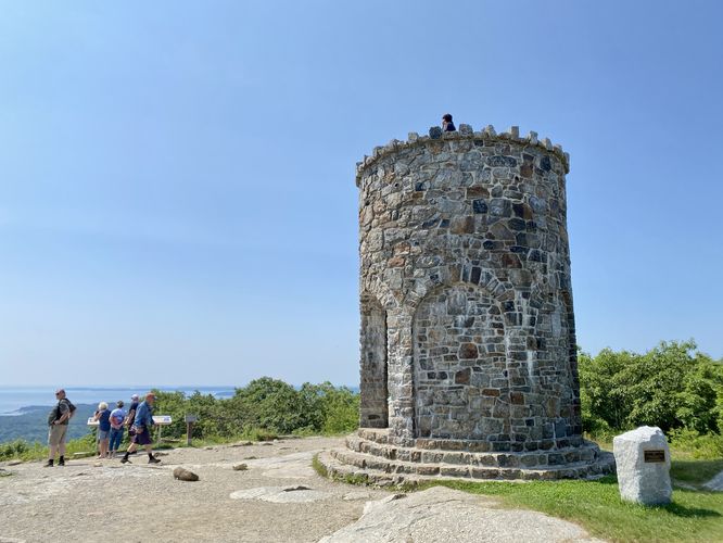
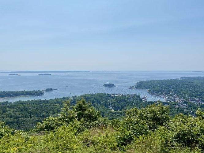
This is not a hike but rather a short walk that leads to the Mt. Battie Tower and two different viewpoints from the summit of Mount Battie. The walk begins at the western side of the parking lot, where visitors will first find the Mt. Battie Tower sitting atop the mountain's summit. Here, you can explore the tower by climbing its steps to find a view of Camden and the surrounding area or you can find a similar (albeit, better) view from below the tower. This route leads visitors out to the viewpoint below the tower first, then ascends the tower for a similar view. The route then leads visitors back to parking and east, along Mt. Battie Road, to reach another viewpoint from the mountain's summit. The view from the east section of this route provides a similar, but quieter (tourist-wise) view of Camden, the Atlantic Ocean, and the islands offshore. The route then leads back to parking on the west side of the lot for ~0.3-mile walk.
Parking & Fees
There's a per-person entry fee, as of July 2024. For non-residents, it's a $6/adult fee. For Maine residents, the fee is $4/adult. Hikers will find parking at the lot located at the end of Mt. Battie Road. The lot is large enough to fit a couple dozen vehicles as of July 2024.
Pets
Dogs are allowed only if leashed and must be cleaned up after.
Other Hikes
While in the area, you might want to consider hiking Mt. Megunticook for more stunning views of the area.
Walk
This is not a hike but rather a short walk that leads to the Mt. Battie Tower and two different viewpoints from the summit of Mount Battie. The walk begins at the western side of the parking lot, where visitors will first find the Mt. Battie Tower sitting atop the mountain's summit. Here, you can explore the tower by climbing its steps to find a view of Camden and the surrounding area or you can find a similar (albeit, better) view from below the tower. This route leads visitors out to the viewpoint below the tower first, then ascends the tower for a similar view. The route then leads visitors back to parking and east, along Mt. Battie Road, to reach another viewpoint from the mountain's summit. The view from the east section of this route provides a similar, but quieter (tourist-wise) view of Camden, the Atlantic Ocean, and the islands offshore. The route then leads back to parking on the west side of the lot for ~0.3-mile walk.
Parking & Fees
There's a per-person entry fee, as of July 2024. For non-residents, it's a $6/adult fee. For Maine residents, the fee is $4/adult. Hikers will find parking at the lot located at the end of Mt. Battie Road. The lot is large enough to fit a couple dozen vehicles as of July 2024.
Pets
Dogs are allowed only if leashed and must be cleaned up after.
Other Hikes
While in the area, you might want to consider hiking Mt. Megunticook for more stunning views of the area.