Loading...

🎉 Enjoy a Free 7-Day Supporter Trial and Unlock Exclusive Perks — No Credit Card Required. Learn more.

Mingo Falls Hike

Directions
Map
Pictures
Send to App
Distance:
0.8 Miles / 1.3 km
Type:
Out-and-Back
Difficulty:
Easy
Time to Hike:
~24 minutes
Features:
Surface Type:
Dirt
Town:
Cherokee, North Carolina
Directions:
35.53401, -83.27627
Added:
April 01, 2025
Updated:
April 06, 2025
Copy Trail Link Hiking this trail? Send a friend or family member a link to this trail guide for your own safety. Hike at your own risk (disclaimer)
Loading...
Loading...
387'

Total Change
513'

Ascent
513'

Descent

Download the Trail Route for Offline Use

Supporters get exclusive access to download trail routes to the MyHikes app for offline use. Stay prepared on your adventure, even without an internet connection! Become a Supporter today to unlock this feature and hike with confidence.

Send to App

Mingo Falls Hike

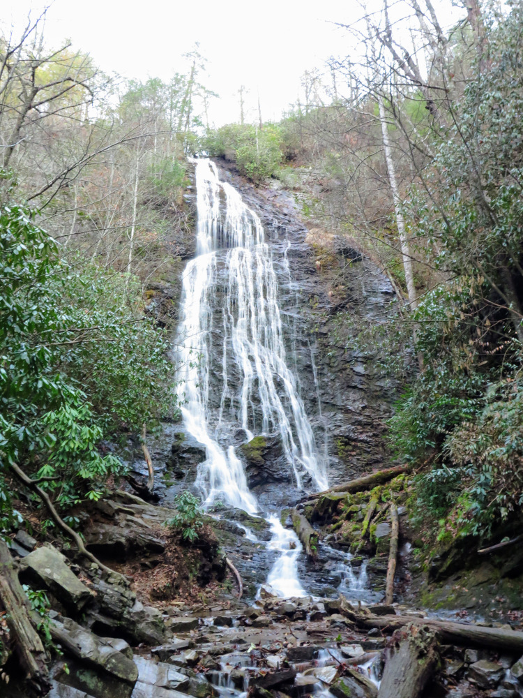
The spectacular Mingo Falls is located in the Qualla Boundary of the Eastern Band of Cherokee Indians, just outside of the Oconaluftee Visitor Center of Great Smoky Mountains National Park. Mingo Creek drops dramatically into the Raven Fork Gorge over two waterfalls in succession. The first, Mingo Falls, is over 150 feet tall and one of the finest in the state. The second, Upper Mingo Falls, is just above the main falls but virtually unknown to the public and requires some route-finding. This is an excellent quick hike for any visitors staying in Cherokee or Bryson City.
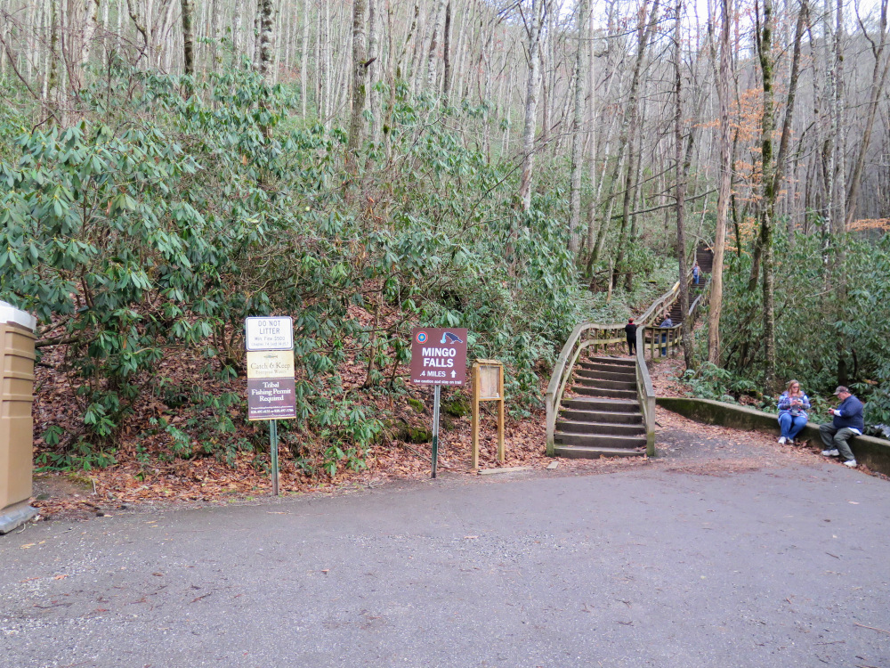
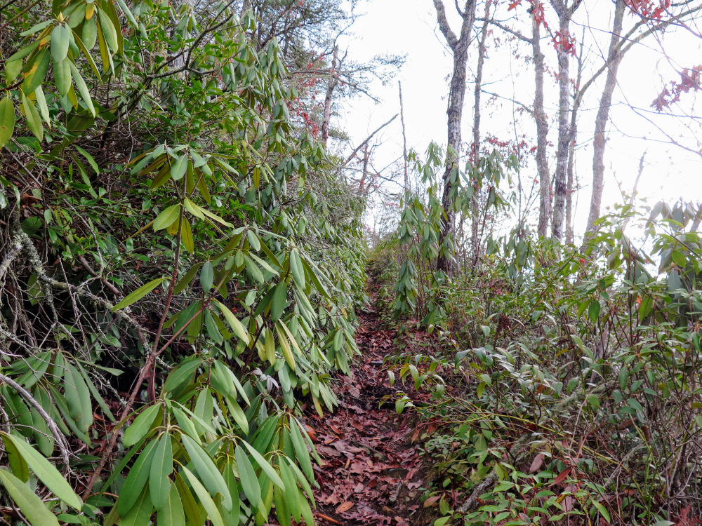
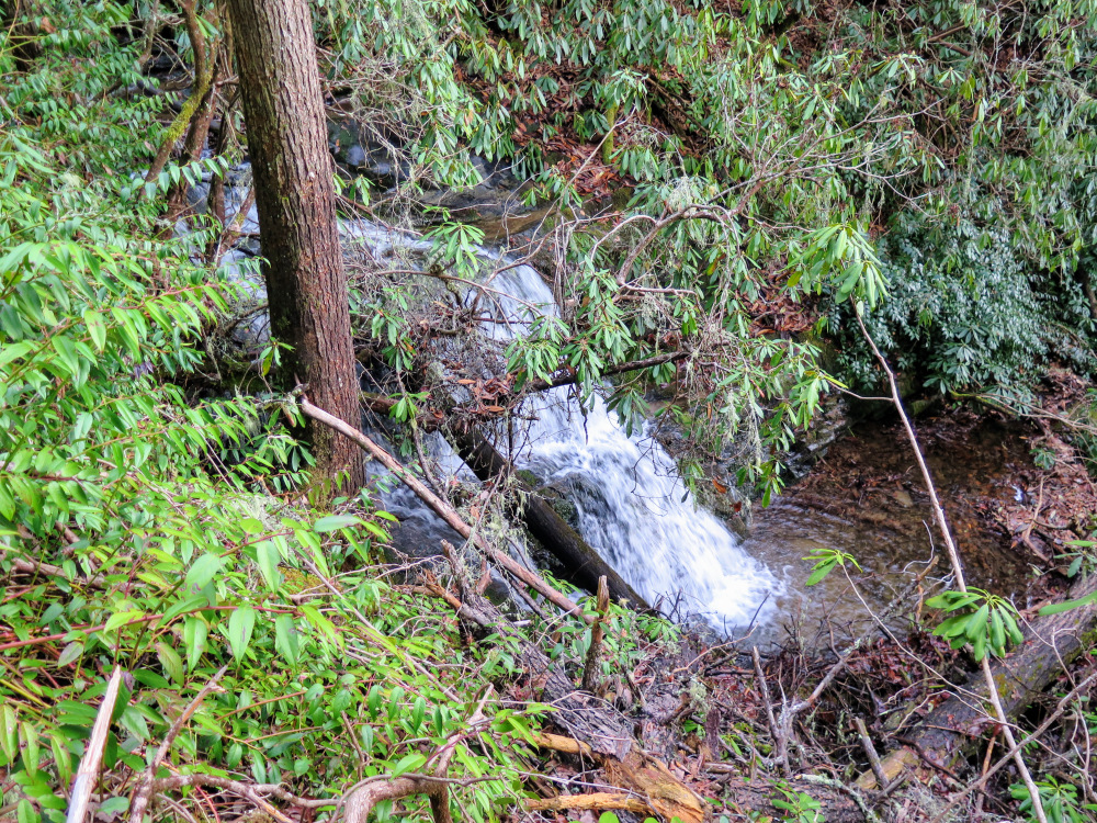
Upper Mingo Falls is a beautiful double-drop waterfall hidden above Mingo Falls. There is an unofficial trail at the top of the stairs to the left above the boulder. The usage path climbs 0.3-mile steeply to the base of the upper falls. Use extreme cauntion if you decide to hike to the upper falls, as there are a myriad of unmarked usage paths and exposed rock faces close to Mingo Falls where a fall would be fatal. Do Not venture out onto the rock faces. This trail is unknown to almost all visitors, so if you take it you are likely on your own and hiking at your own risk.

These directions go to to the base of the upper falls:

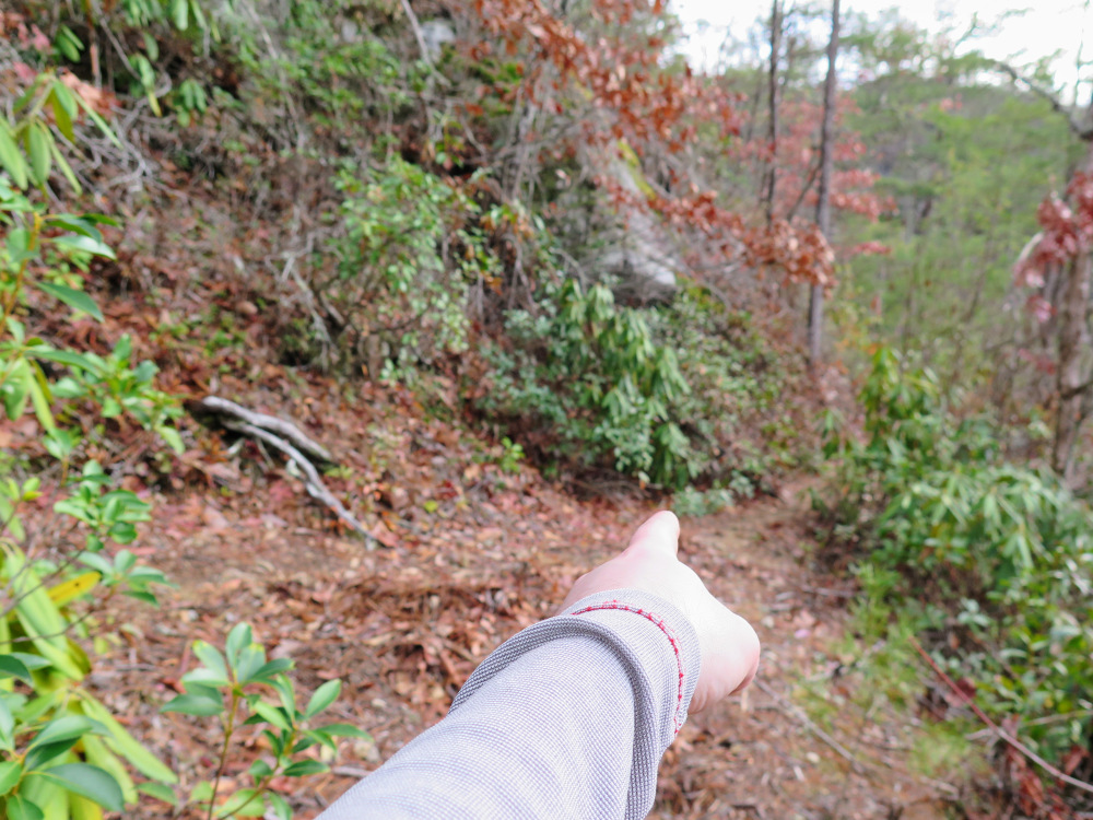
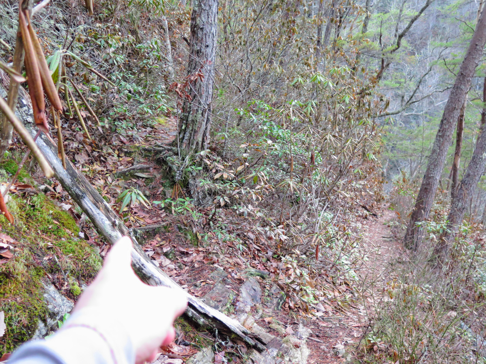
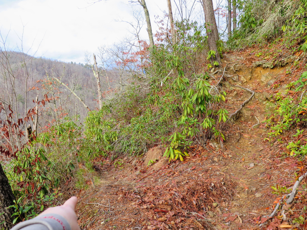
  • Mile 0.25 – After a switchback the trail encounters a Y-junction, continue right heading towards the creek.
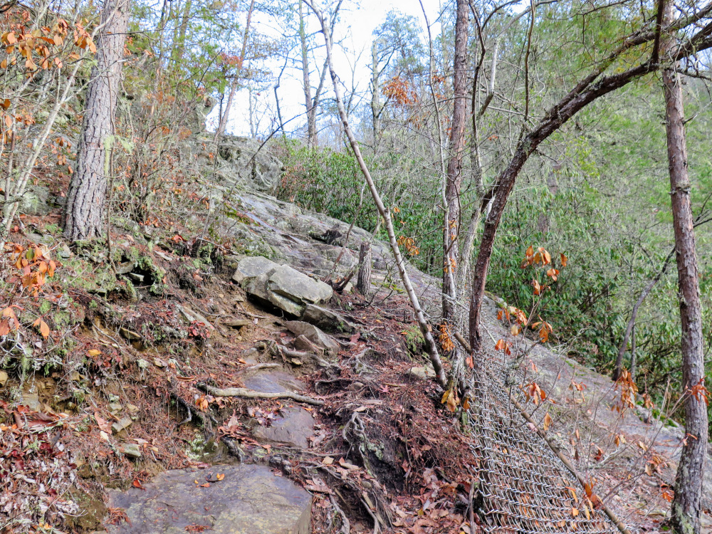
  • Mile 0.3 – At a Y-junction turn left on the trail going uphill. Avoid any trail leading right downhill, these can only lead to trouble. You’ll soon pass by a broken chain-link fence and then you’ll have to scramble over a large rocky section. Resist the temptation to scramble for a better look from the open rock, if you fall it will be fatal.
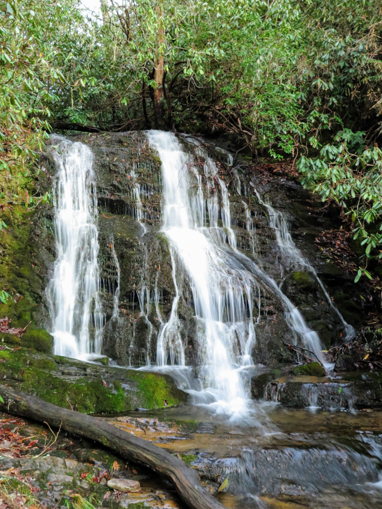
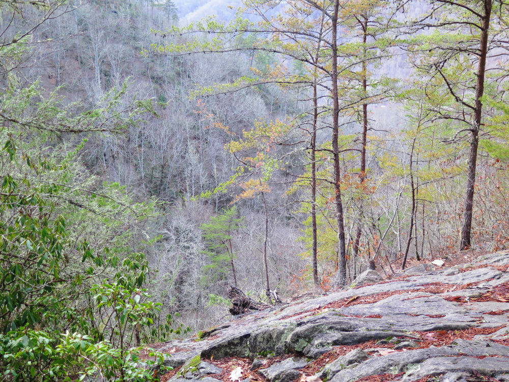
  • Mile 0.4 – The trail ends at Upper Mingo Falls. The lower 10-foot drop is obscured by trees and is not worth the steep bank scramble. The upper 20-foot drop is a beautiful freefall broken by small ledges and surrounded by lush vegetation.
  • Mile 0.55 – Turn left at the Y-junction from Mile 0.25.
  • Mile 0.7 – Back on the main trail turn left towards Mingo Falls.
  • Mile 0.75 – The trail ends at a bridge over Mingo Creek at the base of Mingo Falls. The creek plunges 150 feet in an amphitheater characterized by exposed ledges and encroaching foliage.
  • Mile 1.0 – Hike ends at the Mingo Falls parking lot.
By HikingUpward Contributor: Zach Robbins
Explore 25 trails near Cherokee, NC
  1. Parking

    35.53401, -83.27627
  2. Main Trailhead

    35.534008, -83.276273
No community routes found. To add your own hike as a Community Route for this Trail guide, leave a Trip Report with an attached GPX file.

Hazards

Snakes
Poison Ivy/Oak

Seasons

All

Trip Reports

Trail Guide By:
HikingUpward user profile picture
0.8 miles / 1.3 km

Weather Forecast

In Cherokee, NC

Explore Hiking Trails

You May Also Like

Colorado's Million Dollar Highway - Plan a day's drive adventure along the iconic Million Dollar Highway in Colorado. Explore the best short trails, roadside stops, waterfalls, vistas, ghost towns, and hot springs within a ~6 hour road trip.
Explore

Colorado's Million Dollar Highway

Plan a day's drive adventure along the iconic Million Dollar Highway in Colorado. Explore the best short trails, roadside stops, waterfalls, vistas, ghost towns, and hot springs within a ~6 hour road trip.

Read
Glacier's Going-to-the-Sun Road - Discover the breathtaking beauty of Glacier National Park along the iconic Going-to-the-Sun Road. From stunning roadside stops to picturesque waterfalls and vistas, this engineering marvel offers endless opportunities for exploration.
Explore

Glacier's Going-to-the-Sun Road

Discover the breathtaking beauty of Glacier National Park along the iconic Going-to-the-Sun Road. From stunning roadside stops to picturesque waterfalls and vistas, this engineering marvel offers endless opportunities for exploration.

Read
New York's Best Waterfalls - Whether you're planning a day hike, roadside stop, or a leisurely short walk, this guide provides hikers, travelers, and locals alike with 63 different locations to over 100 scenic waterfalls to help plan your next adventure!
Explore

New York's Best Waterfalls

Whether you're planning a day hike, roadside stop, or a leisurely short walk, this guide provides hikers, travelers, and locals alike with 63 different locations to over 100 scenic waterfalls to help plan your next adventure!

Read
25 Best Day Hikes in North Carolina - Discover the top 25 best day hikes in North Carolina, from breathtaking waterfalls to mountain peaks. Explore hidden gems, scenic views, and trails suitable for all skill levels, perfect for your next outdoor adventure.
Explore

25 Best Day Hikes in North Carolina

Discover the top 25 best day hikes in North Carolina, from breathtaking waterfalls to mountain peaks. Explore hidden gems, scenic views, and trails suitable for all skill levels, perfect for your next outdoor adventure.

Read

Before you boogie...

Find our trail guides useful? Consider becoming a Supporter to unlock perks!

MyHikes is an indie platform that makes exploring public trails easier for everyone. The platform has no investors, no ads, and is owned and operated by one person, Dave Miller. Dave has personally mapped and written over 1,800 trail guides on MyHikes for the public to explore. MyHikes has helped millions outdoor enthusiasts plan their next adventure.

But it takes a lot of time 🕦, money 💰, work, and espresso shots ☕ to run MyHikes, including hiking , mapping , writing , and publishing new trails with high-quality (accurate) information... along with software engineering (coding) the platform like building new features, website and mobile app development (iOS and Android), site maintainance . and much much more.

Supporters unlock website and mobile app perks with an annual one-time payment of $25 (you renew) 😎👍. Or you can simply make a Donation of your choice. Otherwise, you can support us by telling your friends about MyHikes - both quick and free 🎉

Admin user profile picture

Dave Miller
MyHikes Founder