The Miller Trail to Grand View at Tioga State Forest near Gaines, Pennsylvania is a difficult 3.1-mile out-and-back hike that leads to a sweeping and uninhibited vista on Cedar Mountain, Grand View.
Deer Fence - July, 2023
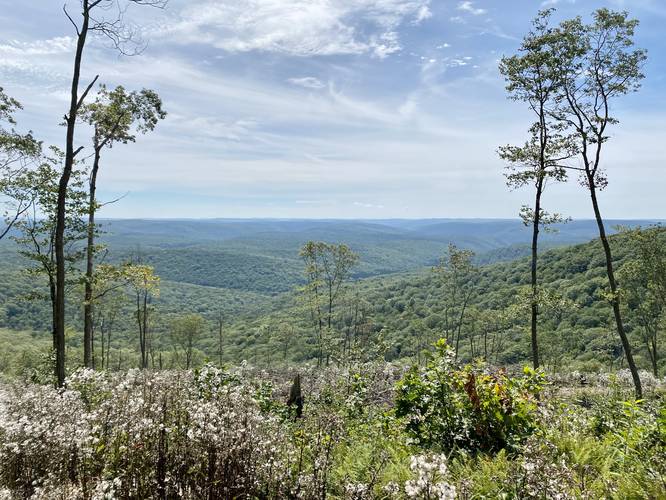
Note that as of July, 2023 there's now a deer fence surrounding the logged area at Grand View. For now, this impedes part of the view.
Trails
This hike follows an old forestry trail that's no longer maintained by Tioga State Forest - the Miller Trail, which leads up Cedar Mountain's eastern slopes from Painter-Leetonia Road. This old trail may have been an old logging grade for a small train to haul timber down the mountain to Little Slate Run. Today, the trail's a bit overgrown, has no blazes, and can be hard to follow. I (Admin) plan to resurrect this trail from the dead with new blazes and signs soon (2022-2023).
Hike Description
This hike begins along Painter-Leetonia Road, near the trailhead for the Little Slate Run Trail and Little Slate Run Falls. Instead of hiking toward the creek, hike east along the road toward the 99-year lease camp and look for an old logging grade that cuts horizontally across the front yard of the building - this is the Miller Trail.
Creek Crossing - Mile 0.15
Once on the trail, hikers will want to follow the path as it leads uphill and along a tributary for Little Slate Run. Not far up the hill, approximately 0.15 miles, hikers will reach a creek crossing where the old trail continues on the western side of the creek. Hikers may notice white blazes on the trees near this turn, but these blazes appear to be hunter's marks and can be ignored. Once on the opposite side of the creek, as of September 2022, hike for about 300-feet to reach a "clearing" where several trees have fallen in grassy and open area. Here is where the hike becomes tricky as it's difficult to find the continuation of the Miller Trail.
Tricky Turn - Mile 0.2
Around mile 0.2, as stated above, hikers will have already crossed the creek and hiked ~300-feet down the trail to reach a clearing in the woods. At the clearing, head due-west and aim for a set of Hemlock trees which sit just uphill on the mountain's slopes. Hikers should be able to spot the lost trail as it meanders its way up a steep slope of Cedar Mountain. Here, the trail becomes much easier to follow - if not impossible to lose; however, it took me two tries to find this lost trail and ultimately needed a custom GPX file loaded on a separate app to guide myself here (hence, why I plan to return to blaze and maintain this trail).
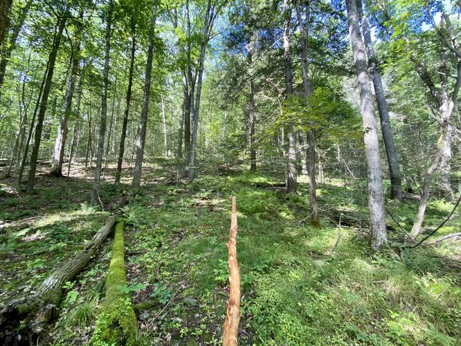
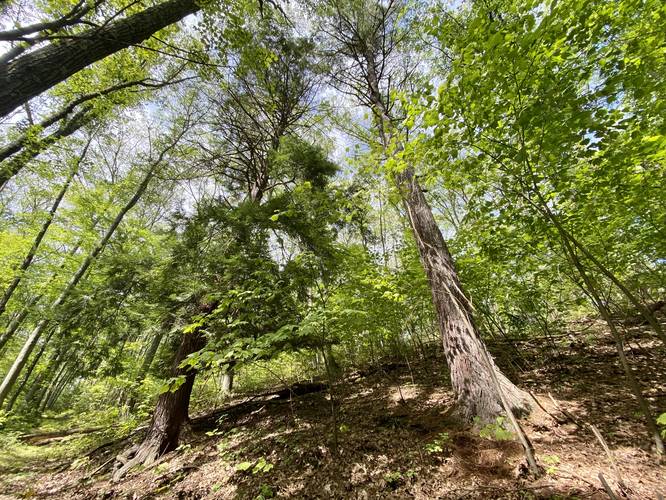
Hike up Cedar Mountain - Miles 0.25 to 0.9
Once you find the continuation of the old Miller Trail, hikers should not have a difficult time staying on-track to find their way up Cedar Mountain; however, it's not an easy climb. The hardest section of the mountain lies between the clearing and about 0.2-miles up-trail from there. The trail will become less-steep around mile 0.45, but is still an uphill slog until you reach mile 0.8, where the trail finally levels out to an easy grade. Along the way, hikers will pass through a deciduous forest full of American Beech, Hemlocks, and some White Pine trees. There's even a White Pine around mile 0.45 that appears to be an old-growth; however, I did not have a measuring tool with me for this hike to estimate its age. Finally, around mile 0.9, hikers will hop off of the Miller Trail and on to the Cedar Mountain service road that leads out to the summit of Cedar Mountain and ultimately, Grand View.
Cedar Mountain Service Road - Mile 0.9
At mile 0.9, hikers will have climbed 720-feet to reach the end of the Miller Trail at a junction with the Cedar Mountain service road. Here, hikers will take a left-hand turn to head toward the summit of Cedar Mountain. Hikers should also note where they took a turn from for their hike back, as this trail is pretty much "hidden" as of September 2022.
Mountain Summit, Radio Towers, Turn to Grand View - Mile 1.38
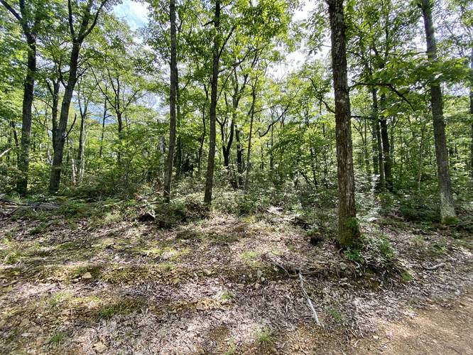
Around mile 1.38, hikers will reach the summit of Cedar Mountain with radio transmission towers adjacent. The summit isn't the best part of this hike, but feels great to finally make it to the top of the mountain. Just beyond the radio towers is a logging road the leads down the eastern slopes of Cedar Mountain to a vista point named Grand View. Take your left-hand turn here to reach Grand View.
Grand View - Mile 1.55
Around mile 1.55, hikers will reach Grand View - and the main stop along this hike. Grand View is an uninhibited vista that encompasses almost all of Tioga State Forest from Cedar Mountain looking south. On clear days, hikers can even see mountain peaks within Tiadaghton State Forest as well. Note that Cedar Mountain is also Tioga County's tallest mountain. Despite where this GPS recording stops, as of September 2022, the area was logged fairly-recently, so hikers can meander around the clearing a bit to find different views. Just beware of the rattlesnakes, which live in the area.
Hiking Out
While there usually isn't much to write about for the hike out in any out-and-back hike, this trail is special. Since there aren't any trailhead signs, and due to the hidden western terminus for the Miller Trail, hikers should take note of the landscape near the trailhead so they can find it on their return hike back down the mountain.
Parking
Hikers will find a small "turnout" near the trailhead for the Little Slate Run Trail; however, it's a very small space that can fit just a few cars at most.
Pets
Dogs are allowed if leashed and their waste should be carried out by the hiker.
Warning
Sun exposure: Once on the Cedar Mountain service road, and even out at Grand View, there's a lot of sun exposure. It's best to wear sunscreen and bring a hat, in addition to plenty of water for this hike.
Timber Rattlesnakes: This area is home to the Timber Rattlesnake and while there may not be any dens on this part of Cedar Mountain, the snakes tend to roam from April to early October through any section of the forests out here. Be on the lookout and give any rattlesnake you find plenty of extra room.
Camping and Backpacking
There's one small campsite located at the junction of Mill Run Road and the Cedar Mountain service road; however, there are no other predefined campsites along this route. Backpackers and campers must follow all state forest rules and regulations if backcountry / primitive / dispersed camping.
Deer Fence - July, 2023
Note that as of July, 2023 there's now a deer fence surrounding the logged area at Grand View. For now, this impedes part of the view.
Trails
This hike follows an old forestry trail that's no longer maintained by Tioga State Forest - the Miller Trail, which leads up Cedar Mountain's eastern slopes from Painter-Leetonia Road. This old trail may have been an old logging grade for a small train to haul timber down the mountain to Little Slate Run. Today, the trail's a bit overgrown, has no blazes, and can be hard to follow. I (Admin) plan to resurrect this trail from the dead with new blazes and signs soon (2022-2023).
Hike Description
This hike begins along Painter-Leetonia Road, near the trailhead for the Little Slate Run Trail and Little Slate Run Falls. Instead of hiking toward the creek, hike east along the road toward the 99-year lease camp and look for an old logging grade that cuts horizontally across the front yard of the building - this is the Miller Trail.
Creek Crossing - Mile 0.15
Once on the trail, hikers will want to follow the path as it leads uphill and along a tributary for Little Slate Run. Not far up the hill, approximately 0.15 miles, hikers will reach a creek crossing where the old trail continues on the western side of the creek. Hikers may notice white blazes on the trees near this turn, but these blazes appear to be hunter's marks and can be ignored. Once on the opposite side of the creek, as of September 2022, hike for about 300-feet to reach a "clearing" where several trees have fallen in grassy and open area. Here is where the hike becomes tricky as it's difficult to find the continuation of the Miller Trail.
Tricky Turn - Mile 0.2
Around mile 0.2, as stated above, hikers will have already crossed the creek and hiked ~300-feet down the trail to reach a clearing in the woods. At the clearing, head due-west and aim for a set of Hemlock trees which sit just uphill on the mountain's slopes. Hikers should be able to spot the lost trail as it meanders its way up a steep slope of Cedar Mountain. Here, the trail becomes much easier to follow - if not impossible to lose; however, it took me two tries to find this lost trail and ultimately needed a custom GPX file loaded on a separate app to guide myself here (hence, why I plan to return to blaze and maintain this trail).
Hike up Cedar Mountain - Miles 0.25 to 0.9
Once you find the continuation of the old Miller Trail, hikers should not have a difficult time staying on-track to find their way up Cedar Mountain; however, it's not an easy climb. The hardest section of the mountain lies between the clearing and about 0.2-miles up-trail from there. The trail will become less-steep around mile 0.45, but is still an uphill slog until you reach mile 0.8, where the trail finally levels out to an easy grade. Along the way, hikers will pass through a deciduous forest full of American Beech, Hemlocks, and some White Pine trees. There's even a White Pine around mile 0.45 that appears to be an old-growth; however, I did not have a measuring tool with me for this hike to estimate its age. Finally, around mile 0.9, hikers will hop off of the Miller Trail and on to the Cedar Mountain service road that leads out to the summit of Cedar Mountain and ultimately, Grand View.
Cedar Mountain Service Road - Mile 0.9
At mile 0.9, hikers will have climbed 720-feet to reach the end of the Miller Trail at a junction with the Cedar Mountain service road. Here, hikers will take a left-hand turn to head toward the summit of Cedar Mountain. Hikers should also note where they took a turn from for their hike back, as this trail is pretty much "hidden" as of September 2022.
Mountain Summit, Radio Towers, Turn to Grand View - Mile 1.38
Around mile 1.38, hikers will reach the summit of Cedar Mountain with radio transmission towers adjacent. The summit isn't the best part of this hike, but feels great to finally make it to the top of the mountain. Just beyond the radio towers is a logging road the leads down the eastern slopes of Cedar Mountain to a vista point named Grand View. Take your left-hand turn here to reach Grand View.
Grand View - Mile 1.55
Around mile 1.55, hikers will reach Grand View - and the main stop along this hike. Grand View is an uninhibited vista that encompasses almost all of Tioga State Forest from Cedar Mountain looking south. On clear days, hikers can even see mountain peaks within Tiadaghton State Forest as well. Note that Cedar Mountain is also Tioga County's tallest mountain. Despite where this GPS recording stops, as of September 2022, the area was logged fairly-recently, so hikers can meander around the clearing a bit to find different views. Just beware of the rattlesnakes, which live in the area.
Hiking Out
While there usually isn't much to write about for the hike out in any out-and-back hike, this trail is special. Since there aren't any trailhead signs, and due to the hidden western terminus for the Miller Trail, hikers should take note of the landscape near the trailhead so they can find it on their return hike back down the mountain.
Parking
Hikers will find a small "turnout" near the trailhead for the Little Slate Run Trail; however, it's a very small space that can fit just a few cars at most.
Pets
Dogs are allowed if leashed and their waste should be carried out by the hiker.
Warning
Sun exposure: Once on the Cedar Mountain service road, and even out at Grand View, there's a lot of sun exposure. It's best to wear sunscreen and bring a hat, in addition to plenty of water for this hike.
Timber Rattlesnakes: This area is home to the Timber Rattlesnake and while there may not be any dens on this part of Cedar Mountain, the snakes tend to roam from April to early October through any section of the forests out here. Be on the lookout and give any rattlesnake you find plenty of extra room.
Camping and Backpacking
There's one small campsite located at the junction of Mill Run Road and the Cedar Mountain service road; however, there are no other predefined campsites along this route. Backpackers and campers must follow all state forest rules and regulations if backcountry / primitive / dispersed camping.