The Mill Run Trail at Tioga State Forest in Gaines, Pennsylvania is an easy 3.3-mile out-and-back trail that leads to the edge of a mountain and has obstructed views of neighboring mountains; however, none of the views are noteworthy.
This short trail is great for a nice hike in the woods of Tioga State Forest, especially outside of Summer months when there's no overgrowth. The trailhead can be found a few feet from the entrance to the Old Supply Trail - the first right-hand turn.
Hikers will pass a yellow gate near the trailhead for this trail, but beyond the yellow gate are no noteworthy points along the trail. During the colder months, hikers will find obstructed views along the trail of neighboring mountains. During the warmer months, when leaves are on the trees, there are absolutely no views.
The trail gradually heads uphill before undulating for about a half-mile before heading back downhill to the end of the trail. Around January 2020 the trees have some blue rings along them - probably meaning something to loggers, but at the end of the trail, hikers will find a handful of these blue rings along the trees where the trail seemingly ends.
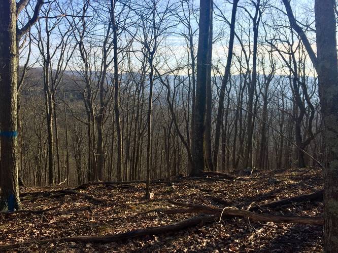
Obstructed Views
Where the trail abruptly ends, near the edge of the mountain, will be some obstructed views of the mountains that sit adjacent to the one that the trail follows.
Camping
Camping is permitted off-trail along this trail; however, there were no designated campsites. Also be warned that due to logging, it may not be the smartest to camp off of a logging road depending on when the state forest plans to deforest around here again.
Pets
Dogs are allowed if leashed and their waste must be carried out by the hiker.
Parking
Hikers can find parking at the coordinates provided. The parking lot is shared with access to the Old Supply Trail and has space for about 5 vehicles.
Winter Road Conditions
Tioga State Forest does not maintain this road during the winter. Do not attempt driving on this road without proper equipment including snow tires and/or chains unless the road is clear. High wind storms may also cause trees to fall across the road, making the road impassible. If you plan to visit during the winter, plan accordingly.
This short trail is great for a nice hike in the woods of Tioga State Forest, especially outside of Summer months when there's no overgrowth. The trailhead can be found a few feet from the entrance to the Old Supply Trail - the first right-hand turn.
Hikers will pass a yellow gate near the trailhead for this trail, but beyond the yellow gate are no noteworthy points along the trail. During the colder months, hikers will find obstructed views along the trail of neighboring mountains. During the warmer months, when leaves are on the trees, there are absolutely no views.
The trail gradually heads uphill before undulating for about a half-mile before heading back downhill to the end of the trail. Around January 2020 the trees have some blue rings along them - probably meaning something to loggers, but at the end of the trail, hikers will find a handful of these blue rings along the trees where the trail seemingly ends.
Obstructed Views
Where the trail abruptly ends, near the edge of the mountain, will be some obstructed views of the mountains that sit adjacent to the one that the trail follows.
Camping
Camping is permitted off-trail along this trail; however, there were no designated campsites. Also be warned that due to logging, it may not be the smartest to camp off of a logging road depending on when the state forest plans to deforest around here again.
Pets
Dogs are allowed if leashed and their waste must be carried out by the hiker.
Parking
Hikers can find parking at the coordinates provided. The parking lot is shared with access to the Old Supply Trail and has space for about 5 vehicles.
Winter Road Conditions
Tioga State Forest does not maintain this road during the winter. Do not attempt driving on this road without proper equipment including snow tires and/or chains unless the road is clear. High wind storms may also cause trees to fall across the road, making the road impassible. If you plan to visit during the winter, plan accordingly.