The Lower Rock Garden Trail at Royal Botanical Gardens in Hamilton, Ontario is an easy 0.5 km one-way trail that leads through the lower section of the Rock Garden and features beautiful water features including a couple of small waterfalls.
Trail
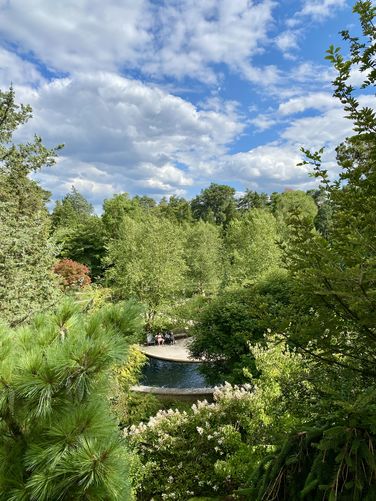
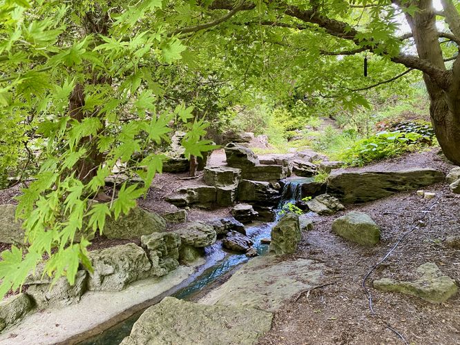
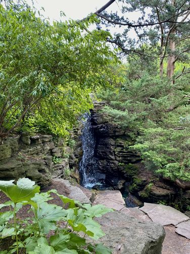
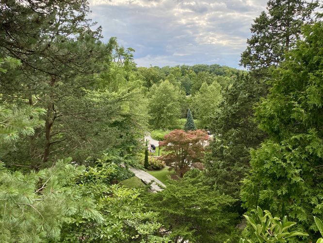
This trail begins at the main trailhead for the RBG Rock Garden and heads south to begin. The trail reaches a viewpoint located high above the water features before leading down a series of staircases to reach the lowest points within the rock garden. During our visit, we meandered around a skinny trail that ran between evergreens before it dipped down to reach the human-made "black" water creek that flows through the rock garden. Our route leads over to a view of water fountains that feed the creek before heading back -- this section of the trail is by-far the most scenic with views of the dark reflection waters in the creek, colorful vegetation, and a small footbridge that spans the water. We then walked across the footbridge and continued southward, passing a view of a scenic human-made 1-meter tall waterfall. The trail then bends around in the south to reach a statue sitting adjacent to the water -- another nice spot to take photos, before reaching a small cascade. We then began our hike back uphill to reach the Rock Garden Accessible Loop, but before we reached the end of this trail, we passed a beautiful ~8-foot tall human-made waterfall that spills down into the dark reflection creek below. We ended the walk along this trail before taking the Rock Garden Accessible Loop back to the trailhead.
Connection with Albion Falls
Visitors may not know that portions of the rock garden were built with boulders and rocks from the Albion Falls area.
Parking
The main parking lot is located on the east side of York Blvd. The parking lot is very large and can fit many dozens of vehicles as of August 2024.
Pets
Well-behaved dogs are allowed on the trails within RBG but must be leashed and cleaned up after.
Trail
This trail begins at the main trailhead for the RBG Rock Garden and heads south to begin. The trail reaches a viewpoint located high above the water features before leading down a series of staircases to reach the lowest points within the rock garden. During our visit, we meandered around a skinny trail that ran between evergreens before it dipped down to reach the human-made "black" water creek that flows through the rock garden. Our route leads over to a view of water fountains that feed the creek before heading back -- this section of the trail is by-far the most scenic with views of the dark reflection waters in the creek, colorful vegetation, and a small footbridge that spans the water. We then walked across the footbridge and continued southward, passing a view of a scenic human-made 1-meter tall waterfall. The trail then bends around in the south to reach a statue sitting adjacent to the water -- another nice spot to take photos, before reaching a small cascade. We then began our hike back uphill to reach the Rock Garden Accessible Loop, but before we reached the end of this trail, we passed a beautiful ~8-foot tall human-made waterfall that spills down into the dark reflection creek below. We ended the walk along this trail before taking the Rock Garden Accessible Loop back to the trailhead.
Connection with Albion Falls
Visitors may not know that portions of the rock garden were built with boulders and rocks from the Albion Falls area.
Parking
The main parking lot is located on the east side of York Blvd. The parking lot is very large and can fit many dozens of vehicles as of August 2024.
Pets
Well-behaved dogs are allowed on the trails within RBG but must be leashed and cleaned up after.