The Lisa Falls Trail at Wasatch National Forest near Granite, Utah is an easy 0.3-mile out-and-back hike that leads to the base of a large multi-tiered waterfall named Lisa Falls.
Hike Description
This short hike begins along the north side of UT-210 Little Cottonwood Road, almost directly across the street from the Little Cottonwood Trail. The Lisa Falls Trail heads northwest to reach an unnamed creek that flows into Little Cottonwood Canyon and Little Cottonwood Creek in the valley below. The trail itself is mostly dirt substrate with rocks along the way.
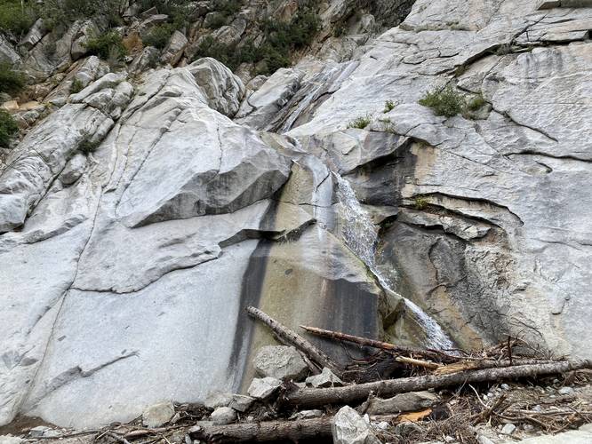
Lisa Falls - Mile 0.1
Hikers will reach Lisa Falls around mile 0.1. During low water flow seasons, hikers can cross the creek to reach an even-better view of Lisa Falls from the creek's western banks from the boulders. Note that a bit of scrambling is required to get the best view on the west side of the creek.
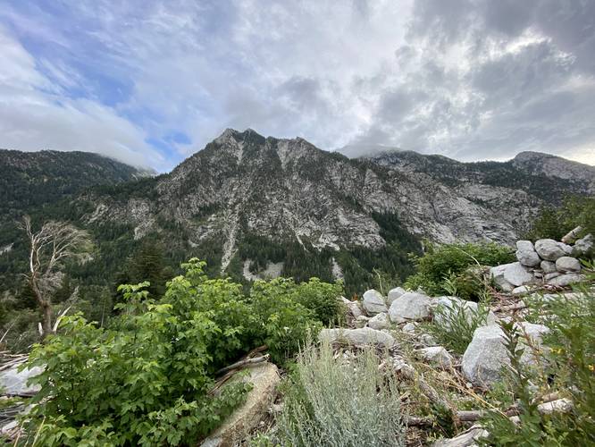
Little Cottonwood Canyon View
From Lisa Falls, hikers will get a beautiful view of the Little Cottonwood Canyon and its surrounding mountains.
After visiting the waterfall, the hike out to parking is a simple 0.1+ mile walk back downhill.
Parking
Hikers will find a parking turnout at the coordinates provided, on the north side of UT-210 on Little Cottonwood Road.
Pets
Dogs are not allowed on this trail.
Warnings
Rockfalls: This trail passes steep mountain slopes where falling rock from above may come crashing down, without warning, at any time.
Flash flooding: This waterfall can flash flood from time to time, so it's best to understand recent weather patterns and conditions upstream before planning this hike. At the very least, be cautious that a flash flood could happen anytime.
Hike Description
This short hike begins along the north side of UT-210 Little Cottonwood Road, almost directly across the street from the Little Cottonwood Trail. The Lisa Falls Trail heads northwest to reach an unnamed creek that flows into Little Cottonwood Canyon and Little Cottonwood Creek in the valley below. The trail itself is mostly dirt substrate with rocks along the way.
Lisa Falls - Mile 0.1
Hikers will reach Lisa Falls around mile 0.1. During low water flow seasons, hikers can cross the creek to reach an even-better view of Lisa Falls from the creek's western banks from the boulders. Note that a bit of scrambling is required to get the best view on the west side of the creek.
Little Cottonwood Canyon View
From Lisa Falls, hikers will get a beautiful view of the Little Cottonwood Canyon and its surrounding mountains.
After visiting the waterfall, the hike out to parking is a simple 0.1+ mile walk back downhill.
Parking
Hikers will find a parking turnout at the coordinates provided, on the north side of UT-210 on Little Cottonwood Road.
Pets
Dogs are not allowed on this trail.
Warnings
Rockfalls: This trail passes steep mountain slopes where falling rock from above may come crashing down, without warning, at any time.
Flash flooding: This waterfall can flash flood from time to time, so it's best to understand recent weather patterns and conditions upstream before planning this hike. At the very least, be cautious that a flash flood could happen anytime.