Lambs Park Loop at Tioga State Forest near Canton, Pennsylvania is an easy 0.8-mile loop hike that features an abandoned stone furnace and a vista of Bradford County from Armenia Mountain.
Hours
Note that Lambs Park is a small designated area within Tioga State Forest which is only open from dawn to dusk each day. The road gate is open for driving from May 20 through November 20th each year, according to the signage. During off-season, this area can be hiked-in as described.
Trails
This hike follows one unnamed and un-mapped trail nicknamed the Lambs Park Loop. This trail follows yellow blazes. Please note that there are other off-shoot trails that also follow yellow blazes, so it's best to pay attention to each turn.
Trail Description
This hike begins (during the off-season) by first hiking in on the Lambs Lookout Trail to reach this trailhead. Once at the trailhead, hikers have two choices - either start their hike near the vista or start their hike with the vista being the last thing they see, which is what this hike does as it follows the loop counter-clockwise.
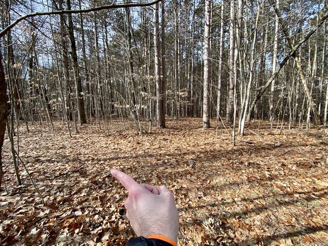
Left-Hand Turn - Mile 0.1
Around mile 0.1, hikers will reach a trail junction where yellow blazes go both left and right. Take a left-hand turn here to stay on the loop.
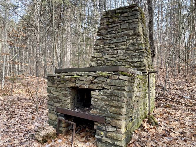
Abandoned Stone Furnace - Mile 0.25
At mile 0.25, hikers will find an old abandoned stone furnace sitting right on the trail. There's no signage, so it's difficult to tell what this furnace was once used for. Regardless, it's a neat find in the middle of the woods.
Road Crossing - Mile 0.35
At mile 0.35, hikers will cross the entrance road to Lambs Park and Lambs Lookout. Just after crossing the entrance road, hikers will be pleasantly surprised by the 30-feet of moss-covered trail that extends down the path. This is a nice change of pace as the moss softens each footstep.
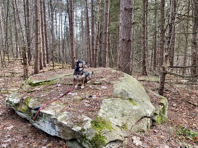
Large Boulder - Mile 0.5
Around mile 0.5 is a large boulder that sits on-trail. Our dog Jax used this as a perch, but people might find it useful to take a seat for a quick break.
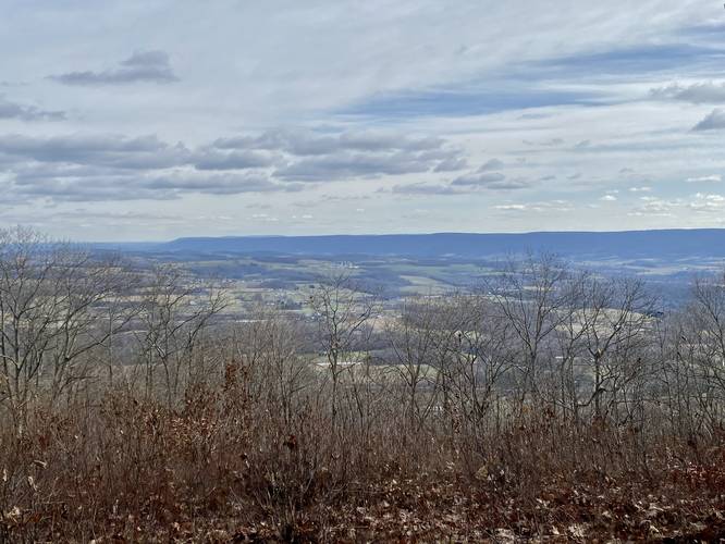
Lambs Lookout - Mile 0.65
Around mile 0.65, hikers will reach the off-trail vista named Lambs Lookout. The view form this vantage point isn't as nice as the view just up the hill, but it's worth checking out before the trail leads you back up to that view.
Finishing the Loop
After passing Lambs Lookout, hikers will make their way through the main parking area (May 20 - Nov 20) to reach the trailhead for a 0.8-mile loop hike.
Parking
Hikers will find parking at the coordinates provided, located at the junction of Lambs Lookout Lane and Mountain Ave during off-season (Nov 20 - May 19) each year. If visiting between May 20 - Nov 20, you can park right at the main lookout to reach this trailhead much quicker.
Pets
Dogs are allowed if leashed and their waste should be carried out by the hiker.
Camping and Backpacking
Tioga State Forest allowed camping and backpacking - specifically dispersed / primitive / backcountry camping; however, camping and backpacking are not allowed within the Lambs Lookout / Lambs Park region of Tioga State Forest. Please note that this "park" inside the state forest is not well-defined on the state forest map, but it's save to assume that no one should setup a campsite near or at Lambs Lookout or on any nearby trails like the Lambs Park Loop.
Hours
Note that Lambs Park is a small designated area within Tioga State Forest which is only open from dawn to dusk each day. The road gate is open for driving from May 20 through November 20th each year, according to the signage. During off-season, this area can be hiked-in as described.
Trails
This hike follows one unnamed and un-mapped trail nicknamed the Lambs Park Loop. This trail follows yellow blazes. Please note that there are other off-shoot trails that also follow yellow blazes, so it's best to pay attention to each turn.
Trail Description
This hike begins (during the off-season) by first hiking in on the Lambs Lookout Trail to reach this trailhead. Once at the trailhead, hikers have two choices - either start their hike near the vista or start their hike with the vista being the last thing they see, which is what this hike does as it follows the loop counter-clockwise.
Left-Hand Turn - Mile 0.1
Around mile 0.1, hikers will reach a trail junction where yellow blazes go both left and right. Take a left-hand turn here to stay on the loop.
Abandoned Stone Furnace - Mile 0.25
At mile 0.25, hikers will find an old abandoned stone furnace sitting right on the trail. There's no signage, so it's difficult to tell what this furnace was once used for. Regardless, it's a neat find in the middle of the woods.
Road Crossing - Mile 0.35
At mile 0.35, hikers will cross the entrance road to Lambs Park and Lambs Lookout. Just after crossing the entrance road, hikers will be pleasantly surprised by the 30-feet of moss-covered trail that extends down the path. This is a nice change of pace as the moss softens each footstep.
Large Boulder - Mile 0.5
Around mile 0.5 is a large boulder that sits on-trail. Our dog Jax used this as a perch, but people might find it useful to take a seat for a quick break.
Lambs Lookout - Mile 0.65
Around mile 0.65, hikers will reach the off-trail vista named Lambs Lookout. The view form this vantage point isn't as nice as the view just up the hill, but it's worth checking out before the trail leads you back up to that view.
Finishing the Loop
After passing Lambs Lookout, hikers will make their way through the main parking area (May 20 - Nov 20) to reach the trailhead for a 0.8-mile loop hike.
Parking
Hikers will find parking at the coordinates provided, located at the junction of Lambs Lookout Lane and Mountain Ave during off-season (Nov 20 - May 19) each year. If visiting between May 20 - Nov 20, you can park right at the main lookout to reach this trailhead much quicker.
Pets
Dogs are allowed if leashed and their waste should be carried out by the hiker.
Camping and Backpacking
Tioga State Forest allowed camping and backpacking - specifically dispersed / primitive / backcountry camping; however, camping and backpacking are not allowed within the Lambs Lookout / Lambs Park region of Tioga State Forest. Please note that this "park" inside the state forest is not well-defined on the state forest map, but it's save to assume that no one should setup a campsite near or at Lambs Lookout or on any nearby trails like the Lambs Park Loop.