The Lady Finger Point Trail at Antelope Island State Park near Syracuse, Utah is an easy 0.4-mile out-and-back hike that features views of the Great Salt Lake.
Hike Description
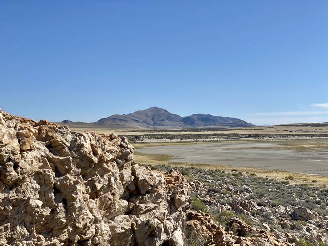
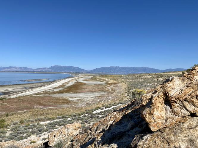
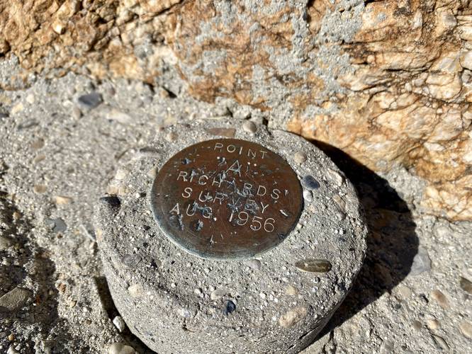
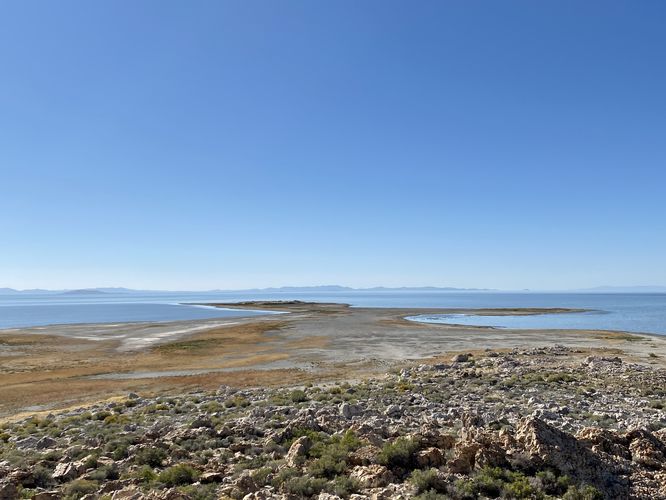
This short hike begins at the main trailhead for Lady Finger Point, at the parking coordinates provided, and follows the trail out to its terminus where it ends along a large rock outcropping. The trail itself starts out extremely flat and easy with minimal tripping hazards along the way. Shortly into the hike, that all changes, as the trail heads into a large rock outcropping where you have to watch your step. Once on the rock outcropping, the trail meanders its way over the rocks and out to some really nice views of the Great Salt Lake and Antelope Island's mountain - Frary Peak. A keen-eyed hiker may even spot the survey marker from 1956 labeled "Point 'A' Richards' Survey Aug 1956" which can be found embedded in the bedrock around mile 0.2. From the rocky outcropping, hikers will take in the views before hiking out along this very short but scenic trail.
Note that this trail also provides hikers will a chance to see wild bison; however, we did not see any on this hike in late September 2023. We did, however, find wild bison off of the Buffalo Point Trail, which seems to be a more popular grazing area for the animals.
Parking
Hikers will find a large parking lot at the coordinates provided. The lot is large enough to fit a couple dozen vehicles.
Pets
Dogs are allowed only if leashed and must be cleaned up after.
Entry Fee
As of September 2023, there's a $20/vehicle entry fee to get into Antelope Island State Park.
Hike Description
This short hike begins at the main trailhead for Lady Finger Point, at the parking coordinates provided, and follows the trail out to its terminus where it ends along a large rock outcropping. The trail itself starts out extremely flat and easy with minimal tripping hazards along the way. Shortly into the hike, that all changes, as the trail heads into a large rock outcropping where you have to watch your step. Once on the rock outcropping, the trail meanders its way over the rocks and out to some really nice views of the Great Salt Lake and Antelope Island's mountain - Frary Peak. A keen-eyed hiker may even spot the survey marker from 1956 labeled "Point 'A' Richards' Survey Aug 1956" which can be found embedded in the bedrock around mile 0.2. From the rocky outcropping, hikers will take in the views before hiking out along this very short but scenic trail.
Note that this trail also provides hikers will a chance to see wild bison; however, we did not see any on this hike in late September 2023. We did, however, find wild bison off of the Buffalo Point Trail, which seems to be a more popular grazing area for the animals.
Parking
Hikers will find a large parking lot at the coordinates provided. The lot is large enough to fit a couple dozen vehicles.
Pets
Dogs are allowed only if leashed and must be cleaned up after.
Entry Fee
As of September 2023, there's a $20/vehicle entry fee to get into Antelope Island State Park.