The Buffalo Point Trail at Antelope Island State Park near Syracuse, Utah is a moderate 1-mile loop hike that features stunning views of Antelope Island, the Great Salt Lake, and a chance to see wild bison and wild antelope.
Hike Description
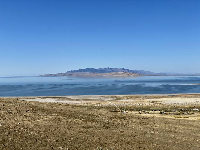
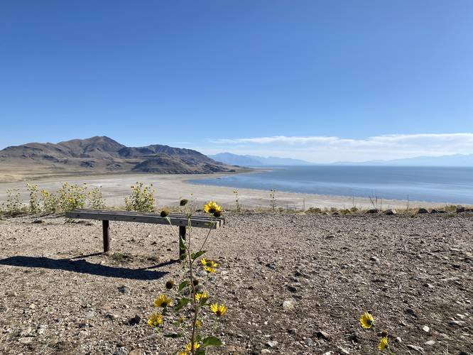
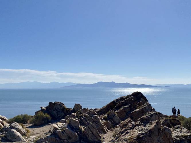
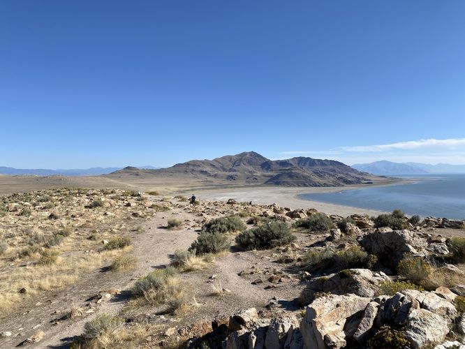
This hike begins at the main trailhead located at the western side of the parking lot and heads-in along the northern side of the loop trail to begin. Hikers will immediately have unobstructed views surrounding them, mostly of the Great Salt Lake, for virtually the entire hike. The initial climb up to Buffalo Point is not difficult, but is not easy either, hence the "Moderate" difficulty; however, as you ascend you'll find beautiful views along the way. About half-way to the top, hikers will find a fork in the trail - this is the loop continuation - with a bench on the opposite side. If you wish to take a short break, you can sit on the bench to take in the south-facing views of Antelope Island and the Great Salt Lake. Pushing onward, hikers will hit two switchbacks that climb to the top of Buffalo Point, where you'll find a flat hill top that provides more views. At the far end of the hill is a large rock outcropping that's fun to scramble around on and where you can find more places to photograph the area. After visiting the "summit" of Buffalo Point, the hike down follows a similar path out, but passes the half-way point bench along the way as it follows the southern side of the loop back to parking.
If you're lucky, you'll find plenty of wild bison grazing in the wide-open fields below. During our hike we did not see any wild antelope, but they are out there!
Parking
Hikers will find a large parking lot at the coordinates provided. The lot is large enough to fit a few dozen vehicles.
Pets
Dogs are allowed only if leashed and must be cleaned up after.
Restrooms
There are non-flush restrooms at the parking lot, as of September 2023.
Entry Fee
As of September 2023, there's a $20/vehicle entry fee to get into Antelope Island State Park.
Hike Description
This hike begins at the main trailhead located at the western side of the parking lot and heads-in along the northern side of the loop trail to begin. Hikers will immediately have unobstructed views surrounding them, mostly of the Great Salt Lake, for virtually the entire hike. The initial climb up to Buffalo Point is not difficult, but is not easy either, hence the "Moderate" difficulty; however, as you ascend you'll find beautiful views along the way. About half-way to the top, hikers will find a fork in the trail - this is the loop continuation - with a bench on the opposite side. If you wish to take a short break, you can sit on the bench to take in the south-facing views of Antelope Island and the Great Salt Lake. Pushing onward, hikers will hit two switchbacks that climb to the top of Buffalo Point, where you'll find a flat hill top that provides more views. At the far end of the hill is a large rock outcropping that's fun to scramble around on and where you can find more places to photograph the area. After visiting the "summit" of Buffalo Point, the hike down follows a similar path out, but passes the half-way point bench along the way as it follows the southern side of the loop back to parking.
If you're lucky, you'll find plenty of wild bison grazing in the wide-open fields below. During our hike we did not see any wild antelope, but they are out there!
Parking
Hikers will find a large parking lot at the coordinates provided. The lot is large enough to fit a few dozen vehicles.
Pets
Dogs are allowed only if leashed and must be cleaned up after.
Restrooms
There are non-flush restrooms at the parking lot, as of September 2023.
Entry Fee
As of September 2023, there's a $20/vehicle entry fee to get into Antelope Island State Park.